TopoQuest Logo
Do you find TopoQuest useful?
Help keep TopoQuest running and adding new maps/features by donating!
Bitcoin:  19c7KJd3qBynnjoSw5npx9KScwjBe4ifkT
Litecoin:  LXs6TkuXGGXo1vDsWCkWVdjQX94eUKd6ui
Home View Maps Find Maps Find Places Resources & Links


White Plains, Mississippi Topographic Map

USGS Map Title: White Plains, MS
USGS Map MRC: 30088E8
DRG (GeoTIFF) Download: o30088e8.tif


Neighboring USGS Topographic Map Quads:


  Airey, MS  
30089F1
 

  Beatrice, MS  
30088F8
 

  Vestry, MS  
30088F7
 

  Success, MS  
30089E1
 

  White Plains, MS  
30088E8
 

  Latimer, MS  
30088E7
 

  Gulfport North, MS  
30089D1
 

  Biloxi, MS  
30088D8
 

  Ocean Springs, MS  
30088D7


Map MRC Location:

N31°
W89°
N31°
W88°
H8 H7 H6 H5 H4 H3 H2 H1
G8 G7 G6 G5 G4 G3 G2 G1
F8 F7 F6 F5 F4 F3 F2 F1
E8 E7 E6 E5 E4 E3 E2 E1
D8 D7 D6 D5 D4 D3 D2 D1
C8 C7 C6 C5 C4 C3 C2 C1
B8 B7 B6 B5 B4 B3 B2 B1
A8 A7 A6 A5 A4 A3 A2 A1
N30°
W89°
N30°
W88°

White Plains, MS USGS 1:24K Topographic Map Preview:
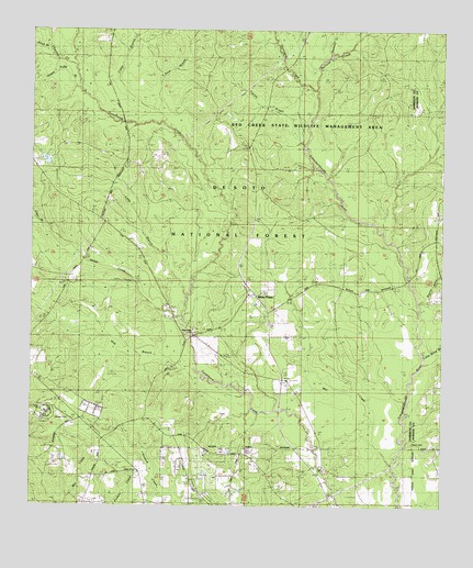
White Plains, MS USGS Topographic Map
Click on map above to begin viewing in our Map Viewer.

This topographic map contains these locations and features:
Feature Name Type Latitude Longitude GNIS ID View Map
Bayou BillieStreamN30.5538°W88.8828°692480View Map
Camp BranchStreamN30.6008°W88.9603°692811View Map
Camp HillSummitN30.5266°W88.9973°705405View Map
Cates Mobile Home ParkPopulated PlaceN30.5147°W88.9419°2596122View Map
Choctaw CreekStreamN30.6155°W88.9873°692898View Map
Clear BranchStreamN30.5738°W88.9989°692922View Map
Cypress BranchStreamN30.5894°W88.9145°693028View Map
Green Pond BranchStreamN30.6096°W88.9864°693357View Map
Harrison County Fire Service - East Harrison Volunteer Fire DepartmentBuildingN30.5122°W88.9170°2332839View Map
Harrison County Fire Service - North Woolmarket Volunteer Fire DepartmentBuildingN30.5233°W88.9876°2332840View Map
Heritage Baptist ChurchChurchN30.5113°W88.9679°2596387View Map
Hester CreekStreamN30.5488°W88.9542°693456View Map
Hog BranchStreamN30.5355°W88.9503°693493View Map
Hurricane Bay BranchStreamN30.6235°W88.9273°693563View Map
Hurricane CreekStreamN30.6096°W88.9142°693568View Map
Krohn CemeteryCemeteryN30.5169°W88.8842°693671View Map
Leisure Lake Resort Recreational Vehicle ParkLocaleN30.5386°W88.9245°2596175View Map
Little Bang BranchStreamN30.5380°W88.8809°693738View Map
Long BranchStreamN30.5558°W88.9534°693807View Map
Mill CreekStreamN30.5116°W88.8903°693985View Map
Pasture BranchStreamN30.5738°W88.9989°694324View Map
Progress School (historical)SchoolN30.5099°W88.9125°705427View Map
Railroad CreekStreamN30.6096°W88.9139°694502View Map
Ramsey CreekStreamN30.6191°W88.9100°694506View Map
Reed BranchStreamN30.6049°W88.9625°694544View Map
Reed BranchStreamN30.6196°W88.9953°694545View Map
Walden CemeteryCemeteryN30.5232°W88.9886°705433View Map
White PlainsPopulated PlaceN30.5558°W88.9306°705434View Map
White Plains ChurchChurchN30.5452°W88.9509°695153View Map
Woolmarket Community CenterBuildingN30.5226°W88.9907°2596376View Map

Note: Coordinates in the location and feature list above are referenced to NAD83 datum.


Copyright (C) 2008-2024 Ryan Niemi / Sunset Dynamics ... All Rights Reserved