TopoQuest Logo
Do you find TopoQuest useful?
Help keep TopoQuest running and adding new maps/features by donating!
Bitcoin:  19c7KJd3qBynnjoSw5npx9KScwjBe4ifkT
Litecoin:  LXs6TkuXGGXo1vDsWCkWVdjQX94eUKd6ui
Home View Maps Find Maps Find Places Resources & Links


Latrobe, California Topographic Map

USGS Map Title: Latrobe, CA
USGS Map MRC: 38120E8
DRG (GeoTIFF) Download: o38120e8.tif


Neighboring USGS Topographic Map Quads:


  Clarksville, CA  
38121F1
 

  Shingle Springs, CA  
38120F8
 

  Placerville, CA  
38120F7
 

  Folsom SE, CA  
38121E1
 

  Latrobe, CA  
38120E8
 

  Fiddletown, CA  
38120E7
 

  Carbondale, CA  
38121D1
 

  Irish Hill, CA  
38120D8
 

  Amador City, CA  
38120D7


Map MRC Location:

N39°
W121°
N39°
W120°
H8 H7 H6 H5 H4 H3 H2 H1
G8 G7 G6 G5 G4 G3 G2 G1
F8 F7 F6 F5 F4 F3 F2 F1
E8 E7 E6 E5 E4 E3 E2 E1
D8 D7 D6 D5 D4 D3 D2 D1
C8 C7 C6 C5 C4 C3 C2 C1
B8 B7 B6 B5 B4 B3 B2 B1
A8 A7 A6 A5 A4 A3 A2 A1
N38°
W121°
N38°
W120°

Latrobe, CA USGS 1:24K Topographic Map Preview:
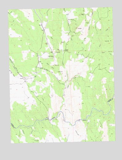
Latrobe, CA USGS Topographic Map
Click on map above to begin viewing in our Map Viewer.

This topographic map contains these locations and features:
Feature Name Type Latitude Longitude GNIS ID View Map
Big Canyon CreekStreamN38.5271°W120.9444°219151View Map
Big Canyon Creek 469 DamDamN38.6099°W120.9027°1663904View Map
Big Canyon MineMineN38.6107°W120.9058°219153View Map
Brandon CornerPopulated PlaceN38.5857°W120.9344°252636View Map
Brandon SchoolSchoolN38.5844°W120.9413°219776View Map
BrelaPopulated PlaceN38.5752°W120.9658°1658130View Map
Bugtown MineMineN38.5935°W120.9349°220088View Map
BullardPopulated PlaceN38.6091°W120.9613°1658167View Map
China MountainSummitN38.5930°W120.8799°221051View Map
Chinese CemeteryCemeteryN38.5841°W120.8816°221065View Map
Clark CreekStreamN38.5221°W120.9549°221153View Map
Copper Hill MineMineN38.5019°W120.9680°221539View Map
DuganPopulated PlaceN38.6044°W120.9588°252666View Map
Fanny CreekStreamN38.5849°W120.8974°223389View Map
FlonellisPopulated PlaceN38.5694°W120.9647°1658551View Map
French CreekStreamN38.5866°W120.9119°223901View Map
French Creek SchoolSchoolN38.6135°W120.9302°223905View Map
Grapevine RavineValleyN38.5149°W120.9255°224458View Map
Hungry HollowFlatN38.5649°W120.9399°225771View Map
LatrobePopulated PlaceN38.5596°W120.9838°1658949View Map
Latrobe Elementary SchoolSchoolN38.5582°W120.9813°1744731View Map
Latrobe Fire Protection District Station 91BuildingN38.5589°W120.9810°2624536View Map
Little Indian CreekStreamN38.5510°W120.9324°227280View Map
Marble CreekStreamN38.6199°W120.9986°228068View Map
Michigan Bar DitchCanalN38.5194°W120.9513°234280View Map
Miller RanchLocaleN38.5655°W120.8763°228745View Map
Millers Hill SchoolSchoolN38.5402°W120.9833°1744740View Map
Mount AigareSummitN38.6057°W120.9197°218025View Map
Shingle CreekStreamN38.6207°W120.9316°233011View Map
ShrubPopulated PlaceN38.5924°W120.9547°1659654View Map
Slate CreekStreamN38.5785°W120.9105°233238View Map
Slug GulchValleyN38.5644°W120.9399°233300View Map
SugarloafSummitN38.5805°W120.9505°235648View Map
Sugarloaf MineMineN38.5716°W120.9469°235665View Map
Vandalia MineMineN38.6180°W120.9133°237023View Map
White Man RavineValleyN38.5538°W120.9341°237645View Map

Note: Coordinates in the location and feature list above are referenced to NAD83 datum.


Copyright (C) 2008-2025 Ryan Niemi / Sunset Dynamics ... All Rights Reserved