TopoQuest Logo
Do you find TopoQuest useful?
Help keep TopoQuest running and adding new maps/features by donating!
Bitcoin:  19c7KJd3qBynnjoSw5npx9KScwjBe4ifkT
Litecoin:  LXs6TkuXGGXo1vDsWCkWVdjQX94eUKd6ui
Home View Maps Find Maps Find Places Resources & Links


Fiddletown, California Topographic Map

USGS Map Title: Fiddletown, CA
USGS Map MRC: 38120E7
DRG (GeoTIFF) Download: o38120e7.tif


Neighboring USGS Topographic Map Quads:


  Shingle Springs, CA  
38120F8
 

  Placerville, CA  
38120F7
 

  Camino, CA  
38120F6
 

  Latrobe, CA  
38120E8
 

  Fiddletown, CA  
38120E7
 

  Aukum, CA  
38120E6
 

  Irish Hill, CA  
38120D8
 

  Amador City, CA  
38120D7
 

  Pine Grove, CA  
38120D6


Map MRC Location:

N39°
W121°
N39°
W120°
H8 H7 H6 H5 H4 H3 H2 H1
G8 G7 G6 G5 G4 G3 G2 G1
F8 F7 F6 F5 F4 F3 F2 F1
E8 E7 E6 E5 E4 E3 E2 E1
D8 D7 D6 D5 D4 D3 D2 D1
C8 C7 C6 C5 C4 C3 C2 C1
B8 B7 B6 B5 B4 B3 B2 B1
A8 A7 A6 A5 A4 A3 A2 A1
N38°
W121°
N38°
W120°

Fiddletown, CA USGS 1:24K Topographic Map Preview:
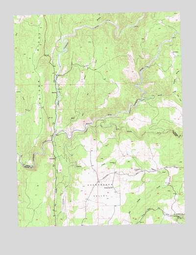
Fiddletown, CA USGS Topographic Map
Click on map above to begin viewing in our Map Viewer.

This topographic map contains these locations and features:
Feature Name Type Latitude Longitude GNIS ID View Map
Amador Fire Protection District Station 123BuildingN38.5049°W120.7579°2624602View Map
Amador Foothill WineryLocaleN38.5299°W120.7927°1733282View Map
Baldinelli VineyardsLocaleN38.5230°W120.8219°1733284View Map
Bell RanchLocaleN38.6007°W120.7572°218988View Map
Big Indian CreekStreamN38.5507°W120.8494°219202View Map
Briarcliff MinesMineN38.5632°W120.8349°219810View Map
Charles Spinetta VineyardsLocaleN38.5427°W120.7841°1733294View Map
Clockspring VineyardsLocaleN38.5421°W120.7997°1733299View Map
D'Agostini WineryLocaleN38.5332°W120.7680°1733300View Map
Deaver VineyardsLocaleN38.5410°W120.7958°1733301View Map
Domaine De La Terre Rouge-Easton WineryLocaleN38.5144°W120.8260°1733303View Map
East Big Canyon CreekStreamN38.5616°W120.8455°222848View Map
EnterprisePopulated PlaceN38.5402°W120.8472°1655999View Map
FiddletownPopulated PlaceN38.5038°W120.7555°223482View Map
Fiddletown CemeteryCemeteryN38.5021°W120.7577°1733305View Map
Fiddletown Census Designated PlaceCensusN38.5091°W120.7605°2583012View Map
Fiddletown Community HallBuildingN38.5044°W120.7577°1733306View Map
Fiddletown Masonic CemeteryCemeteryN38.5024°W120.7574°1733307View Map
Fiddletown Post OfficePost OfficeN38.5057°W120.7601°2769365View Map
Flat CreekStreamN38.5769°W120.7569°223579View Map
Grizzly GulchValleyN38.5780°W120.7547°224636View Map
Head HouseBuildingN38.5049°W120.7569°1733313View Map
Jameson 481 DamDamN38.5249°W120.8027°1663908View Map
Karly VineyardsLocaleN38.5357°W120.8269°1733325View Map
Kenworthy VineyardsLocaleN38.5180°W120.8177°1733326View Map
Logtown RidgeRidgeN38.6163°W120.8577°227484View Map
Martinez CreekStreamN38.6185°W120.8130°228183View Map
Middle Fork Cosumnes RiverStreamN38.5538°W120.8474°245861View Map
Montevina WineryLocaleN38.5157°W120.7969°1733337View Map
NashvillePopulated PlaceN38.5788°W120.8452°1656185View Map
North Fork Cosumnes RiverStreamN38.5538°W120.8474°267071View Map
Pigeon CreekStreamN38.5427°W120.8480°234460View Map
Pigeon Creek SchoolSchoolN38.5319°W120.7510°230642View Map
Plymouth DitchCanalN38.5338°W120.8377°230832View Map
Prospect HillSummitN38.5316°W120.7883°1656234View Map
Renwood-Santino WineryLocaleN38.5380°W120.8024°1733353View Map
Santino WineryLocaleN38.5444°W120.7927°1733361View Map
Schallhorne BuildingBuildingN38.5041°W120.7569°1733363View Map
Shenandoah Lake 486 DamDamN38.5332°W120.8144°1663911View Map
Shenandoah Pioneer CemeteryCemeteryN38.5366°W120.8027°232951View Map
Shenandoah SchoolSchoolN38.5221°W120.8044°232952View Map
Shenandoah ValleyFlatN38.5205°W120.8158°232953View Map
Shenandoah Valley MuseumBuildingN38.5449°W120.7760°1733364View Map
Shenandoah VineyardsLocaleN38.5360°W120.7885°1733365View Map
Sobon Estate VineyardsLocaleN38.5394°W120.7719°1733366View Map
South Fork Cosumnes RiverStreamN38.5594°W120.8213°267443View Map
Spanish CreekStreamN38.5744°W120.7808°235150View Map
Story VineyardsLocaleN38.5416°W120.8177°1733367View Map
The VineyardsLocaleN38.5269°W120.8160°1733368View Map
Vino Noceto WineryLocaleN38.5194°W120.8219°1733372View Map

Note: Coordinates in the location and feature list above are referenced to NAD83 datum.


Copyright (C) 2008-2024 Ryan Niemi / Sunset Dynamics ... All Rights Reserved