TopoQuest Logo
Do you find TopoQuest useful?
Help keep TopoQuest running and adding new maps/features by donating!
Bitcoin:  19c7KJd3qBynnjoSw5npx9KScwjBe4ifkT
Litecoin:  LXs6TkuXGGXo1vDsWCkWVdjQX94eUKd6ui
Home View Maps Find Maps Find Places Resources & Links


Laura Lake, Minnesota Topographic Map

USGS Map Title: Laura Lake, MN
USGS Map MRC: 46094H1
DRG (GeoTIFF) Download: o46094h1.tif


Neighboring USGS Topographic Map Quads:


  Longville, MN  
46094H2
 

  Laura Lake, MN  
46094H1
 

  Thunder Lake, MN  
46093H8
 

  Stewart Lake, MN  
46094G2
 

  Mitchell Lake, MN  
46094G1
 

  Roosevelt Lake, MN  
46093G8


Map MRC Location:

N47°
W95°
N47°
W94°
H8 H7 H6 H5 H4 H3 H2 H1
G8 G7 G6 G5 G4 G3 G2 G1
F8 F7 F6 F5 F4 F3 F2 F1
E8 E7 E6 E5 E4 E3 E2 E1
D8 D7 D6 D5 D4 D3 D2 D1
C8 C7 C6 C5 C4 C3 C2 C1
B8 B7 B6 B5 B4 B3 B2 B1
A8 A7 A6 A5 A4 A3 A2 A1
N46°
W95°
N46°
W94°

Laura Lake, MN USGS 1:24K Topographic Map Preview:
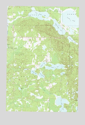
Laura Lake, MN USGS Topographic Map
Click on map above to begin viewing in our Map Viewer.

This topographic map contains these locations and features:
Feature Name Type Latitude Longitude GNIS ID View Map
Cranberry LakeLakeN46.9020°W94.1017°655854View Map
Daggett Brook DamDamN46.9033°W94.0886°1776131View Map
Daggett Brook ReservoirReservoirN46.9033°W94.0886°1776132View Map
Hoister LakeLakeN46.9250°W94.0922°656608View Map
Island LakeLakeN46.9284°W94.0406°656730View Map
Lake GeorgeLakeN46.8812°W94.0269°656368View Map
Lake TwentysixLakeN46.9184°W94.0642°658786View Map
Laura BrookStreamN46.9930°W94.0094°656960View Map
Laura LakeLakeN46.9838°W94.0133°656961View Map
Little Bass LakeLakeN46.9604°W94.0128°657023View Map
Lower Trelipe LakeReservoirN46.9902°W94.0706°657247View Map
Minnesota Chippewa Trust LandCivilN46.9876°W94.0355°2419018View Map
Mitten LakeLakeN46.9310°W94.0624°657439View Map
Northby CreekStreamN46.9525°W94.1241°657631View Map
O'Conner LakeLakeN46.9206°W94.0283°657643View Map
Safe Air Seaplane BaseAirportN46.9863°W94.1244°660260View Map
Salem Lutheran CemeteryCemeteryN46.9875°W94.1167°2071078View Map
SnowballLocaleN46.9750°W94.0291°659403View Map
Snowball Post Office (historical)Post OfficeN46.9750°W94.0289°2071265View Map
Stevens LakeLakeN46.9219°W94.0775°658472View Map
Township of TrelipeCivilN46.8905°W94.0917°665806View Map
Trelipe CreekStreamN46.9819°W94.1222°658740View Map
Upper Trelipe LakeLakeN46.9747°W94.0354°658827View Map

Note: Coordinates in the location and feature list above are referenced to NAD83 datum.


Copyright (C) 2008-2025 Ryan Niemi / Sunset Dynamics ... All Rights Reserved