TopoQuest Logo
Do you find TopoQuest useful?
Help keep TopoQuest running and adding new maps/features by donating!
Bitcoin:  19c7KJd3qBynnjoSw5npx9KScwjBe4ifkT
Litecoin:  LXs6TkuXGGXo1vDsWCkWVdjQX94eUKd6ui
Home View Maps Find Maps Find Places Resources & Links


Thunder Lake, Minnesota Topographic Map

USGS Map Title: Thunder Lake, MN
USGS Map MRC: 46093H8
DRG (GeoTIFF) Download: o46093h8.tif


Neighboring USGS Topographic Map Quads:


  Laura Lake, MN  
46094H1
 

  Thunder Lake, MN  
46093H8
 

  Shovel Lake, MN  
46093H7
 

  Mitchell Lake, MN  
46094G1
 

  Roosevelt Lake, MN  
46093G8
 

  Edna Lake, MN  
46093G7


Map MRC Location:

N47°
W94°
N47°
W93°
H8 H7 H6 H5 H4 H3 H2 H1
G8 G7 G6 G5 G4 G3 G2 G1
F8 F7 F6 F5 F4 F3 F2 F1
E8 E7 E6 E5 E4 E3 E2 E1
D8 D7 D6 D5 D4 D3 D2 D1
C8 C7 C6 C5 C4 C3 C2 C1
B8 B7 B6 B5 B4 B3 B2 B1
A8 A7 A6 A5 A4 A3 A2 A1
N46°
W94°
N46°
W93°

Thunder Lake, MN USGS 1:24K Topographic Map Preview:
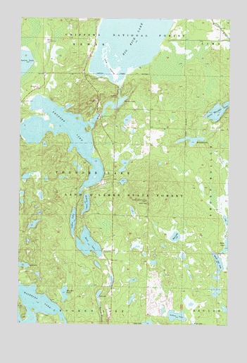
Thunder Lake, MN USGS Topographic Map
Click on map above to begin viewing in our Map Viewer.

This topographic map contains these locations and features:
Feature Name Type Latitude Longitude GNIS ID View Map
Abe LakeLakeN46.8873°W93.9521°655069View Map
Baker LakeLakeN46.9079°W93.8756°655194View Map
Bass LakeLakeN46.9077°W93.9587°655242View Map
Big Rice LakeLakeN46.9939°W93.9335°655374View Map
Blue Bill LakeLakeN46.8876°W93.9725°655443View Map
Coffin LakeLakeN46.9169°W93.9678°655773View Map
Deer LakeLakeN46.9110°W93.9064°655961View Map
Draper Lookout TowerTowerN46.9258°W93.9250°659823View Map
Kidney LakeLakeN46.9243°W93.9600°656886View Map
Land O'Lakes State ForestForestN46.9341°W93.9441°656943View Map
Lost LakeLakeN46.8988°W93.9993°657227View Map
Low IslandIslandN46.9805°W93.9480°657235View Map
Michaud LakeLakeN46.9505°W93.8974°657382View Map
Oxbow LakeLakeN46.8787°W93.9055°657714View Map
Pug Hole LakeLakeN46.9662°W93.9395°657952View Map
Steiner Landing Strip (historical)AirportN46.9894°W93.9844°659364View Map
Thunder LakeReservoirN46.9584°W93.9751°658681View Map
Township of Thunder LakeCivilN46.9338°W93.9655°665787View Map
White Oak LakeLakeN46.9009°W93.8807°658988View Map

Note: Coordinates in the location and feature list above are referenced to NAD83 datum.


Copyright (C) 2008-2025 Ryan Niemi / Sunset Dynamics ... All Rights Reserved