TopoQuest Logo
Do you find TopoQuest useful?
Help keep TopoQuest running and adding new maps/features by donating!
Bitcoin:  19c7KJd3qBynnjoSw5npx9KScwjBe4ifkT
Litecoin:  LXs6TkuXGGXo1vDsWCkWVdjQX94eUKd6ui
Home View Maps Find Maps Find Places Resources & Links


Laurel Bloomery, Tennessee Topographic Map

USGS Map Title: Laurel Bloomery, TN
USGS Map MRC: 36081E7
DRG (GeoTIFF) Download: o36081e7.tif


Neighboring USGS Topographic Map Quads:


  Abingdon, VA  
36081F8
 

  Damascus, VA  
36081F7
 

  Konnarock, VA  
36081F6
 

  Shady Valley, TN  
36081E8
 

  Laurel Bloomery, TN  
36081E7
 

  Grayson, NC  
36081E6
 

  Doe, TN  
36081D8
 

  Mountain City, TN  
36081D7
 

  Baldwin Gap, NC  
36081D6


Map MRC Location:

N37°
W82°
N37°
W81°
H8 H7 H6 H5 H4 H3 H2 H1
G8 G7 G6 G5 G4 G3 G2 G1
F8 F7 F6 F5 F4 F3 F2 F1
E8 E7 E6 E5 E4 E3 E2 E1
D8 D7 D6 D5 D4 D3 D2 D1
C8 C7 C6 C5 C4 C3 C2 C1
B8 B7 B6 B5 B4 B3 B2 B1
A8 A7 A6 A5 A4 A3 A2 A1
N36°
W82°
N36°
W81°

Laurel Bloomery, TN USGS 1:24K Topographic Map Preview:
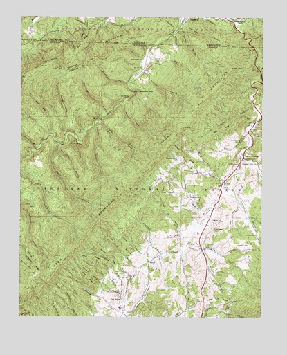
Laurel Bloomery, TN USGS Topographic Map
Click on map above to begin viewing in our Map Viewer.

This topographic map contains these locations and features:
Feature Name Type Latitude Longitude GNIS ID View Map
Adams BranchStreamN36.5093°W81.8221°1327444View Map
Arnold BranchStreamN36.5698°W81.8668°1327472View Map
Atchison BranchStreamN36.5546°W81.7715°1327475View Map
Atchison ChurchChurchN36.5329°W81.7515°1640577View Map
Atchison SchoolSchoolN36.5343°W81.7529°1327476View Map
Backbone BranchStreamN36.5968°W81.8196°1327482View Map
Backbone RockPillarN36.5940°W81.8140°1327483View Map
Backbone Rock Recreation AreaParkN36.5946°W81.8143°1646905View Map
Blevins BranchStreamN36.6179°W81.7968°1481844View Map
Butt MountainSummitN36.6032°W81.7660°1327772View Map
Camp A-Hi-S-Ta-DiLocaleN36.5987°W81.7548°1646906View Map
Camp HollowValleyN36.5817°W81.8338°1327792View Map
Camp Hollow MineMineN36.5751°W81.8310°1642195View Map
Camp McArthur (historical)LocaleN36.6154°W81.8032°1498234View Map
Chalk BranchStreamN36.5823°W81.8343°1327869View Map
Chalk Branch ProspectMineN36.5704°W81.8396°1640583View Map
Cold SpringPopulated PlaceN36.5068°W81.8226°1327949View Map
Commissioner District 1CivilN36.5452°W81.7632°2464251View Map
Cornett CemeteryCemeteryN36.5307°W81.7601°1327975View Map
Corum BranchStreamN36.5246°W81.8048°1327976View Map
Dan Wiley BranchStreamN36.5734°W81.8460°1652473View Map
Dark HollowValleyN36.5764°W81.8590°1328019View Map
Davis HollowValleyN36.6135°W81.8039°1328027View Map
Dollars Station (historical)LocaleN36.6057°W81.7535°1642199View Map
Dowe ChapelChurchN36.5521°W81.7957°1328071View Map
Dry BranchStreamN36.5612°W81.7504°1328080View Map
Drystone BranchStreamN36.5290°W81.7804°1328093View Map
East Tank Hollow ProspectMineN36.5862°W81.8187°1640586View Map
Elliot BranchStreamN36.6029°W81.7512°1328131View Map
EurekaPopulated PlaceN36.5562°W81.7696°1328152View Map
Fagall BranchStreamN36.5723°W81.8543°1328156View Map
Fairview SchoolSchoolN36.5660°W81.7940°1328164View Map
Fenner BranchStreamN36.5076°W81.8218°1328179View Map
First District Volunteer Fire Department LaurelBuildingN36.5669°W81.7592°2654848View Map
Flatwood BranchStreamN36.5262°W81.8023°1328193View Map
Fox HollowValleyN36.5001°W81.7789°1328221View Map
FullerPopulated PlaceN36.5232°W81.8079°1328237View Map
Garland RidgeRidgeN36.5257°W81.8282°1328250View Map
Gentry BranchStreamN36.5046°W81.8210°1328256View Map
Gentry CemeteryCemeteryN36.5787°W81.7543°1328257View Map
Gentry CreekStreamN36.5690°W81.7615°1328258View Map
Greer BranchStreamN36.5801°W81.7554°1328335View Map
Grindstone RidgeRidgeN36.5268°W81.8735°1326935View Map
Hall BranchStreamN36.5162°W81.8168°1328365View Map
Hall HollowValleyN36.5027°W81.7687°1328367View Map
Haunted HollowValleyN36.5767°W81.8518°1328407View Map
Hawkins ProspectMineN36.5487°W81.7740°1640592View Map
Hogback MineMineN36.5732°W81.8312°1642210View Map
Hoot Owl HollowValleyN36.5358°W81.7928°1328479View Map
John RidgeRidgeN36.5168°W81.8390°1328573View Map
Johnson County Memorial Hospital (historical)HospitalN36.5037°W81.8229°1640596View Map
Laurel BloomeryPopulated PlaceN36.5662°W81.7596°1328639View Map
Laurel Bloomery Post OfficePost OfficeN36.5666°W81.7600°1649272View Map
Laurel CreekStreamN36.6232°W81.7646°1290727View Map
Laurel Elementary SchoolSchoolN36.5654°W81.7562°1640598View Map
LaureldalePopulated PlaceN36.6237°W81.7621°1495828View Map
Lick BranchStreamN36.5815°W81.7537°1640599View Map
London Bridge BranchStreamN36.6201°W81.7935°1485032View Map
Long HollowValleyN36.5478°W81.7614°1328777View Map
Lord RidgeRidgeN36.5304°W81.8218°1328786View Map
Lyons BranchStreamN36.5882°W81.7540°1328816View Map
Maple BranchStreamN36.5798°W81.8362°1328830View Map
Matron CemeteryCemeteryN36.5640°W81.7623°1328848View Map
McCann BranchStreamN36.5573°W81.7676°1328858View Map
Morfield RidgeRidgeN36.5676°W81.7893°1328942View Map
Neely MineMineN36.5912°W81.8110°1642224View Map
Negro Grave HollowValleyN36.5801°W81.7535°1329002View Map
North Fork Gentry CreekStreamN36.5623°W81.7512°1329021View Map
North Fork McCann BranchStreamN36.5601°W81.7773°1329022View Map
Parks GapGapN36.5407°W81.8621°1649282View Map
Parks Gap ProspectMineN36.5409°W81.8623°1640603View Map
Patrick BranchStreamN36.5012°W81.8196°1326967View Map
Pleasant Home ChurchChurchN36.5640°W81.7526°1639481View Map
Pond RidgeRidgeN36.6157°W81.8426°1486329View Map
Red Fox RidgeRidgeN36.5157°W81.7962°1639554View Map
Reservoir BranchStreamN36.6032°W81.8115°1639574View Map
Reynolds MineMineN36.6109°W81.7971°1642228View Map
Sandy Flat RidgeRidgeN36.5079°W81.7709°1639700View Map
Scott ProspectMineN36.5301°W81.7579°1642232View Map
Sebert ProspectMineN36.6082°W81.8007°1640608View Map
Second District Volunteer Fire DepartmentBuildingN36.5063°W81.8223°2654600View Map
Shady Valley Division (historical)CensusN36.5446°W81.8698°1648803View Map
Sheets ProspectMineN36.5079°W81.7768°1640609View Map
ShingletownPopulated PlaceN36.5504°W81.7879°1326992View Map
Shingletown BranchStreamN36.5471°W81.7762°1326993View Map
Silver LakePopulated PlaceN36.5385°W81.7757°1327009View Map
Silver Lake MineMineN36.5423°W81.7771°1642234View Map
South Fork Furnace CreekStreamN36.5001°W81.7548°1327067View Map
South Fork McCann BranchStreamN36.5601°W81.7773°1327069View Map
Stack RidgeRidgeN36.5785°W81.7707°1327093View Map
State Line MineMineN36.6129°W81.7951°1642237View Map
Stillhouse BranchStreamN36.5843°W81.8296°1327116View Map
Stone BranchStreamN36.5151°W81.8179°1327119View Map
Stout RidgeRidgeN36.5254°W81.8376°1327134View Map
Sugarcamp BranchStreamN36.6218°W81.7935°1487702View Map
Sugarcamp BranchStreamN36.5726°W81.8548°1847147View Map
SutherlandPopulated PlaceN36.6043°W81.8101°1327166View Map
Sutherland SchoolSchoolN36.6062°W81.8107°1327168View Map
Tank HollowValleyN36.5902°W81.8219°1327182View Map
Thomas BranchStreamN36.5107°W81.8273°1327208View Map
Trigger BranchStreamN36.5401°W81.7807°1327252View Map
Venable HollowValleyN36.5598°W81.7637°1327303View Map
Ward MineMineN36.5271°W81.7512°1642244View Map
Waters BranchStreamN36.5768°W81.7573°1327327View Map
Wesley ChapelChurchN36.5501°W81.7879°1640618View Map
West Tank Hollow ProspectMineN36.5812°W81.8235°1640619View Map
Whitetop Laurel CreekStreamN36.6237°W81.7648°1488344View Map
WillsPopulated PlaceN36.5337°W81.7935°1327397View Map
Wills BranchStreamN36.5268°W81.7901°1327398View Map
Wills CemeteryCemeteryN36.5307°W81.7868°1327399View Map
Wills MineMineN36.5296°W81.7754°1642248View Map
Wills SchoolSchoolN36.5410°W81.7748°1327400View Map

Note: Coordinates in the location and feature list above are referenced to NAD83 datum.


Copyright (C) 2008-2024 Ryan Niemi / Sunset Dynamics ... All Rights Reserved