TopoQuest Logo
Do you find TopoQuest useful?
Help keep TopoQuest running and adding new maps/features by donating!
Bitcoin:  19c7KJd3qBynnjoSw5npx9KScwjBe4ifkT
Litecoin:  LXs6TkuXGGXo1vDsWCkWVdjQX94eUKd6ui
Home View Maps Find Maps Find Places Resources & Links


Lawrenceton, Missouri Topographic Map

USGS Map Title: Lawrenceton, MO
USGS Map MRC: 37090H3
DRG (GeoTIFF) Download: o37090h3.tif


Neighboring USGS Topographic Map Quads:


  Halifax, MO  
38090A4
 

  Danby, MO  
38090A3
 

  Bloomsdale, MO  
38090A2
 

  French Village, MO  
37090H4
 

  Lawrenceton, MO  
37090H3
 

  Weingarten, MO  
37090H2
 

  Farmington, MO  
37090G4
 

  Sprott, MO  
37090G3
 

  Coffman, MO  
37090G2


Map MRC Location:

N38°
W91°
N38°
W90°
H8 H7 H6 H5 H4 H3 H2 H1
G8 G7 G6 G5 G4 G3 G2 G1
F8 F7 F6 F5 F4 F3 F2 F1
E8 E7 E6 E5 E4 E3 E2 E1
D8 D7 D6 D5 D4 D3 D2 D1
C8 C7 C6 C5 C4 C3 C2 C1
B8 B7 B6 B5 B4 B3 B2 B1
A8 A7 A6 A5 A4 A3 A2 A1
N37°
W91°
N37°
W90°

Lawrenceton, MO USGS 1:24K Topographic Map Preview:
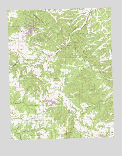
Lawrenceton, MO USGS Topographic Map
Click on map above to begin viewing in our Map Viewer.

This topographic map contains these locations and features:
Feature Name Type Latitude Longitude GNIS ID View Map
Beckemeyer CemeteryCemeteryN37.9974°W90.2718°713844View Map
Bequette CemeteryCemeteryN37.9392°W90.3221°713978View Map
Cunningham BranchStreamN37.9820°W90.3226°755962View Map
Erb LakeReservoirN37.9106°W90.3238°763706View Map
Goose CreekStreamN37.9978°W90.2743°756117View Map
Goose Creek LakeReservoirN37.9812°W90.3354°764011View Map
Goose Creek Lake DamDamN37.9817°W90.3418°764010View Map
Goose Creek Lake Fire Department Station 1BuildingN37.9803°W90.3522°2620884View Map
Goose Creek Lake Fire Department Station 2BuildingN37.9761°W90.3440°2620883View Map
Herman School (historical)SchoolN37.8864°W90.2629°737622View Map
Jenning CemeteryCemeteryN37.9360°W90.3392°720298View Map
Lake Seven Falls Dam Number 2DamN37.9117°W90.3285°764480View Map
Lake Seven Falls Dam Number 3DamN37.9101°W90.3201°763705View Map
LawrencetonPopulated PlaceN37.9651°W90.3051°736314View Map
Lawrenceton School (historical)SchoolN37.9653°W90.3054°737623View Map
Little Vine CemeteryCemeteryN37.8881°W90.3357°2703043View Map
Little Vine ChurchChurchN37.8884°W90.3357°736319View Map
Little Vine HillSummitN37.8898°W90.3346°737624View Map
Little Vine School (historical)SchoolN37.8853°W90.3354°737621View Map
Mackley CemeteryCemeteryN37.8954°W90.3497°721730View Map
MillPopulated PlaceN37.8895°W90.3468°739952View Map
Number 615 DamDamN37.8867°W90.3518°764669View Map
Patterson CemeteryCemeteryN37.9331°W90.3215°724086View Map
Pin Hook BranchStreamN37.9687°W90.3004°737625View Map
Pine RidgeRidgeN37.9623°W90.2885°724391View Map
Pinhook HollowValleyN37.9687°W90.3004°724408View Map
Pinkston DamDamN37.9667°W90.3085°764489View Map
Pinkston Lake (historical)ReservoirN37.9656°W90.3079°758326View Map
Saint Lawrences Catholic ChurchChurchN37.9656°W90.3054°737627View Map
Thurman School (historical)SchoolN37.9281°W90.3337°737620View Map
Township of UnionCivilN37.8792°W90.3290°767328View Map

Note: Coordinates in the location and feature list above are referenced to NAD83 datum.


Copyright (C) 2008-2024 Ryan Niemi / Sunset Dynamics ... All Rights Reserved