TopoQuest Logo
Do you find TopoQuest useful?
Help keep TopoQuest running and adding new maps/features by donating!
Bitcoin:  19c7KJd3qBynnjoSw5npx9KScwjBe4ifkT
Litecoin:  LXs6TkuXGGXo1vDsWCkWVdjQX94eUKd6ui
Home View Maps Find Maps Find Places Resources & Links


Weingarten, Missouri Topographic Map

USGS Map Title: Weingarten, MO
USGS Map MRC: 37090H2
DRG (GeoTIFF) Download: o37090h2.tif


Neighboring USGS Topographic Map Quads:


  Danby, MO  
38090A3
 

  Bloomsdale, MO  
38090A2
 

  Prairie du Rocher, IL  
38090A1
 

  Lawrenceton, MO  
37090H3
 

  Weingarten, MO  
37090H2
 

  Sainte Genevieve, MO  
37090H1
 

  Sprott, MO  
37090G3
 

  Coffman, MO  
37090G2
 

  Minnith, MO  
37090G1


Map MRC Location:

N38°
W91°
N38°
W90°
H8 H7 H6 H5 H4 H3 H2 H1
G8 G7 G6 G5 G4 G3 G2 G1
F8 F7 F6 F5 F4 F3 F2 F1
E8 E7 E6 E5 E4 E3 E2 E1
D8 D7 D6 D5 D4 D3 D2 D1
C8 C7 C6 C5 C4 C3 C2 C1
B8 B7 B6 B5 B4 B3 B2 B1
A8 A7 A6 A5 A4 A3 A2 A1
N37°
W91°
N37°
W90°

Weingarten, MO USGS 1:24K Topographic Map Preview:
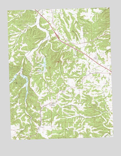
Weingarten, MO USGS Topographic Map
Click on map above to begin viewing in our Map Viewer.

This topographic map contains these locations and features:
Feature Name Type Latitude Longitude GNIS ID View Map
Bald Creek HollowValleyN37.9881°W90.1671°738168View Map
Big Bottom CreekStreamN37.9695°W90.2001°714130View Map
Coal CreekStreamN37.9517°W90.1643°738161View Map
Coots CreekStreamN37.9867°W90.2118°738166View Map
Copper MinePopulated PlaceN37.9037°W90.1465°716302View Map
Copper Mine CreekStreamN37.8959°W90.1390°738159View Map
Cornwall Copper MineMineN37.9064°W90.1446°737629View Map
Deakin RidgeRidgeN37.9648°W90.2354°738163View Map
Flint Bottom CreekStreamN37.8817°W90.1254°718023View Map
Grayhawk Census Designated PlaceCensusN37.9310°W90.2390°2587075View Map
Hickory CreekStreamN37.9289°W90.2298°719444View Map
Hogg CreekStreamN37.8976°W90.1384°738160View Map
Indian CreekStreamN37.9748°W90.1979°720110View Map
Joe Schilly HollowValleyN37.9826°W90.2146°738165View Map
Lake AnneReservoirN37.9470°W90.2066°758390View Map
Lake Forest DamDamN37.9534°W90.2065°763693View Map
Lake Forest EstatesPopulated PlaceN37.9451°W90.2085°2647218View Map
Lake Forest Volunteer Fire DepartmentBuildingN37.9487°W90.2152°2620881View Map
Lake MarianReservoirN37.9411°W90.2122°758388View Map
Lake Marian DamDamN37.9409°W90.2112°764497View Map
Lake OcieReservoirN37.9197°W90.2295°766173View Map
Lake Ocie DamDamN37.9270°W90.2293°766201View Map
Lake SkiReservoirN37.9339°W90.2450°758391View Map
Lake Ski DamDamN37.9384°W90.2404°764873View Map
Lake SusanReservoirN37.9465°W90.2130°758389View Map
Lake Susan DamDamN37.9464°W90.2118°764498View Map
Lake Wanda LeeReservoirN37.9277°W90.2320°758387View Map
Lake Wanda Lee DamDamN37.9381°W90.2354°763692View Map
Lick HollowValleyN37.9198°W90.2029°737630View Map
Little Bottom CreekStreamN37.9598°W90.1846°721166View Map
Moonshine HollowValleyN37.9914°W90.1673°738169View Map
New OffenburgPopulated PlaceN37.9087°W90.1973°723288View Map
New Offenburg Census Designated PlaceCensusN37.9081°W90.2022°2587095View Map
Our Lady Help of Christians Catholic ChurchChurchN37.8945°W90.2123°737631View Map
Our Lady of Help SchoolSchoolN37.8945°W90.2123°742039View Map
Pikes PeakSummitN37.9856°W90.2390°738167View Map
Pile Driver HollowValleyN37.9714°W90.2060°738164View Map
Pine Valley School (historical)SchoolN37.9362°W90.2137°724397View Map
Red Hill School (historical)SchoolN37.9492°W90.1493°737628View Map
Rocky Ridge RanchPopulated PlaceN37.9303°W90.2385°738162View Map
Saint Josephs Catholic ChurchChurchN37.9512°W90.1437°737632View Map
Sainte Genevieve CountyCivilN37.8944°W90.1944°765806View Map
Schwent SpringSpringN37.8953°W90.1610°738158View Map
Siebert Bottom HollowValleyN37.9767°W90.2335°738173View Map
Sugar HillsRangeN37.9851°W90.1423°738170View Map
Valle HollowValleyN37.8756°W90.1804°738157View Map
WeingartenPopulated PlaceN37.8876°W90.2146°728478View Map
Weingarten Census Designated PlaceCensusN37.8894°W90.2173°2587120View Map
Weingarten Volunteer Fire DepartmentBuildingN37.8984°W90.2139°2620879View Map
ZellPopulated PlaceN37.9526°W90.1429°729223View Map
Zell StationLocaleN37.9381°W90.1398°729224View Map
Zell Volunteer Fire DepartmentBuildingN37.9516°W90.1425°2620882View Map

Note: Coordinates in the location and feature list above are referenced to NAD83 datum.


Copyright (C) 2008-2024 Ryan Niemi / Sunset Dynamics ... All Rights Reserved