TopoQuest Logo
Do you find TopoQuest useful?
Help keep TopoQuest running and adding new maps/features by donating!
Bitcoin:  19c7KJd3qBynnjoSw5npx9KScwjBe4ifkT
Litecoin:  LXs6TkuXGGXo1vDsWCkWVdjQX94eUKd6ui
Home View Maps Find Maps Find Places Resources & Links


Laws, California Topographic Map

USGS Map Title: Laws, CA
USGS Map MRC: 37118D3
DRG (GeoTIFF) Download: o37118d3.tif


Neighboring USGS Topographic Map Quads:


  Chidago Canyon, CA  
37118E4
 

  Chalfant Valley, CA  
37118E3
 

  Mount Barcroft, CA  
37118E2
 

  Fish Slough, CA  
37118D4
 

  Laws, CA  
37118D3
 

  Blanco Mountain, CA  
37118D2
 

  Bishop, CA  
37118C4
 

  Poleta Canyon, CA  
37118C3
 

  Westgard Pass, CA  
37118C2


Map MRC Location:

N38°
W119°
N38°
W118°
H8 H7 H6 H5 H4 H3 H2 H1
G8 G7 G6 G5 G4 G3 G2 G1
F8 F7 F6 F5 F4 F3 F2 F1
E8 E7 E6 E5 E4 E3 E2 E1
D8 D7 D6 D5 D4 D3 D2 D1
C8 C7 C6 C5 C4 C3 C2 C1
B8 B7 B6 B5 B4 B3 B2 B1
A8 A7 A6 A5 A4 A3 A2 A1
N37°
W119°
N37°
W118°

Laws, CA USGS 1:24K Topographic Map Preview:
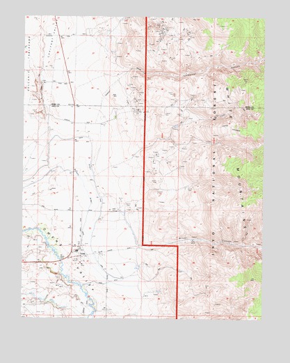
Laws, CA USGS Topographic Map
Click on map above to begin viewing in our Map Viewer.

This topographic map contains these locations and features:
Feature Name Type Latitude Longitude GNIS ID View Map
Chalfant ValleyValleyN37.4235°W118.3468°220880View Map
Churchill PitMineN37.4674°W118.2976°1682065View Map
Coldwater CanyonValleyN37.4783°W118.3207°266586View Map
Gunter Canyon MineMineN37.4474°W118.2759°1682047View Map
Gunter CreekStreamN37.4260°W118.3368°266787View Map
LawsPopulated PlaceN37.4008°W118.3457°1659742View Map
Laws DitchCanalN37.3891°W118.3329°1667233View Map
North End School (historical)SchoolN37.4335°W118.3493°1703650View Map
North Fork Bishop CreekStreamN37.3752°W118.3421°272677View Map
North McNally CanalCanalN37.4372°W118.3404°267083View Map
Railroad MuseumBuildingN37.3994°W118.3462°1667245View Map
Silver CanyonValleyN37.4058°W118.3162°267246View Map
South McNally CanalCanalN37.4305°W118.3443°267528View Map
Southern Belle MineMineN37.4619°W118.3173°267542View Map
White Gull PitMineN37.4297°W118.2893°1682064View Map

Note: Coordinates in the location and feature list above are referenced to NAD83 datum.


Copyright (C) 2008-2025 Ryan Niemi / Sunset Dynamics ... All Rights Reserved