TopoQuest Logo
Do you find TopoQuest useful?
Help keep TopoQuest running and adding new maps/features by donating!
Bitcoin:  19c7KJd3qBynnjoSw5npx9KScwjBe4ifkT
Litecoin:  LXs6TkuXGGXo1vDsWCkWVdjQX94eUKd6ui
Home View Maps Find Maps Find Places Resources & Links


Le Roy, Minnesota Topographic Map

USGS Map Title: Le Roy, MN
USGS Map MRC: 43092E5
DRG (GeoTIFF) Download: o43092e5.tif


Neighboring USGS Topographic Map Quads:


  Dexter, MN  
43092F6
 

  Grand Meadow, MN  
43092F5
 

  Spring Valley, MN  
43092F4
 

  Adams, MN  
43092E6
 

  Le Roy, MN  
43092E5
 

  Ostrander, MN  
43092E4
 

  Little Cedar, IA  
43092D6
 

  McIntire, IA  
43092D5
 

  Lime Springs NW, IA  
43092D4


Map MRC Location:

N44°
W93°
N44°
W92°
H8 H7 H6 H5 H4 H3 H2 H1
G8 G7 G6 G5 G4 G3 G2 G1
F8 F7 F6 F5 F4 F3 F2 F1
E8 E7 E6 E5 E4 E3 E2 E1
D8 D7 D6 D5 D4 D3 D2 D1
C8 C7 C6 C5 C4 C3 C2 C1
B8 B7 B6 B5 B4 B3 B2 B1
A8 A7 A6 A5 A4 A3 A2 A1
N43°
W93°
N43°
W92°

Le Roy, MN USGS 1:24K Topographic Map Preview:
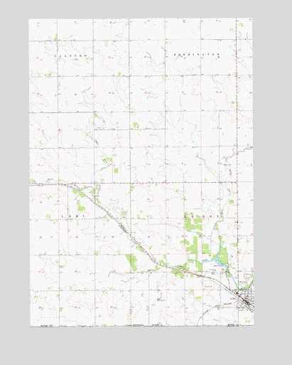
Le Roy, MN USGS Topographic Map
Click on map above to begin viewing in our Map Viewer.

This topographic map contains these locations and features:
Feature Name Type Latitude Longitude GNIS ID View Map
Austin Medical CenterHospitalN43.5105°W92.5049°2050283View Map
Bethany Bible ChurchChurchN43.5089°W92.5030°2050287View Map
City of Le RoyCivilN43.5133°W92.5077°2395657View Map
First Baptist ChurchChurchN43.5122°W92.5038°2050284View Map
First Presbyterian ChurchChurchN43.5166°W92.5016°2050286View Map
Lake LouiseLakeN43.5239°W92.5149°647226View Map
Lake LouiseReservoirN43.5269°W92.5213°1776563View Map
Lake Louise DamDamN43.5233°W92.5152°1776562View Map
Lake Louise State ParkParkN43.5336°W92.5255°1817634View Map
Le RoyPopulated PlaceN43.5097°W92.5038°646545View Map
Le Roy (historical)LocaleN43.5094°W92.5052°2050281View Map
Le Roy CemeteryCemeteryN43.5214°W92.5230°646546View Map
Le Roy Lutheran ChurchChurchN43.5111°W92.5038°2050285View Map
Le Roy Ostrander High SchoolSchoolN43.5136°W92.5099°2050280View Map
Le Roy Parkside Mobile Home ParkPopulated PlaceN43.5083°W92.5052°2050289View Map
Le Roy Post OfficePost OfficeN43.5105°W92.5038°2050279View Map
Le Roy Public LibraryBuildingN43.5144°W92.5030°2050278View Map
LeRoy Volunteer Fire DepartmentBuildingN43.5095°W92.5031°2666606View Map
Little Iowa RiverStreamN43.5277°W92.5202°646821View Map
Lutheran CemeteryCemeteryN43.5216°W92.5196°2050337View Map
North Branch Upper Iowa RiverStreamN43.5525°W92.5885°648620View Map
Saint Patrick's ChurchChurchN43.5144°W92.5124°2050288View Map
Saint Patricks CemeteryCemeteryN43.5216°W92.5210°650943View Map
Township of Le RoyCivilN43.5443°W92.5091°664762View Map

Note: Coordinates in the location and feature list above are referenced to NAD83 datum.


Copyright (C) 2008-2024 Ryan Niemi / Sunset Dynamics ... All Rights Reserved