TopoQuest Logo
Do you find TopoQuest useful?
Help keep TopoQuest running and adding new maps/features by donating!
Bitcoin:  19c7KJd3qBynnjoSw5npx9KScwjBe4ifkT
Litecoin:  LXs6TkuXGGXo1vDsWCkWVdjQX94eUKd6ui
Home View Maps Find Maps Find Places Resources & Links


Ostrander, Minnesota Topographic Map

USGS Map Title: Ostrander, MN
USGS Map MRC: 43092E4
DRG (GeoTIFF) Download: o43092e4.tif


Neighboring USGS Topographic Map Quads:


  Grand Meadow, MN  
43092F5
 

  Spring Valley, MN  
43092F4
 

  Wykoff, MN  
43092F3
 

  Le Roy, MN  
43092E5
 

  Ostrander, MN  
43092E4
 

  Cherry Grove, MN  
43092E3
 

  McIntire, IA  
43092D5
 

  Lime Springs NW, IA  
43092D4
 

  Lime Springs, IA  
43092D3


Map MRC Location:

N44°
W93°
N44°
W92°
H8 H7 H6 H5 H4 H3 H2 H1
G8 G7 G6 G5 G4 G3 G2 G1
F8 F7 F6 F5 F4 F3 F2 F1
E8 E7 E6 E5 E4 E3 E2 E1
D8 D7 D6 D5 D4 D3 D2 D1
C8 C7 C6 C5 C4 C3 C2 C1
B8 B7 B6 B5 B4 B3 B2 B1
A8 A7 A6 A5 A4 A3 A2 A1
N43°
W93°
N43°
W92°

Ostrander, MN USGS 1:24K Topographic Map Preview:
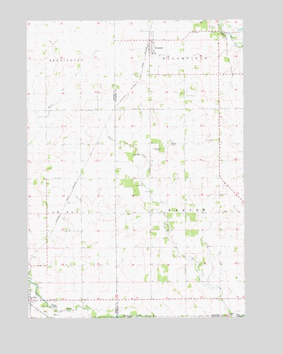
Ostrander, MN USGS Topographic Map
Click on map above to begin viewing in our Map Viewer.

This topographic map contains these locations and features:
Feature Name Type Latitude Longitude GNIS ID View Map
Beaver CreekStreamN43.5011°W92.3818°639817View Map
Bethany CemeteryCemeteryN43.5589°W92.4796°639993View Map
Bloomfield CemeteryCemeteryN43.5933°W92.4088°640274View Map
City of OstranderCivilN43.6143°W92.4264°2396101View Map
KROC-FM (Rochester)TowerN43.5708°W92.4271°663331View Map
KTTC-TV (Rochester)TowerN43.5708°W92.4271°663371View Map
Le Roy ClinicHospitalN43.5077°W92.4960°2050282View Map
OstranderPopulated PlaceN43.6136°W92.4279°649031View Map
Ostrander (historical)LocaleN43.6180°W92.4121°2050833View Map
Ostrander Alternative SchoolSchoolN43.6111°W92.4257°2050837View Map
Ostrander Fire DepartmentBuildingN43.6144°W92.4296°2666257View Map
Ostrander Lutheran CemeteryCemeteryN43.5336°W92.4196°2050809View Map
Ostrander Mobile Home ParkPopulated PlaceN43.6169°W92.4279°2050834View Map
Ostrander Nursing HomeHospitalN43.6136°W92.4279°2050838View Map
Ostrander Police DepartmentBuildingN43.6129°W92.4297°2758776View Map
Ostrander Post OfficePost OfficeN43.6136°W92.4279°2050839View Map
Root River Country ClubLocaleN43.6219°W92.3907°659935View Map
Township of BeaverCivilN43.5441°W92.3894°663537View Map
Trinity Lutheran ChurchChurchN43.6111°W92.4271°2050836View Map

Note: Coordinates in the location and feature list above are referenced to NAD83 datum.


Copyright (C) 2008-2024 Ryan Niemi / Sunset Dynamics ... All Rights Reserved