TopoQuest Logo
Do you find TopoQuest useful?
Help keep TopoQuest running and adding new maps/features by donating!
Bitcoin:  19c7KJd3qBynnjoSw5npx9KScwjBe4ifkT
Litecoin:  LXs6TkuXGGXo1vDsWCkWVdjQX94eUKd6ui
Home View Maps Find Maps Find Places Resources & Links


Leaburg, Oregon Topographic Map

USGS Map Title: Leaburg, OR
USGS Map MRC: 44122A6
DRG (GeoTIFF) Download: o44122a6.tif


Neighboring USGS Topographic Map Quads:


  Marcola, OR  
44122B7
 

  Mount Nebo, OR  
44122B6
 

  Vida, OR  
44122B5
 

  Walterville, OR  
44122A7
 

  Leaburg, OR  
44122A6
 

  Goat Point, OR  
44122A5
 

  Lowell, OR  
43122H7
 

  Fall Creek Lake, OR  
43122H6
 

  Saddleblanket Mountain, OR  
43122H5


Map MRC Location:

N45°
W123°
N45°
W122°
H8 H7 H6 H5 H4 H3 H2 H1
G8 G7 G6 G5 G4 G3 G2 G1
F8 F7 F6 F5 F4 F3 F2 F1
E8 E7 E6 E5 E4 E3 E2 E1
D8 D7 D6 D5 D4 D3 D2 D1
C8 C7 C6 C5 C4 C3 C2 C1
B8 B7 B6 B5 B4 B3 B2 B1
A8 A7 A6 A5 A4 A3 A2 A1
N44°
W123°
N44°
W122°

Leaburg, OR USGS 1:24K Topographic Map Preview:
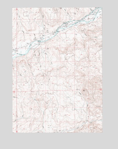
Leaburg, OR USGS Topographic Map
Click on map above to begin viewing in our Map Viewer.

This topographic map contains these locations and features:
Feature Name Type Latitude Longitude GNIS ID View Map
Alder CreekStreamN44.0776°W122.7331°1130783View Map
Cogswell CreekStreamN44.1162°W122.6345°1119091View Map
DeerhornPopulated PlaceN44.0818°W122.7484°1119843View Map
Deerhorn County ParkParkN44.0901°W122.7165°1162253View Map
Deerhorn Landing Boat RampLocaleN44.0913°W122.7157°2668335View Map
Deerhorn Post Office (historical)Post OfficeN44.0818°W122.7484°1165138View Map
Eugene Water and Electric Board CanalCanalN44.1126°W122.6545°1120531View Map
Forest CreekStreamN44.0887°W122.7206°1130782View Map
Greenwood CemeteryCemeteryN44.1124°W122.6444°1121415View Map
Greenwood Landing Boat RampLocaleN44.1197°W122.6329°2668189View Map
Greenwood Landing County ParkParkN44.1207°W122.6317°1157408View Map
Haagen CreekStreamN44.0846°W122.7262°1130781View Map
Holden CreekStreamN44.0918°W122.7101°1121898View Map
Johnson CreekStreamN44.1115°W122.6690°1122476View Map
Lane CreekStreamN44.0787°W122.7392°1122937View Map
LeaburgPopulated PlaceN44.1073°W122.6770°1123011View Map
Leaburg Landing Boat RampLocaleN44.1044°W122.6808°2668471View Map
Leaburg Landing County ParkParkN44.1040°W122.6804°1157409View Map
Leaburg Post OfficePost OfficeN44.1073°W122.6770°1165523View Map
Leaburg Power PlantLocaleN44.1012°W122.6892°1163733View Map
McKenzie Fire and Rescue Station 3 - Camp Creek StationBuildingN44.1067°W122.6761°2576697View Map
McKenzie River Golf CourseLocaleN44.0887°W122.7234°1163811View Map
McKenzie Salmon HatcheryLocaleN44.1185°W122.6365°1123989View Map
Miles PeakSummitN44.0423°W122.6505°1136538View Map
Montgomery CreekStreamN44.1248°W122.6290°1130777View Map
O'Brien CreekStreamN44.0929°W122.7179°1130780View Map
Ritchie CreekStreamN44.1079°W122.6642°1126050View Map
Spring CreekStreamN44.0860°W122.7179°1131042View Map
Sturdy CreekStreamN44.0104°W122.6476°1127680View Map
Wallace CreekStreamN44.1137°W122.6720°1130779View Map
Ward CreekStreamN44.1235°W122.6317°1130778View Map

Note: Coordinates in the location and feature list above are referenced to NAD83 datum.


Copyright (C) 2008-2025 Ryan Niemi / Sunset Dynamics ... All Rights Reserved