TopoQuest Logo
Do you find TopoQuest useful?
Help keep TopoQuest running and adding new maps/features by donating!
Bitcoin:  19c7KJd3qBynnjoSw5npx9KScwjBe4ifkT
Litecoin:  LXs6TkuXGGXo1vDsWCkWVdjQX94eUKd6ui
Home View Maps Find Maps Find Places Resources & Links


Marcola, Oregon Topographic Map

USGS Map Title: Marcola, OR
USGS Map MRC: 44122B7
DRG (GeoTIFF) Download: o44122b7.tif


Neighboring USGS Topographic Map Quads:


  Union Point, OR  
44122C8
 

  Crawfordsville, OR  
44122C7
 

  Chandler Mountain, OR  
44122C6
 

  Mohawk, OR  
44122B8
 

  Marcola, OR  
44122B7
 

  Mount Nebo, OR  
44122B6
 

  Springfield, OR  
44122A8
 

  Walterville, OR  
44122A7
 

  Leaburg, OR  
44122A6


Map MRC Location:

N45°
W123°
N45°
W122°
H8 H7 H6 H5 H4 H3 H2 H1
G8 G7 G6 G5 G4 G3 G2 G1
F8 F7 F6 F5 F4 F3 F2 F1
E8 E7 E6 E5 E4 E3 E2 E1
D8 D7 D6 D5 D4 D3 D2 D1
C8 C7 C6 C5 C4 C3 C2 C1
B8 B7 B6 B5 B4 B3 B2 B1
A8 A7 A6 A5 A4 A3 A2 A1
N44°
W123°
N44°
W122°

Marcola, OR USGS 1:24K Topographic Map Preview:
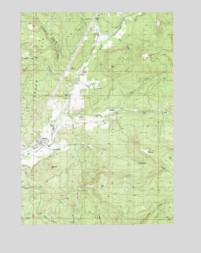
Marcola, OR USGS Topographic Map
Click on map above to begin viewing in our Map Viewer.

This topographic map contains these locations and features:
Feature Name Type Latitude Longitude GNIS ID View Map
Beaver CreekStreamN44.1901°W122.7998°1130582View Map
Bedortha ReservoirReservoirN44.2335°W122.8222°1161012View Map
Bette CreekStreamN44.2373°W122.8012°1130600View Map
Bunker HillSummitN44.2173°W122.8028°1136107View Map
Carolyn CreekStreamN44.2387°W122.7845°1130603View Map
Cartwright CreekStreamN44.1721°W122.8567°1118638View Map
Cash CreekStreamN44.2035°W122.8359°1118654View Map
Crooked CreekStreamN44.2457°W122.8651°1130606View Map
Dorothy CreekStreamN44.2429°W122.7929°1130602View Map
Drury (historical)LocaleN44.1876°W122.8345°1166403View Map
Drury ButteSummitN44.1581°W122.8516°1120103View Map
Drury CreekStreamN44.2307°W122.8101°1120105View Map
Earnest BridgeBridgeN44.2015°W122.8365°1157747View Map
Ethel CreekStreamN44.2304°W122.7901°1130601View Map
Hells HillSummitN44.1474°W122.8113°1121745View Map
Hyland (historical)LocaleN44.1860°W122.8484°1130583View Map
Log CreekStreamN44.2429°W122.7929°1130605View Map
MabelPopulated PlaceN44.2146°W122.8270°1123653View Map
Mabel CemeteryCemeteryN44.2133°W122.8275°1158668View Map
Mabel ParkParkN44.2151°W122.8373°1162182View Map
Mabel Post Office (historical)Post OfficeN44.2146°W122.8270°1165573View Map
MarcolaPopulated PlaceN44.1723°W122.8606°1136515View Map
Marcola CemeteryCemeteryN44.1709°W122.8721°1130596View Map
Marcola Christian ChurchChurchN44.1708°W122.8669°2508155View Map
Marcola DivisionCivilN44.1791°W122.8198°1938054View Map
Marcola Elementary SchoolSchoolN44.1742°W122.8628°1638720View Map
Marcola Post OfficePost OfficeN44.1723°W122.8619°1165584View Map
Mill CreekStreamN44.1901°W122.8390°1124161View Map
Mohawk High SchoolSchoolN44.1710°W122.8532°1124280View Map
Mohawk Valley Rural Fire District Station 1BuildingN44.1708°W122.8709°2577006View Map
Mohawk Valley Rural Fire District Station 2BuildingN44.2246°W122.8198°2576981View Map
Nettle (historical)LocaleN44.1893°W122.8073°1638721View Map
Parsons CreekStreamN44.1640°W122.8734°1125205View Map
Polly CreekStreamN44.2096°W122.8304°1130597View Map
Rock CreekStreamN44.2221°W122.8179°1130598View Map
Seeley CreekStreamN44.2465°W122.8556°1159072View Map
Shotgun CreekStreamN44.2121°W122.8273°1126928View Map
Shotgun Recreational SiteParkN44.2318°W122.8456°1162183View Map
Showalter CreekStreamN44.2226°W122.8606°1126934View Map
Upper Mabel CemeteryCemeteryN44.2325°W122.8150°1130599View Map
WendlingPopulated PlaceN44.1904°W122.7984°1136886View Map
Wendling Picnic AreaLocaleN44.1915°W122.7706°1162180View Map
Wendling Post Office (historical)Post OfficeN44.1904°W122.7984°1166146View Map
Windy PointSummitN44.1679°W122.7731°1161596View Map
Wolf CreekStreamN44.1918°W122.7951°1129268View Map

Note: Coordinates in the location and feature list above are referenced to NAD83 datum.


Copyright (C) 2008-2025 Ryan Niemi / Sunset Dynamics ... All Rights Reserved