TopoQuest Logo
Do you find TopoQuest useful?
Help keep TopoQuest running and adding new maps/features by donating!
Bitcoin:  19c7KJd3qBynnjoSw5npx9KScwjBe4ifkT
Litecoin:  LXs6TkuXGGXo1vDsWCkWVdjQX94eUKd6ui
Home View Maps Find Maps Find Places Resources & Links


Leachville, Arkansas Topographic Map

USGS Map Title: Leachville, AR
USGS Map MRC: 35090H3
DRG (GeoTIFF) Download: o35090h3.tif


Neighboring USGS Topographic Map Quads:


  Paragould East, AR  
36090A4
 

  Cardwell, MO  
36090A3
 

  Arbyrd, MO  
36090A2
 

  Dixie, AR  
35090H4
 

  Leachville, AR  
35090H3
 

  Manila North, AR  
35090H2
 

  Lake City, AR  
35090G4
 

  Caraway, AR  
35090G3
 

  Manila South, AR  
35090G2


Map MRC Location:

N36°
W91°
N36°
W90°
H8 H7 H6 H5 H4 H3 H2 H1
G8 G7 G6 G5 G4 G3 G2 G1
F8 F7 F6 F5 F4 F3 F2 F1
E8 E7 E6 E5 E4 E3 E2 E1
D8 D7 D6 D5 D4 D3 D2 D1
C8 C7 C6 C5 C4 C3 C2 C1
B8 B7 B6 B5 B4 B3 B2 B1
A8 A7 A6 A5 A4 A3 A2 A1
N35°
W91°
N35°
W90°

Leachville, AR USGS 1:24K Topographic Map Preview:
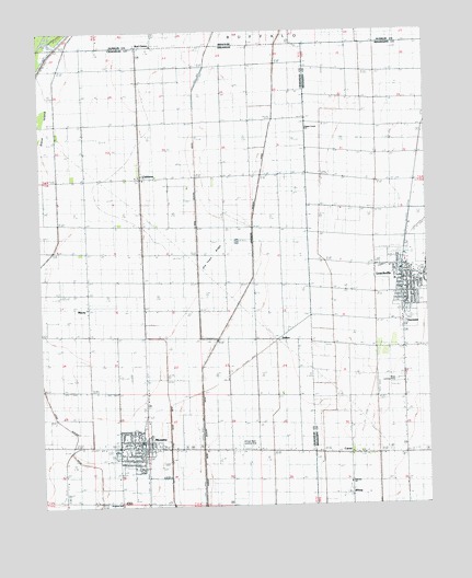
Leachville, AR USGS Topographic Map
Click on map above to begin viewing in our Map Viewer.

This topographic map contains these locations and features:
Feature Name Type Latitude Longitude GNIS ID View Map
BUFFALO IS. CENTRAL HSSchoolN35.8899°W90.3526°78942View Map
Buffalo Island Central East Elementary SchoolSchoolN35.9263°W90.2562°2039066View Map
Buffalo Island Central East Elementary SchoolSchoolN35.9245°W90.2559°61903View Map
Buffalo Island Central Junior High SchoolSchoolN35.9247°W90.2561°2039071View Map
Buffalo Island Central Junior High SchoolSchoolN35.9259°W90.2559°61902View Map
Buffalo Island Central West Elementary SchoolSchoolN35.8897°W90.3532°2039085View Map
Buffalo Island Central West Elementary SchoolSchoolN35.8898°W90.3532°64543View Map
Buffalo Island Emergency Medical ServicesBuildingN35.8919°W90.3428°2119160View Map
CarmiPopulated PlaceN35.8887°W90.2732°57512View Map
ChildressPopulated PlaceN35.9617°W90.3423°76606View Map
City of LeachvilleCivilN35.9229°W90.2539°2404900View Map
City of MonetteCivilN35.8929°W90.3432°2404281View Map
ClearwaterPopulated PlaceN35.9234°W90.2570°57555View Map
DelforePopulated PlaceN35.9203°W90.2965°76778View Map
Happy Corner ChurchChurchN35.9751°W90.2882°49835View Map
Happy CornersPopulated PlaceN35.9759°W90.2887°61898View Map
Kingdom HallChurchN35.8759°W90.3498°64542View Map
Kinnemore SloughStreamN35.9189°W90.3182°730127View Map
KXXA-AM (Monette)TowerN35.8779°W90.3690°85323View Map
LeachvillePopulated PlaceN35.9359°W90.2579°58049View Map
Leachville Police DepartmentBuildingN35.9373°W90.2578°2118534View Map
Leachville Volunteer Fire DepartmentBuildingN35.9370°W90.2570°2116703View Map
Little Ditch Number 3CanalN35.8987°W90.3337°82498View Map
MaceyPopulated PlaceN35.9273°W90.3598°78943View Map
MaceyLocaleN35.9278°W90.3598°56801View Map
Macey School (historical)SchoolN35.9278°W90.3595°75331View Map
Macy CemeteryCemeteryN35.9303°W90.3670°51594View Map
Macy ChurchChurchN35.9276°W90.3607°51595View Map
MonettePopulated PlaceN35.8906°W90.3443°77680View Map
Monette Police DepartmentBuildingN35.8899°W90.3417°2118530View Map
Monette Post OfficePost OfficeN35.8909°W90.3439°2773500View Map
Monette Volunteer Fire DepartmentBuildingN35.8914°W90.3423°2116803View Map
Mud Slough DitchCanalN35.9523°W90.3240°77774View Map
Old Town RidgeRidgeN35.9409°W90.3187°53030View Map
Orr (historical)Populated PlaceN35.8959°W90.2712°61896View Map
Price Landing Strip (historical)AirportN35.9070°W90.2601°64908View Map
Red OnionPopulated PlaceN35.9962°W90.3423°755483View Map
Springfield (historical)Populated PlaceN35.9140°W90.2657°61897View Map
Township of BuffaloCivilN35.9206°W90.3568°66457View Map
Turkey Run School (historical)SchoolN35.9042°W90.3054°64545View Map
Upper Macey School (historical)SchoolN35.9415°W90.3507°64544View Map
WhispPopulated PlaceN35.8779°W90.2751°58865View Map
Whited Brothers Landing Strip (historical)AirportN35.8915°W90.3107°64546View Map

Note: Coordinates in the location and feature list above are referenced to NAD83 datum.


Copyright (C) 2008-2025 Ryan Niemi / Sunset Dynamics ... All Rights Reserved