TopoQuest Logo
Do you find TopoQuest useful?
Help keep TopoQuest running and adding new maps/features by donating!
Bitcoin:  19c7KJd3qBynnjoSw5npx9KScwjBe4ifkT
Litecoin:  LXs6TkuXGGXo1vDsWCkWVdjQX94eUKd6ui
Home View Maps Find Maps Find Places Resources & Links


Lake City, Arkansas Topographic Map

USGS Map Title: Lake City, AR
USGS Map MRC: 35090G4
DRG (GeoTIFF) Download: o35090g4.tif


Neighboring USGS Topographic Map Quads:


  Brookland, AR  
35090H5
 

  Dixie, AR  
35090H4
 

  Leachville, AR  
35090H3
 

  Needham, AR  
35090G5
 

  Lake City, AR  
35090G4
 

  Caraway, AR  
35090G3
 

  Trumann, AR  
35090F5
 

  Hatchie Coon, AR  
35090F4
 

  Rivervale, AR  
35090F3


Map MRC Location:

N36°
W91°
N36°
W90°
H8 H7 H6 H5 H4 H3 H2 H1
G8 G7 G6 G5 G4 G3 G2 G1
F8 F7 F6 F5 F4 F3 F2 F1
E8 E7 E6 E5 E4 E3 E2 E1
D8 D7 D6 D5 D4 D3 D2 D1
C8 C7 C6 C5 C4 C3 C2 C1
B8 B7 B6 B5 B4 B3 B2 B1
A8 A7 A6 A5 A4 A3 A2 A1
N35°
W91°
N35°
W90°

Lake City, AR USGS 1:24K Topographic Map Preview:
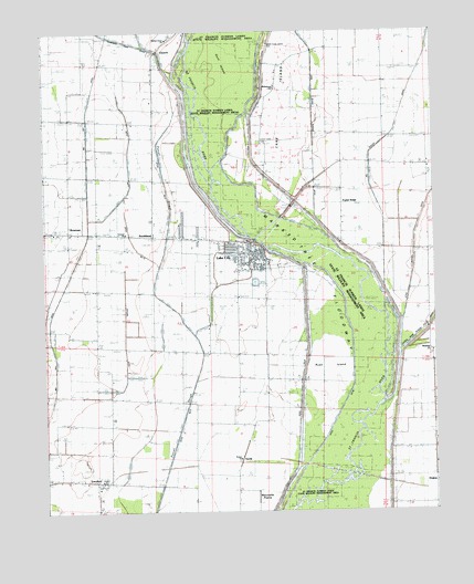
Lake City, AR USGS Topographic Map
Click on map above to begin viewing in our Map Viewer.

This topographic map contains these locations and features:
Feature Name Type Latitude Longitude GNIS ID View Map
Bethabara Baptist ChurchChurchN35.8609°W90.4257°76308View Map
Big Bay DitchCanalN35.8481°W90.4854°46502View Map
Big Slough DitchCanalN35.8670°W90.3779°46603View Map
BowmanPopulated PlaceN35.8231°W90.4926°57416View Map
Bowman Baptist ChurchChurchN35.8229°W90.4957°64664View Map
Bowman School (historical)SchoolN35.8231°W90.4923°75317View Map
Cane IslandIslandN35.8559°W90.4259°47385View Map
Cane Island (historical)Populated PlaceN35.8459°W90.4284°64667View Map
Cane Island Slough DitchCanalN35.8373°W90.4129°76518View Map
Cemmons DonickCanalN35.8390°W90.4412°79120View Map
City of Lake CityCivilN35.8203°W90.4546°2404860View Map
ClaunchPopulated PlaceN35.8709°W90.4623°64553View Map
Claunch School (historical)SchoolN35.8698°W90.4643°75320View Map
Cothern ChurchChurchN35.7912°W90.4376°48064View Map
Cothran School (historical)SchoolN35.7912°W90.4379°64554View Map
Craighead County Sheriff's Office EastBuildingN35.8202°W90.4445°2118522View Map
DeglowPopulated PlaceN35.7515°W90.3762°57636View Map
Ditch Number 10CanalN35.8192°W90.4704°82038View Map
Ditch Number 6CanalN35.8012°W90.4559°82345View Map
Ditch Number 7CanalN35.8351°W90.4712°82372View Map
Ditch Number 8CanalN35.7895°W90.4209°82397View Map
Forest Chapel (historical)ChurchN35.7592°W90.4387°64560View Map
General ChurchChurchN35.8229°W90.4737°78158View Map
Gum IslandIslandN35.8690°W90.4409°49717View Map
Ironwood Slough (historical)GutN35.8440°W90.4726°64564View Map
Lake CityPopulated PlaceN35.8162°W90.4343°77429View Map
Lake City CemeteryCemeteryN35.8134°W90.4284°70018View Map
Lake City Police DepartmentBuildingN35.8170°W90.4322°2118521View Map
Lake City Volunteer Fire Main StationBuildingN35.8167°W90.4443°2116678View Map
Lower Cane Island CemeteryCemeteryN35.8459°W90.4309°51498View Map
Lower Mangrum School (historical)SchoolN35.7770°W90.3754°64566View Map
LunsfordPopulated PlaceN35.7573°W90.4804°58104View Map
Lunsford Baptist ChurchChurchN35.7562°W90.4834°64692View Map
Lunsford School (historical)SchoolN35.7576°W90.4798°75330View Map
Mangrum CemeteryCemeteryN35.7901°W90.3762°51638View Map
Mangrum ChurchChurchN35.7917°W90.3762°51639View Map
Marked Tree FloodwayCanalN35.7959°W90.4043°66228View Map
Maumelle PrairieFlatN35.7537°W90.4323°51743View Map
Old Craddock Mill (historical)LocaleN35.8592°W90.4996°64574View Map
Poplar RidgePopulated PlaceN35.8298°W90.4045°78077View Map
Poplar Ridge ChapelChurchN35.8381°W90.4037°53696View Map
Prairie ChurchChurchN35.7640°W90.4384°53759View Map
Prairie School (historical)SchoolN35.7504°W90.4387°64580View Map
Refuge School (historical)SchoolN35.8226°W90.4734°64581View Map
Riverside High SchoolSchoolN35.8161°W90.4387°64699View Map
Riverside West Elementary SchoolSchoolN35.8191°W90.4525°64700View Map
Rush IslandIslandN35.7865°W90.4095°54281View Map
Saint Francis River BridgeBridgeN35.8209°W90.4326°64583View Map
Saint Francis Sunken Lands State Wildlife Management AreaParkN35.7556°W90.4154°66229View Map
SandyPopulated PlaceN35.7659°W90.4359°58585View Map
SouthlandPopulated PlaceN35.8215°W90.4645°58663View Map
Spicewood SloughGutN35.8598°W90.4946°64586View Map
Taylors DitchCanalN35.7815°W90.4762°55479View Map
Thompson Creek DitchCanalN35.8670°W90.4609°55546View Map
Township of Lake CityCivilN35.8207°W90.4518°66462View Map
Township of PrairieCivilN35.7610°W90.4452°66468View Map
Upper Cane Island CemeteryCemeteryN35.8706°W90.4223°55851View Map
Walnut Grove ChurchChurchN35.8717°W90.4623°56009View Map

Note: Coordinates in the location and feature list above are referenced to NAD83 datum.


Copyright (C) 2008-2024 Ryan Niemi / Sunset Dynamics ... All Rights Reserved