TopoQuest Logo
Do you find TopoQuest useful?
Help keep TopoQuest running and adding new maps/features by donating!
Bitcoin:  19c7KJd3qBynnjoSw5npx9KScwjBe4ifkT
Litecoin:  LXs6TkuXGGXo1vDsWCkWVdjQX94eUKd6ui
Home View Maps Find Maps Find Places Resources & Links


Bartlett Mountain, Arizona Topographic Map

USGS Map Title: Bartlett Mountain, AZ
USGS Map MRC: 31111D3
DRG (GeoTIFF) Download: o31111d3.tif


Neighboring USGS Topographic Map Quads:


  Wilbur Canyon, AZ  
31111E4
 

  Arivaca, AZ  
31111E3
 

  Murphy Peak, AZ  
31111E2
 

  Cumero Mountain, AZ  
31111D4
 

  Bartlett Mountain, AZ  
31111D3
 

  Ruby, AZ  
31111D2


  Alamo Spring, AZ  
31111C2


Map MRC Location:

N32°
W112°
N32°
W111°
H8 H7 H6 H5 H4 H3 H2 H1
G8 G7 G6 G5 G4 G3 G2 G1
F8 F7 F6 F5 F4 F3 F2 F1
E8 E7 E6 E5 E4 E3 E2 E1
D8 D7 D6 D5 D4 D3 D2 D1
C8 C7 C6 C5 C4 C3 C2 C1
B8 B7 B6 B5 B4 B3 B2 B1
A8 A7 A6 A5 A4 A3 A2 A1
N31°
W112°
N31°
W111°

Bartlett Mountain, AZ USGS 1:24K Topographic Map Preview:
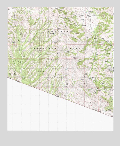
Bartlett Mountain, AZ USGS Topographic Map
Click on map above to begin viewing in our Map Viewer.

This topographic map contains these locations and features:
Feature Name Type Latitude Longitude GNIS ID View Map
Agua Cercada CanyonValleyN31.4426°W111.3573°25729View Map
Agua Cercada SpringSpringN31.4779°W111.3162°25730View Map
Agua Cercada TankReservoirN31.4731°W111.3201°25731View Map
Agua Cercada WellWellN31.4612°W111.3382°25732View Map
Alamo MineMineN31.4348°W111.3179°42693View Map
Austerlitz (historical)LocaleN31.4693°W111.2687°36533View Map
Austerlitz MineMineN31.4684°W111.2701°25848View Map
Bartlett MountainSummitN31.4062°W111.2605°26013View Map
Black PeakSummitN31.4734°W111.2932°26435View Map
Bonita CanyonValleyN31.3890°W111.3187°45597View Map
Bonita TankReservoirN31.4377°W111.3053°36556View Map
Boundary TankReservoirN31.3953°W111.2609°26660View Map
Brick MineMineN31.4615°W111.2529°26736View Map
California GulchValleyN31.3820°W111.2548°45598View Map
CaņoncitoValleyN31.4573°W111.3587°27264View Map
Cantina WashStreamN31.4001°W111.3673°45600View Map
Casa PiedraPopulated PlaceN31.3893°W111.2507°27317View Map
Cemetery TankReservoirN31.4875°W111.2857°27461View Map
Choctaw MineMineN31.4943°W111.2701°27610View Map
Cobre MountainSummitN31.4487°W111.2945°27763View Map
Cobre RidgeRidgeN31.4651°W111.2882°27764View Map
Coches CanyonValleyN31.4345°W111.3601°27766View Map
Corner TankReservoirN31.4813°W111.2711°27949View Map
Dart TankReservoirN31.4620°W111.2727°28282View Map
El Oro CemeteryCemeteryN31.4279°W111.2773°28835View Map
El Oro MineMineN31.4226°W111.2834°28836View Map
Grapevine SpringSpringN31.4827°W111.2988°29515View Map
Holden CanyonValleyN31.4001°W111.2687°45614View Map
Holden TankReservoirN31.4174°W111.2773°30050View Map
Japanese TankReservoirN31.4502°W111.2704°36665View Map
Japanese ValleyValleyN31.4490°W111.2707°30505View Map
Juan Encinas (historical)LocaleN31.4237°W111.3109°36675View Map
Land TankReservoirN31.4034°W111.2784°30865View Map
Margarita TankReservoirN31.4450°W111.2565°31509View Map
Mojonera CanyonValleyN31.4390°W111.3562°31948View Map
Mojonera WellWellN31.4643°W111.3198°31949View Map
Nogalito SpringSpringN31.4326°W111.2840°32339View Map
Oak TankReservoirN31.4643°W111.3691°32468View Map
Old GloryPopulated PlaceN31.4343°W111.2537°32501View Map
Old Glory SpringSpringN31.4409°W111.2565°32503View Map
Oro BlancoPopulated PlaceN31.4959°W111.2798°36757View Map
Oro Blanco DamDamN31.4951°W111.2826°36758View Map
Oro Blanco RanchLocaleN31.4945°W111.2798°32556View Map
Oro Blanco ReservoirReservoirN31.4948°W111.2826°36760View Map
Oro Fino MineMineN31.4051°W111.2518°32558View Map
Palomas TankReservoirN31.4698°W111.2821°32649View Map
Partridge (historical)Populated PlaceN31.4798°W111.2754°36768View Map
Pasture TankReservoirN31.4323°W111.3732°32708View Map
Road Canyon WellWellN31.4826°W111.3318°33650View Map
Road TankReservoirN31.4658°W111.2580°33653View Map
Saint Christopher MineMineN31.4815°W111.2876°33950View Map
Saucita TankReservoirN31.4437°W111.2970°36835View Map
Saucito SpringSpringN31.4223°W111.3065°34090View Map
Saucito SpringSpringN31.4451°W111.2907°34091View Map
Sentinel PeakSummitN31.3962°W111.2521°34261View Map
Sierra CanyonValleyN31.4190°W111.3557°45607View Map
Sierra SpringSpringN31.4556°W111.3018°34415View Map
Sierra TanksReservoirN31.4355°W111.3348°34416View Map
Sierra WellWellN31.4329°W111.3343°34417View Map
Skunk SpringSpringN31.4861°W111.3036°34507View Map
Tres Bellotas RanchLocaleN31.4287°W111.3554°35461View Map
Tres Bellotas WellWellN31.4729°W111.3601°35462View Map
Turner TankReservoirN31.4220°W111.3231°35590View Map
Upper Turner TankReservoirN31.4298°W111.3181°35726View Map
Warsaw SpringSpringN31.4229°W111.2640°35902View Map
Warsaw TankReservoirN31.4287°W111.2758°35903View Map
Yanks SpringSpringN31.4917°W111.2952°36437View Map
Yellow Jacket MineMineN31.4987°W111.3165°36456View Map
Yellow Jacket TankReservoirN31.4995°W111.3193°36914View Map

Note: Coordinates in the location and feature list above are referenced to NAD83 datum.


Copyright (C) 2008-2025 Ryan Niemi / Sunset Dynamics ... All Rights Reserved