TopoQuest Logo
Do you find TopoQuest useful?
Help keep TopoQuest running and adding new maps/features by donating!
Bitcoin:  19c7KJd3qBynnjoSw5npx9KScwjBe4ifkT
Litecoin:  LXs6TkuXGGXo1vDsWCkWVdjQX94eUKd6ui
Home View Maps Find Maps Find Places Resources & Links


Bartlett Mountain, California Topographic Map

USGS Map Title: Bartlett Mountain, CA
USGS Map MRC: 39122B7
DRG (GeoTIFF) Download: o39122b7.tif


Neighboring USGS Topographic Map Quads:


  Elk Mountain, CA  
39122C8
 

  Potato Hill, CA  
39122C7
 

  Fouts Springs, CA  
39122C6
 

  Upper Lake, CA  
39122B8
 

  Bartlett Mountain, CA  
39122B7
 

  Bartlett Springs, CA  
39122B6
 

  Lakeport, CA  
39122A8
 

  Lucerne, CA  
39122A7
 

  Clearlake Oaks, CA  
39122A6


Map MRC Location:

N40°
W123°
N40°
W122°
H8 H7 H6 H5 H4 H3 H2 H1
G8 G7 G6 G5 G4 G3 G2 G1
F8 F7 F6 F5 F4 F3 F2 F1
E8 E7 E6 E5 E4 E3 E2 E1
D8 D7 D6 D5 D4 D3 D2 D1
C8 C7 C6 C5 C4 C3 C2 C1
B8 B7 B6 B5 B4 B3 B2 B1
A8 A7 A6 A5 A4 A3 A2 A1
N39°
W123°
N39°
W122°

Bartlett Mountain, CA USGS 1:24K Topographic Map Preview:
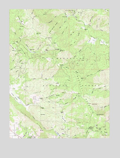
Bartlett Mountain, CA USGS Topographic Map
Click on map above to begin viewing in our Map Viewer.

This topographic map contains these locations and features:
Feature Name Type Latitude Longitude GNIS ID View Map
Alder CreekStreamN39.2432°W122.8017°256155View Map
Alder Spring RidgeRidgeN39.2302°W122.8192°256172View Map
Alley CampLocaleN39.2182°W122.8681°256190View Map
Bartlett MountainSummitN39.1724°W122.7883°1657999View Map
Bartlett Mountain SummitGapN39.1346°W122.7769°256565View Map
Buck RidgeRidgeN39.1607°W122.7958°257585View Map
Bucknell TrailTrailN39.2374°W122.7647°257634View Map
Carter GladesFlatN39.1641°W122.8442°258015View Map
Charlie Alley PeakSummitN39.2160°W122.8725°266552View Map
Crabtree LodgeLocaleN39.2427°W122.8028°258854View Map
Elk KnobSummitN39.2327°W122.8603°259849View Map
Elk Knob TrailTrailN39.2391°W122.8628°259850View Map
Elk ValleyBasinN39.2354°W122.8594°259860View Map
Ellis FlatFlatN39.1854°W122.8355°259873View Map
Forty Springs ValleyStreamN39.1324°W122.8203°260281View Map
French RidgeRidgeN39.2443°W122.8378°266729View Map
Gilbert CreekStreamN39.1560°W122.8578°260558View Map
Hazel SpringSpringN39.2105°W122.8312°261199View Map
High Glade LookoutLocaleN39.2096°W122.8111°1666656View Map
High Glade SpringSpringN39.2109°W122.8140°261318View Map
Hogback RidgeRidgeN39.1371°W122.8403°271600View Map
Howes CampLocaleN39.1279°W122.7547°261581View Map
Jones RanchLocaleN39.2185°W122.7578°1666657View Map
Ladder RidgeRidgeN39.1696°W122.8319°262259View Map
Lincoln BluffCliffN39.1546°W122.8369°262483View Map
Little PinnacleSummitN39.1582°W122.7733°262689View Map
Live Oak HollowValleyN39.2432°W122.7947°262756View Map
Long Valley RidgeRidgeN39.1310°W122.7617°262890View Map
Low GapGapN39.1954°W122.8117°262988View Map
Mary Ann RidgeRidgeN39.1938°W122.7536°228190View Map
Middle Creek FlatFlatN39.2104°W122.8505°263509View Map
Middle Creek Flat TrailTrailN39.2160°W122.8355°263510View Map
Nice Census Designated PlaceCensusN39.1266°W122.8525°2408925View Map
Pilot GroveWoodsN39.2263°W122.8425°264733View Map
Pinnacle RockSummitN39.1477°W122.7647°264794View Map
Pitney RidgeRidgeN39.2121°W122.8622°264823View Map
Rattlesnake CreekStreamN39.2446°W122.8061°265197View Map
Red RockSummitN39.2221°W122.8275°265318View Map
Rose PlacePopulated PlaceN39.1657°W122.8178°1659542View Map
Round MountainSummitN39.1471°W122.8336°265606View Map
Sam Alley RidgeRidgeN39.1929°W122.8683°267210View Map
Sawmill FlatFlatN39.1371°W122.7686°265867View Map
Sky RockSummitN39.2152°W122.8289°266252View Map
Sulphur SpringSpringN39.1495°W122.8089°267901View Map
Swede CanyonValleyN39.2329°W122.7733°268016View Map
Tea CanyonValleyN39.1621°W122.8319°268111View Map
Telegraph RockPillarN39.1629°W122.8348°268124View Map
The PocketFlatN39.1785°W122.8158°268206View Map
Twin ValleyStreamN39.2166°W122.7511°268551View Map
Wild Bill CreekStreamN39.2352°W122.7794°269072View Map
Wild Bill PlacePopulated PlaceN39.2307°W122.7817°1660178View Map
Wild Bill RidgeRidgeN39.2157°W122.7958°269074View Map
Willow FlatFlatN39.1829°W122.8280°269167View Map
Wilson ValleyStreamN39.1454°W122.8111°269216View Map
Windy PointSummitN39.1825°W122.7835°269236View Map
Windy RidgeRidgeN39.1913°W122.7992°269239View Map
Wyman GladeFlatN39.2135°W122.8728°269326View Map

Note: Coordinates in the location and feature list above are referenced to NAD83 datum.


Copyright (C) 2008-2024 Ryan Niemi / Sunset Dynamics ... All Rights Reserved