TopoQuest Logo
Do you find TopoQuest useful?
Help keep TopoQuest running and adding new maps/features by donating!
Bitcoin:  19c7KJd3qBynnjoSw5npx9KScwjBe4ifkT
Litecoin:  LXs6TkuXGGXo1vDsWCkWVdjQX94eUKd6ui
Home View Maps Find Maps Find Places Resources & Links


Bartley, Nebraska Topographic Map

USGS Map Title: Bartley, NE
USGS Map MRC: 40100C3
DRG (GeoTIFF) Download: o40100c3.tif


Neighboring USGS Topographic Map Quads:


  Bartley NW, NE  
40100D4
 

  Freedom, NE  
40100D3
 

  Medicine Creek Dam, NE  
40100D2
 

  Bartley SW, NE  
40100C4
 

  Bartley, NE  
40100C3
 

  Cambridge, NE  
40100C2
 

  Indianola, NE  
40100B4
 

  Danbury NE, NE  
40100B3
 

  Wilsonville NW, NE  
40100B2


Map MRC Location:

N41°
W101°
N41°
W100°
H8 H7 H6 H5 H4 H3 H2 H1
G8 G7 G6 G5 G4 G3 G2 G1
F8 F7 F6 F5 F4 F3 F2 F1
E8 E7 E6 E5 E4 E3 E2 E1
D8 D7 D6 D5 D4 D3 D2 D1
C8 C7 C6 C5 C4 C3 C2 C1
B8 B7 B6 B5 B4 B3 B2 B1
A8 A7 A6 A5 A4 A3 A2 A1
N40°
W101°
N40°
W100°

Bartley, NE USGS 1:24K Topographic Map Preview:
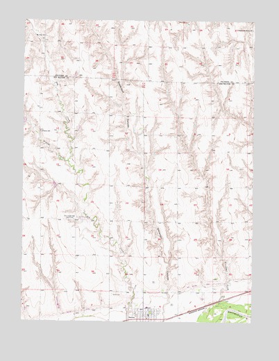
Bartley, NE USGS Topographic Map
Click on map above to begin viewing in our Map Viewer.

This topographic map contains these locations and features:
Feature Name Type Latitude Longitude GNIS ID View Map
Alliance Election PrecinctCivilN40.3069°W100.3655°1928691View Map
Alliance SchoolSchoolN40.3286°W100.3663°826966View Map
Bartley CemeteryCemeteryN40.2614°W100.3263°827206View Map
Bartley Christian ChurchChurchN40.2506°W100.3088°1841256View Map
Bartley Equity ElevatorLocaleN40.2506°W100.3088°1841257View Map
Bartley Post OfficePost OfficeN40.2511°W100.3086°1841259View Map
Bartley Public LibraryBuildingN40.2506°W100.3088°1841258View Map
Bartley Volunteer Fire DepartmentBuildingN40.2533°W100.3064°1841255View Map
Dry Creek CemeteryCemeteryN40.2931°W100.3454°828836View Map
Dry Creek Dam 3-ADamN40.3331°W100.3736°1767830View Map
Dry Creek Dam 5-ADamN40.3058°W100.3566°1767828View Map
Dry Creek Dam 8-ADamN40.2550°W100.3404°1767822View Map
Dry Creek Dam 8-BDamN40.2550°W100.3546°1767824View Map
Dry Creek Dam 8-CDamN40.2539°W100.3732°1767826View Map
Dry Creek Dam 8-CLakeN40.2547°W100.3734°1767827View Map
Dry Creek Reservoir 3-ALakeN40.3327°W100.3749°1767831View Map
Dry Creek Reservoir 5-ALakeN40.3069°W100.3588°1767829View Map
Dry Creek Reservoir 8-ALakeN40.2562°W100.3415°1767823View Map
Dry Creek Reservoir 8-BLakeN40.2562°W100.3550°1767825View Map
Dry Creek SchoolLocaleN40.2922°W100.3474°828840View Map
Fair Hope SchoolLocaleN40.3278°W100.2799°829200View Map
Kemper Memorial United Methodist ChurchChurchN40.2506°W100.3088°1841254View Map
Mallalieu College (historical)SchoolN40.2506°W100.3088°1841260View Map
Mallalieu University Historical MarkerParkN40.2506°W100.3088°1841281View Map
Mount Zion CemeteryCemeteryN40.3683°W100.3635°1765008View Map
Mount Zion ChurchChurchN40.3686°W100.3640°831494View Map
North Valley Election PrecinctCivilN40.3061°W100.2530°1929114View Map
Pleasant Hill SchoolLocaleN40.3647°W100.2668°832203View Map
Sunnyside School (historical)SchoolN40.3731°W100.3643°1841143View Map
Township of AllianceCivilN40.3064°W100.3643°1841292View Map
Twin Valley High SchoolSchoolN40.2558°W100.3071°1841261View Map
United Brethren ChurchChurchN40.3714°W100.2510°834288View Map
Village of BartleyCivilN40.2511°W100.3104°2398043View Map
Walnut Grove SchoolLocaleN40.2920°W100.2813°834454View Map
Wildcat CreekStreamN40.3164°W100.3513°834730View Map

Note: Coordinates in the location and feature list above are referenced to NAD83 datum.


Copyright (C) 2008-2025 Ryan Niemi / Sunset Dynamics ... All Rights Reserved