TopoQuest Logo
Do you find TopoQuest useful?
Help keep TopoQuest running and adding new maps/features by donating!
Bitcoin:  19c7KJd3qBynnjoSw5npx9KScwjBe4ifkT
Litecoin:  LXs6TkuXGGXo1vDsWCkWVdjQX94eUKd6ui
Home View Maps Find Maps Find Places Resources & Links


Legend Lake, Wisconsin Topographic Map

USGS Map Title: Legend Lake, WI
USGS Map MRC: 44088H5
DRG (GeoTIFF) Download: o44088h5.tif


Neighboring USGS Topographic Map Quads:


  Markton, WI  
45088A6
 

  Fredenberg Lake, WI  
45088A5
 

  Breed, WI  
45088A4
 

  Keshena, WI  
44088H6
 

  Legend Lake, WI  
44088H5
 

  Berry Lake, WI  
44088H4
 

  Thornton, WI  
44088G6
 

  Shawano, WI  
44088G5
 

  Cecil, WI  
44088G4


Map MRC Location:

N45°
W89°
N45°
W88°
H8 H7 H6 H5 H4 H3 H2 H1
G8 G7 G6 G5 G4 G3 G2 G1
F8 F7 F6 F5 F4 F3 F2 F1
E8 E7 E6 E5 E4 E3 E2 E1
D8 D7 D6 D5 D4 D3 D2 D1
C8 C7 C6 C5 C4 C3 C2 C1
B8 B7 B6 B5 B4 B3 B2 B1
A8 A7 A6 A5 A4 A3 A2 A1
N44°
W89°
N44°
W88°

Legend Lake, WI USGS 1:24K Topographic Map Preview:
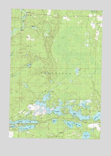
Legend Lake, WI USGS Topographic Map
Click on map above to begin viewing in our Map Viewer.

This topographic map contains these locations and features:
Feature Name Type Latitude Longitude GNIS ID View Map
Beauprey LakeLakeN44.9820°W88.5948°1561415View Map
Blacksmith LakeLakeN44.9000°W88.5576°1561903View Map
Elm CreekStreamN44.9725°W88.5601°1564555View Map
Five Island CreekStreamN44.9947°W88.6043°1565040View Map
Five IslandsIslandN44.9953°W88.6054°1565041View Map
Keshena LakeLakeN44.8861°W88.6198°1567432View Map
La Motte LakeLakeN44.8849°W88.6016°1567681View Map
Legend LakeLakeN44.8992°W88.5715°1576297View Map
Legend LakePopulated PlaceN44.8907°W88.5792°2399761View Map
Legend Lake Census Designated PlaceCensusN44.8909°W88.5441°2393096View Map
Legend Lake Number Three 3 WR 543 DamDamN44.8967°W88.5151°1792108View Map
Little Blacksmith LakeLakeN44.9000°W88.5698°1568202View Map
Little Sand LakeLakeN44.8892°W88.5318°1568401View Map
Long LakeLakeN44.9080°W88.5229°1568546View Map
Moshawquit LakeLakeN44.8972°W88.5005°1569767View Map
Pestiga LakeLakeN44.9130°W88.5776°1571248View Map
Pine LakeLakeN44.8784°W88.5197°1571490View Map
Pywaosit LakeLakeN44.8958°W88.5237°1571985View Map
Rest Haven CemeteryCemeteryN44.9041°W88.6004°1572209View Map
Round LakeLakeN44.8919°W88.5633°1572648View Map
Rushes LakeLakeN44.9411°W88.5337°1572745View Map
Saint Michael CemeteryCemeteryN44.8882°W88.6155°1573367View Map
Sand LakeLakeN44.8890°W88.5425°1573672View Map
Sand Lake Lookout TowerTowerN44.8805°W88.5557°1581335View Map
Sapokesick LakeLakeN44.8997°W88.5382°1573725View Map
Skice LakeLakeN44.8905°W88.5923°1574232View Map
South Branch Fire DepartmentBuildingN44.9941°W88.5480°2696964View Map
Spring LakeLakeN44.9080°W88.5826°1574668View Map
Turtle RapidsRapidsN44.9880°W88.6104°1575745View Map
Waukau LakeLakeN44.9455°W88.5997°1576311View Map
White RapidsRapidsN44.9803°W88.6137°1576651View Map

Note: Coordinates in the location and feature list above are referenced to NAD83 datum.


Copyright (C) 2008-2024 Ryan Niemi / Sunset Dynamics ... All Rights Reserved