TopoQuest Logo
Do you find TopoQuest useful?
Help keep TopoQuest running and adding new maps/features by donating!
Bitcoin:  19c7KJd3qBynnjoSw5npx9KScwjBe4ifkT
Litecoin:  LXs6TkuXGGXo1vDsWCkWVdjQX94eUKd6ui
Home View Maps Find Maps Find Places Resources & Links


Thornton, Wisconsin Topographic Map

USGS Map Title: Thornton, WI
USGS Map MRC: 44088G6
DRG (GeoTIFF) Download: o44088g6.tif


Neighboring USGS Topographic Map Quads:


  Neopit, WI  
44088H7
 

  Keshena, WI  
44088H6
 

  Legend Lake, WI  
44088H5
 

  Gresham, WI  
44088G7
 

  Thornton, WI  
44088G6
 

  Shawano, WI  
44088G5
 

  Clintonville North, WI  
44088F7
 

  Embarrass, WI  
44088F6
 

  Lunds, WI  
44088F5


Map MRC Location:

N45°
W89°
N45°
W88°
H8 H7 H6 H5 H4 H3 H2 H1
G8 G7 G6 G5 G4 G3 G2 G1
F8 F7 F6 F5 F4 F3 F2 F1
E8 E7 E6 E5 E4 E3 E2 E1
D8 D7 D6 D5 D4 D3 D2 D1
C8 C7 C6 C5 C4 C3 C2 C1
B8 B7 B6 B5 B4 B3 B2 B1
A8 A7 A6 A5 A4 A3 A2 A1
N44°
W89°
N44°
W88°

Thornton, WI USGS 1:24K Topographic Map Preview:
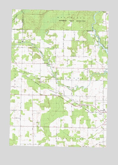
Thornton, WI USGS Topographic Map
Click on map above to begin viewing in our Map Viewer.

This topographic map contains these locations and features:
Feature Name Type Latitude Longitude GNIS ID View Map
825 ReservoirReservoirN44.8383°W88.6251°1793075View Map
Alexian Brothers NovitiateChurchN44.8455°W88.7354°1560756View Map
Boersdorf School (historical)SchoolN44.7516°W88.7190°1876632View Map
College of Menominee Nation - Keshena CampusSchoolN44.8590°W88.6256°2713251View Map
Dillenburg's AirportAirportN44.7539°W88.7280°1582198View Map
Forest SchoolSchoolN44.8272°W88.6465°1565140View Map
Freeman FallsFallsN44.8441°W88.7373°1565296View Map
Gilmer FallsFallsN44.8425°W88.7226°1565539View Map
Hanauer's Tree FarmsLocaleN44.8250°W88.6281°2662939View Map
Keshena Primary SchoolSchoolN44.8723°W88.6277°1567433View Map
Kroenke CreekStreamN44.8141°W88.6948°1560658View Map
Krueger Dairy FarmLocaleN44.7950°W88.6647°2662956View Map
Little Bull FallsFallsN44.8411°W88.7187°1568211View Map
Menominee Indian High SchoolSchoolN44.8711°W88.6316°1831783View Map
Peters Hall School (historical)SchoolN44.8461°W88.7368°1876641View Map
Pine Grove School (historical)SchoolN44.7928°W88.6348°1876642View Map
Red RiverPopulated PlaceN44.8250°W88.7045°1572149View Map
Red RiverStreamN44.8197°W88.6282°1572151View Map
Saint Jakobi Lutheran ChurchChurchN44.8208°W88.6504°1572980View Map
Salem Methodist ChurchChurchN44.8258°W88.7087°1573624View Map
Stony Hill SchoolSchoolN44.7964°W88.7220°1574954View Map
Texas SchoolSchoolN44.8405°W88.6926°1575321View Map
ThorntonPopulated PlaceN44.7966°W88.6912°1575402View Map
Thornton Census Designated PlaceCensusN44.7985°W88.6912°2585076View Map
Town of RichmondCivilN44.8108°W88.6795°1584029View Map
Upper Shawano WP250 DamDamN44.8383°W88.6251°1793074View Map
Weed 2WP1507 DamDamN44.8416°W88.7451°1793076View Map
Weed Dam Pond 159ReservoirN44.8416°W88.7451°1793077View Map
WOWN-FM (Shawano)TowerN44.7797°W88.6315°1582458View Map
WTCH-AM (Shawano)TowerN44.7797°W88.6315°1582350View Map

Note: Coordinates in the location and feature list above are referenced to NAD83 datum.


Copyright (C) 2008-2025 Ryan Niemi / Sunset Dynamics ... All Rights Reserved