TopoQuest Logo
Do you find TopoQuest useful?
Help keep TopoQuest running and adding new maps/features by donating!
Bitcoin:  19c7KJd3qBynnjoSw5npx9KScwjBe4ifkT
Litecoin:  LXs6TkuXGGXo1vDsWCkWVdjQX94eUKd6ui
Home View Maps Find Maps Find Places Resources & Links


Lehman Butte, Idaho Topographic Map

USGS Map Title: Lehman Butte, ID
USGS Map MRC: 43113H7
DRG (GeoTIFF) Download: o43113h7.tif


Neighboring USGS Topographic Map Quads:


  Chilly Buttes, ID  
44113A8
 

  Elkhorn Creek, ID  
44113A7
 

  Leatherman Peak, ID  
44113A6
 

  Porphyry Peak, ID  
43113H8
 

  Lehman Butte, ID  
43113H7
 

  Mackay Reservoir, ID  
43113H6
 

  Big Black Dome, ID  
43113G8
 

  Copper Basin Knob, ID  
43113G7
 

  Shelly Mountain, ID  
43113G6


Map MRC Location:

N44°
W114°
N44°
W113°
H8 H7 H6 H5 H4 H3 H2 H1
G8 G7 G6 G5 G4 G3 G2 G1
F8 F7 F6 F5 F4 F3 F2 F1
E8 E7 E6 E5 E4 E3 E2 E1
D8 D7 D6 D5 D4 D3 D2 D1
C8 C7 C6 C5 C4 C3 C2 C1
B8 B7 B6 B5 B4 B3 B2 B1
A8 A7 A6 A5 A4 A3 A2 A1
N43°
W114°
N43°
W113°

Lehman Butte, ID USGS 1:24K Topographic Map Preview:
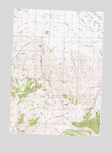
Lehman Butte, ID USGS Topographic Map
Click on map above to begin viewing in our Map Viewer.

This topographic map contains these locations and features:
Feature Name Type Latitude Longitude GNIS ID View Map
Barton Flat CemeteryCemeteryN43.9727°W113.8324°376990View Map
Barton SchoolSchoolN43.9963°W113.8036°399573View Map
Barton SchoolSchoolN43.9957°W113.8045°376993View Map
Boone CreekStreamN43.9813°W113.8325°397463View Map
Corral Creek SummitSummitN43.9057°W113.7950°396330View Map
Dry HollowValleyN43.9841°W113.8495°380886View Map
East Fork Lehman CreekStreamN43.9344°W113.8328°381126View Map
Garden CreekStreamN43.9896°W113.8536°382177View Map
Hamilton CreekStreamN43.9710°W113.7756°382844View Map
Hamilton SpringsSpringN43.9995°W113.8650°382849View Map
Horse WallowBasinN43.8988°W113.8356°383405View Map
Leavitt SpringSpringN43.9466°W113.8067°384586View Map
Lehman BasinBasinN43.9335°W113.8598°384557View Map
Lehman ButteSummitN43.9630°W113.8361°384558View Map
Lehman CreekStreamN43.9682°W113.8150°384559View Map
Mackay DivisionCivilN43.9054°W113.8571°1936754View Map
Mackay Fish HatcheryLocaleN43.9782°W113.8306°396833View Map
Warm SpringsSpringN43.9768°W113.8307°400164View Map
West Fork Lehman CreekStreamN43.9346°W113.8328°393134View Map
West Fork Navarre CreekStreamN43.9266°W113.7506°393155View Map
Wood Road SpringSpringN43.9555°W113.8628°393664View Map

Note: Coordinates in the location and feature list above are referenced to NAD83 datum.


Copyright (C) 2008-2025 Ryan Niemi / Sunset Dynamics ... All Rights Reserved