TopoQuest Logo
Do you find TopoQuest useful?
Help keep TopoQuest running and adding new maps/features by donating!
Bitcoin:  19c7KJd3qBynnjoSw5npx9KScwjBe4ifkT
Litecoin:  LXs6TkuXGGXo1vDsWCkWVdjQX94eUKd6ui
Home View Maps Find Maps Find Places Resources & Links


Lehman Springs, Oregon Topographic Map

USGS Map Title: Lehman Springs, OR
USGS Map MRC: 45118B6
DRG (GeoTIFF) Download: o45118b6.tif


Neighboring USGS Topographic Map Quads:


  Granite Meadows, OR  
45118C7
 

  Tamarack Gulch, OR  
45118C6
 

  Bally Mountain, OR  
45118C5
 

  Owens Butte, OR  
45118B7
 

  Lehman Springs, OR  
45118B6
 

  Sullivan Gulch, OR  
45118B5
 

  Ukiah SE, OR  
45118A7
 

  Pearson Ridge, OR  
45118A6
 

  Tower Mountain, OR  
45118A5


Map MRC Location:

N46°
W119°
N46°
W118°
H8 H7 H6 H5 H4 H3 H2 H1
G8 G7 G6 G5 G4 G3 G2 G1
F8 F7 F6 F5 F4 F3 F2 F1
E8 E7 E6 E5 E4 E3 E2 E1
D8 D7 D6 D5 D4 D3 D2 D1
C8 C7 C6 C5 C4 C3 C2 C1
B8 B7 B6 B5 B4 B3 B2 B1
A8 A7 A6 A5 A4 A3 A2 A1
N45°
W119°
N45°
W118°

Lehman Springs, OR USGS 1:24K Topographic Map Preview:
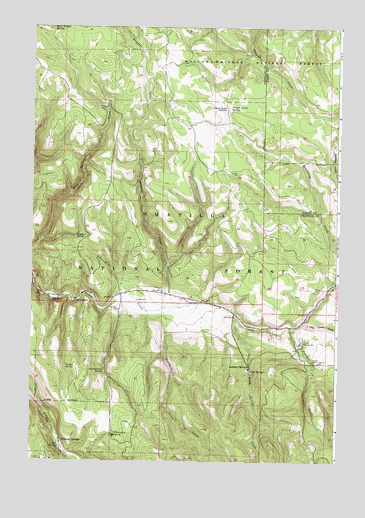
Lehman Springs, OR USGS Topographic Map
Click on map above to begin viewing in our Map Viewer.

This topographic map contains these locations and features:
Feature Name Type Latitude Longitude GNIS ID View Map
Bear Wallow SpringSpringN45.2491°W118.7424°1137779View Map
Bowman CreekStreamN45.1693°W118.6969°1138521View Map
Butcherknife CreekStreamN45.1685°W118.6989°1139043View Map
Butcherknife SpringSpringN45.1510°W118.7201°1139044View Map
Dry Camas CreekStreamN45.1651°W118.6391°1141264View Map
Dugout SpringSpringN45.1897°W118.7281°1141388View Map
Frazier CreekStreamN45.1635°W118.6441°1142422View Map
Frazier Guard StationLocaleN45.1540°W118.6355°1142423View Map
Frazier Recreation SiteLocaleN45.1596°W118.6400°1142418View Map
French Corral MeadowFlatN45.2267°W118.6713°1142457View Map
French Corral SpringSpringN45.2269°W118.6699°1142458View Map
Hidaway SpringsPopulated PlaceN45.1310°W118.7377°1143542View Map
Lehman Hot Springs Post Office (historical)Post OfficeN45.1529°W118.6619°1164469View Map
Lehman Hot Springs Recreation SiteLocaleN45.1512°W118.6622°1156093View Map
Lehman SpringsPopulated PlaceN45.1529°W118.6619°1144928View Map
Nelson MeadowsFlatN45.1721°W118.7052°1153256View Map
Rancheria CreekStreamN45.1765°W118.6261°1148201View Map
Salsbury CreekStreamN45.1857°W118.6261°1148988View Map
Trough SpringSpringN45.1528°W118.7354°1151429View Map
Warm Spring CreekStreamN45.1668°W118.6677°1151895View Map
Willoughby SpringSpringN45.1329°W118.7162°1152402View Map

Note: Coordinates in the location and feature list above are referenced to NAD83 datum.


Copyright (C) 2008-2025 Ryan Niemi / Sunset Dynamics ... All Rights Reserved