TopoQuest Logo
Do you find TopoQuest useful?
Help keep TopoQuest running and adding new maps/features by donating!
Bitcoin:  19c7KJd3qBynnjoSw5npx9KScwjBe4ifkT
Litecoin:  LXs6TkuXGGXo1vDsWCkWVdjQX94eUKd6ui
Home View Maps Find Maps Find Places Resources & Links


Lena, Mississippi Topographic Map

USGS Map Title: Lena, MS
USGS Map MRC: 32089E5
DRG (GeoTIFF) Download: o32089e5.tif


Neighboring USGS Topographic Map Quads:


  Ofahoma, MS  
32089F6
 

  Carthage, MS  
32089F5
 

  McAfee, MS  
32089F4
 

  Ludlow, MS  
32089E6
 

  Lena, MS  
32089E5
 

  Walnut Grove, MS  
32089E4
 

  Forkville, MS  
32089D6
 

  Hillsboro, MS  
32089D5
 

  Harperville, MS  
32089D4


Map MRC Location:

N33°
W90°
N33°
W89°
H8 H7 H6 H5 H4 H3 H2 H1
G8 G7 G6 G5 G4 G3 G2 G1
F8 F7 F6 F5 F4 F3 F2 F1
E8 E7 E6 E5 E4 E3 E2 E1
D8 D7 D6 D5 D4 D3 D2 D1
C8 C7 C6 C5 C4 C3 C2 C1
B8 B7 B6 B5 B4 B3 B2 B1
A8 A7 A6 A5 A4 A3 A2 A1
N32°
W90°
N32°
W89°

Lena, MS USGS 1:24K Topographic Map Preview:
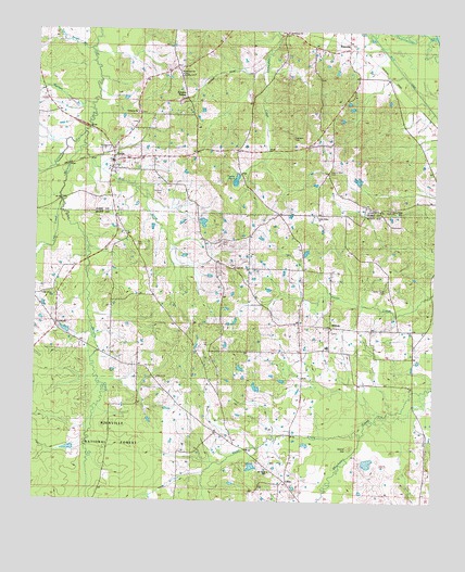
Lena, MS USGS Topographic Map
Click on map above to begin viewing in our Map Viewer.

This topographic map contains these locations and features:
Feature Name Type Latitude Longitude GNIS ID View Map
AbdanPopulated PlaceN32.6140°W89.5667°707059View Map
B Horowitz Pond DamDamN32.5651°W89.5151°695466View Map
B R Gunn Pond DamDamN32.5735°W89.5734°695467View Map
Balucta Church (historical)ChurchN32.5324°W89.5865°695006View Map
Bethlehem ChurchChurchN32.6249°W89.5470°692571View Map
CashPopulated PlaceN32.5674°W89.5720°707286View Map
Cash CemeteryCemeteryN32.5690°W89.5673°692852View Map
Cash ChurchChurchN32.5618°W89.5628°692853View Map
Cedar Grove ChurchChurchN32.5543°W89.6190°1959765View Map
Colombo CreekStreamN32.5982°W89.6106°692948View Map
ContrellPopulated PlaceN32.5468°W89.6179°707287View Map
Contrell ChurchChurchN32.5449°W89.6184°692960View Map
Dumas PondLakeN32.5856°W89.5624°693133View Map
Ealy School (historical)SchoolN32.6132°W89.5823°693145View Map
Elliott CemeteryCemeteryN32.5457°W89.5323°1766217View Map
Exley (historical)LocaleN32.6043°W89.5042°707088View Map
Faith Baptist ChurchChurchN32.5782°W89.5203°707089View Map
Good Hope BranchStreamN32.6196°W89.6098°693315View Map
H Boils Pond DamDamN32.5351°W89.5617°695464View Map
Haley CreekStreamN32.5176°W89.5217°693397View Map
Harmony CemeteryCemeteryN32.6029°W89.5942°707109View Map
Harmony ChurchChurchN32.6032°W89.5945°693416View Map
Hayes Creek CemeteryCemeteryN32.5568°W89.5145°693435View Map
Hays Creek (historical)LocaleN32.5535°W89.5142°704975View Map
Island HillSummitN32.5146°W89.5251°693591View Map
K Gunn Pond DamDamN32.5418°W89.5617°695465View Map
L Gatewood Pond DamDamN32.5118°W89.5634°695461View Map
L Lyle Pond DamDamN32.5135°W89.6117°695462View Map
LenaPopulated PlaceN32.5943°W89.6120°693710View Map
Lena Baptist ChurchChurchN32.5879°W89.6026°707116View Map
Lena CemeteryCemeteryN32.6007°W89.5934°1959760View Map
Lena Methodist ChurchChurchN32.5879°W89.6031°707117View Map
Lena Post OfficePost OfficeN32.5883°W89.6007°2768606View Map
Lena Volunteer Fire DepartmentBuildingN32.5915°W89.6007°2665717View Map
LillianPopulated PlaceN32.5051°W89.5453°693725View Map
Lost CreekStreamN32.5807°W89.6176°693830View Map
MidwayPopulated PlaceN32.5463°W89.5317°693955View Map
Midway High School (historical)SchoolN32.5413°W89.5331°693962View Map
Mount Olivett ChurchChurchN32.5079°W89.5512°1959766View Map
Mullens BranchStreamN32.6051°W89.6095°694132View Map
North Central Scott County Volunteer Fire Department Midway StationBuildingN32.5403°W89.5412°2667975View Map
Pilgrim Rest CemeteryCemeteryN32.5876°W89.5331°694369View Map
Pilgrim Rest Church (historical)ChurchN32.5868°W89.5334°707136View Map
Robinson CemeteryCemeteryN32.5965°W89.5451°694582View Map
Slay CemeteryCemeteryN32.5682°W89.5942°694812View Map
Slay CreekStreamN32.5943°W89.6117°694813View Map
Sproles (historical)LocaleN32.6168°W89.5556°707161View Map
Sproles SidingLocaleN32.6071°W89.5784°1959763View Map
Sweetwater ChurchChurchN32.6135°W89.5801°1959764View Map
Town of LenaCivilN32.5940°W89.5948°2406003View Map
Trinity CemeteryCemeteryN32.5343°W89.5901°695004View Map
TuscolaPopulated PlaceN32.6201°W89.5278°695030View Map
Tuscola Missionary Baptist ChurchChurchN32.6199°W89.5276°707168View Map
Tuscola School (historical)SchoolN32.6107°W89.5262°707169View Map
Tuskala Mita (historical)LocaleN32.6004°W89.5528°704918View Map
Union Ridge ChurchChurchN32.5776°W89.5140°695057View Map
Union Ridge ChurchChurchN32.5760°W89.5370°1959767View Map
Willie Dumas Pond DamDamN32.5851°W89.5617°695468View Map

Note: Coordinates in the location and feature list above are referenced to NAD83 datum.


Copyright (C) 2008-2025 Ryan Niemi / Sunset Dynamics ... All Rights Reserved