TopoQuest Logo
Do you find TopoQuest useful?
Help keep TopoQuest running and adding new maps/features by donating!
Bitcoin:  19c7KJd3qBynnjoSw5npx9KScwjBe4ifkT
Litecoin:  LXs6TkuXGGXo1vDsWCkWVdjQX94eUKd6ui
Home View Maps Find Maps Find Places Resources & Links


Lena Lagoon, Louisiana Topographic Map

USGS Map Title: Lena Lagoon, LA
USGS Map MRC: 29089G5
DRG (GeoTIFF) Download: o29089g5.tif


Neighboring USGS Topographic Map Quads:


  Proctor Point, LA  
29089H6
 

  Pointe aux Marchettes, LA  
29089H5
 

  Lake Eugenie, LA  
29089H4
 

  Yscloskey, LA  
29089G6
 

  Lena Lagoon, LA  
29089G5
 

  Lake Eloi, LA  
29089G4


  Lake Athanasio, LA  
29089F4


Map MRC Location:

N30°
W90°
N30°
W89°
H8 H7 H6 H5 H4 H3 H2 H1
G8 G7 G6 G5 G4 G3 G2 G1
F8 F7 F6 F5 F4 F3 F2 F1
E8 E7 E6 E5 E4 E3 E2 E1
D8 D7 D6 D5 D4 D3 D2 D1
C8 C7 C6 C5 C4 C3 C2 C1
B8 B7 B6 B5 B4 B3 B2 B1
A8 A7 A6 A5 A4 A3 A2 A1
N29°
W90°
N29°
W89°

Lena Lagoon, LA USGS 1:24K Topographic Map Preview:
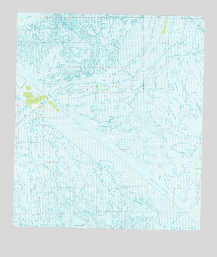
Lena Lagoon, LA USGS Topographic Map
Click on map above to begin viewing in our Map Viewer.

This topographic map contains these locations and features:
Feature Name Type Latitude Longitude GNIS ID View Map
Bayou AlphonseBayN29.8463°W89.5810°559855View Map
Bayou BernardBayN29.7569°W89.5665°559869View Map
Bayou GuyagoBayN29.8623°W89.6059°559977View Map
Bayou PisanaBayN29.8079°W89.5399°560056View Map
Bayou Saint MaloBayN29.8638°W89.5808°560071View Map
Bernard LagoonBayN29.7949°W89.6227°560149View Map
Blind Pisana BayouBayN29.7907°W89.5782°560223View Map
Engineers CanalBayN29.8526°W89.5104°560708View Map
Halfmoon PassLakeN29.8230°W89.5126°560930View Map
Halfmoon Pass BayBayN29.8189°W89.5221°560931View Map
Jahnckes DitchCanalN29.8744°W89.5959°1627348View Map
Lagoon BradyBayN29.8286°W89.5452°1627425View Map
Lagoon GiraudBayN29.8548°W89.5241°1627426View Map
Lena LagoonBayN29.8462°W89.6016°1627470View Map
Little Halfmoon BayBayN29.8332°W89.5159°1627517View Map
Mississippi River-Gulf Outlet CanalBayN29.7924°W89.5516°1627674View Map
Pisana Lagoon (historical)LakeN29.7705°W89.5401°1629403View Map

Note: Coordinates in the location and feature list above are referenced to NAD83 datum.


Copyright (C) 2008-2024 Ryan Niemi / Sunset Dynamics ... All Rights Reserved