TopoQuest Logo
Do you find TopoQuest useful?
Help keep TopoQuest running and adding new maps/features by donating!
Bitcoin:  19c7KJd3qBynnjoSw5npx9KScwjBe4ifkT
Litecoin:  LXs6TkuXGGXo1vDsWCkWVdjQX94eUKd6ui
Home View Maps Find Maps Find Places Resources & Links


Yscloskey, Louisiana Topographic Map

USGS Map Title: Yscloskey, LA
USGS Map MRC: 29089G6
DRG (GeoTIFF) Download: o29089g6.tif


Neighboring USGS Topographic Map Quads:


  Martello Castle, LA  
29089H7
 

  Proctor Point, LA  
29089H6
 

  Pointe aux Marchettes, LA  
29089H5
 

  Delacroix, LA  
29089G7
 

  Yscloskey, LA  
29089G6
 

  Lena Lagoon, LA  
29089G5


Map MRC Location:

N30°
W90°
N30°
W89°
H8 H7 H6 H5 H4 H3 H2 H1
G8 G7 G6 G5 G4 G3 G2 G1
F8 F7 F6 F5 F4 F3 F2 F1
E8 E7 E6 E5 E4 E3 E2 E1
D8 D7 D6 D5 D4 D3 D2 D1
C8 C7 C6 C5 C4 C3 C2 C1
B8 B7 B6 B5 B4 B3 B2 B1
A8 A7 A6 A5 A4 A3 A2 A1
N29°
W90°
N29°
W89°

Yscloskey, LA USGS 1:24K Topographic Map Preview:
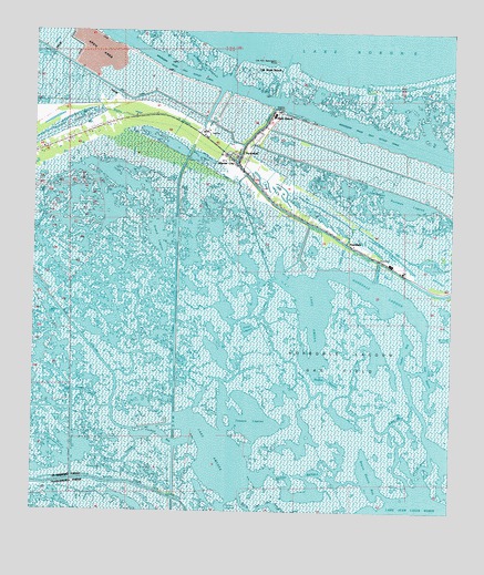
Yscloskey, LA USGS Topographic Map
Click on map above to begin viewing in our Map Viewer.

This topographic map contains these locations and features:
Feature Name Type Latitude Longitude GNIS ID View Map
Alluvial CityPopulated PlaceN29.8413°W89.6914°559767View Map
Antonios LagoonBayN29.8677°W89.7030°559789View Map
Bakers DitchCanalN29.8169°W89.6578°559817View Map
Bayou BatolaBayN29.7542°W89.6677°559861View Map
Bayou Batola BayBayN29.7594°W89.6486°559862View Map
Bayou CatilanoBayN29.7931°W89.6489°559895View Map
Bayou GrosbecBayN29.7701°W89.7163°559974View Map
Bayou JuanitaBayN29.7817°W89.7382°559988View Map
Bayou la ChapeBayN29.7914°W89.7176°559852View Map
Bayou YscloskeyBayN29.8626°W89.6756°560112View Map
Cochon BayBayN29.7645°W89.6944°560446View Map
Crooked BayouBayN29.7920°W89.6765°560537View Map
Douluts CanalBayN29.8547°W89.6505°560647View Map
Dows DitchBayN29.7897°W89.6283°560648View Map
East BayouBayN29.7916°W89.6327°560681View Map
Grand LagoonBayN29.8221°W89.7132°560873View Map
Grass Lagoon (historical)LakeN29.8524°W89.6606°1629390View Map
HopedalePopulated PlaceN29.8205°W89.6567°560997View Map
Hopedale CanalCanalN29.8130°W89.6478°560998View Map
Hopedale LagoonBayN29.8068°W89.6467°560999View Map
Inez LagoonBayN29.8347°W89.6510°1627327View Map
Lake AmedaBayN29.8021°W89.6674°559771View Map
Middle BayouBayN29.7718°W89.6440°1627642View Map
Nicks Lagoon (historical)LakeN29.8449°W89.6501°1629396View Map
Old Fort Beauregard RuinsLocaleN29.8674°W89.6784°1627821View Map
Old Shell BeachPopulated PlaceN29.8666°W89.6784°1627834View Map
Oyster BayBayN29.7929°W89.6387°1627852View Map
Portman LagoonBayN29.8307°W89.6392°1627988View Map
Rabbit Island BayouBayN29.7751°W89.6389°1628016View Map
Redfish BayouBayN29.7844°W89.6628°1628033View Map
Reggio CanalBayN29.8013°W89.7412°1628039View Map
Schooner CanalBayN29.8239°W89.7490°1628188View Map
Shell BeachPopulated PlaceN29.8533°W89.6795°1628213View Map
Spanish BayouBayN29.7827°W89.6371°1628270View Map
Tanasia LagoonBayN29.7751°W89.6855°1628331View Map
Tonys LagoonLakeN29.7980°W89.6862°1628372View Map
Turiano Lagoon (historical)LakeN29.8549°W89.6695°1629422View Map
YscloskeyPopulated PlaceN29.8419°W89.6884°1628547View Map

Note: Coordinates in the location and feature list above are referenced to NAD83 datum.


Copyright (C) 2008-2024 Ryan Niemi / Sunset Dynamics ... All Rights Reserved