TopoQuest Logo
Do you find TopoQuest useful?
Help keep TopoQuest running and adding new maps/features by donating!
Bitcoin:  19c7KJd3qBynnjoSw5npx9KScwjBe4ifkT
Litecoin:  LXs6TkuXGGXo1vDsWCkWVdjQX94eUKd6ui
Home View Maps Find Maps Find Places Resources & Links


Leslie SE, Georgia Topographic Map

USGS Map Title: Leslie SE, GA
USGS Map MRC: 31084G1
DRG (GeoTIFF) Download: o31084g1.tif


Neighboring USGS Topographic Map Quads:


  Smithville East, GA  
31084H2
 

  Leslie, GA  
31084H1
 

  Cobb, GA  
31083H8
 

  Neyami, GA  
31084G2
 

  Leslie SE, GA  
31084G1
 

  Warwick, GA  
31083G8
 

  Leesburg, GA  
31084F2
 

  Albany NE, GA  
31084F1
 

  Doles, GA  
31083F8


Map MRC Location:

N32°
W85°
N32°
W84°
H8 H7 H6 H5 H4 H3 H2 H1
G8 G7 G6 G5 G4 G3 G2 G1
F8 F7 F6 F5 F4 F3 F2 F1
E8 E7 E6 E5 E4 E3 E2 E1
D8 D7 D6 D5 D4 D3 D2 D1
C8 C7 C6 C5 C4 C3 C2 C1
B8 B7 B6 B5 B4 B3 B2 B1
A8 A7 A6 A5 A4 A3 A2 A1
N31°
W85°
N31°
W84°

Leslie SE, GA USGS 1:24K Topographic Map Preview:
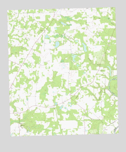
Leslie SE, GA USGS Topographic Map
Click on map above to begin viewing in our Map Viewer.

This topographic map contains these locations and features:
Feature Name Type Latitude Longitude GNIS ID View Map
Antioch Church (historical)ChurchN31.8502°W84.0582°343376View Map
Bodrey LakeReservoirN31.7935°W84.0332°341019View Map
Bodrey Lake DamDamN31.7935°W84.0332°341018View Map
Chokee School (historical)SchoolN31.8716°W84.1021°343378View Map
Hawkins BranchStreamN31.8052°W84.0071°315242View Map
Heath School (historical)SchoolN31.8096°W84.1166°334872View Map
Larramore CemeteryCemeteryN31.8499°W84.0596°343389View Map
Lee County Fire Department Station 6 Chokee 1BuildingN31.7868°W84.0543°2604195View Map
Lee County Fire Department Station 7 Chokee 2BuildingN31.8657°W84.0708°2604198View Map
Liramores Store (historical)LocaleN31.8452°W84.0905°343394View Map
Mossy DellPopulated PlaceN31.7607°W84.1132°332426View Map
Mossy Dell DamDamN31.7752°W84.0949°340314View Map
Mossy Dell LakeReservoirN31.7767°W84.0946°340315View Map
Mount Middleton Church (historical)ChurchN31.8307°W84.0521°334875View Map
New Pine Grove ChurchChurchN31.7768°W84.0732°319492View Map
PhilemaPopulated PlaceN31.7541°W84.0168°332652View Map
Philema DivisionCivilN31.7839°W84.0449°1936468View Map
Phillips Grove ChurchChurchN31.8538°W84.0818°320464View Map
Saint Mathews ChurchChurchN31.8121°W84.0191°322209View Map
Starr BranchStreamN31.7943°W84.0102°323531View Map
The BaySwampN31.8627°W84.0066°324035View Map
United States Pecan Field StationLocaleN31.7505°W84.0182°343407View Map

Note: Coordinates in the location and feature list above are referenced to NAD83 datum.


Copyright (C) 2008-2025 Ryan Niemi / Sunset Dynamics ... All Rights Reserved