TopoQuest Logo
Do you find TopoQuest useful?
Help keep TopoQuest running and adding new maps/features by donating!
Bitcoin:  19c7KJd3qBynnjoSw5npx9KScwjBe4ifkT
Litecoin:  LXs6TkuXGGXo1vDsWCkWVdjQX94eUKd6ui
Home View Maps Find Maps Find Places Resources & Links


Levelland East, Texas Topographic Map

USGS Map Title: Levelland East, TX
USGS Map MRC: 33102E3
DRG (GeoTIFF) Download: o33102e3.tif


Neighboring USGS Topographic Map Quads:


  Hester Ranch, TX  
33102F4
 

  Whitharral, TX  
33102F3
 

  Wolfforth NW, TX  
33102F2
 

  Levelland West, TX  
33102E4
 

  Levelland East, TX  
33102E3
 

  Smyer, TX  
33102E2
 

  Sundown, TX  
33102D4
 

  Lockettville, TX  
33102D3
 

  Ropesville, TX  
33102D2


Map MRC Location:

N34°
W103°
N34°
W102°
H8 H7 H6 H5 H4 H3 H2 H1
G8 G7 G6 G5 G4 G3 G2 G1
F8 F7 F6 F5 F4 F3 F2 F1
E8 E7 E6 E5 E4 E3 E2 E1
D8 D7 D6 D5 D4 D3 D2 D1
C8 C7 C6 C5 C4 C3 C2 C1
B8 B7 B6 B5 B4 B3 B2 B1
A8 A7 A6 A5 A4 A3 A2 A1
N33°
W103°
N33°
W102°

Levelland East, TX USGS 1:24K Topographic Map Preview:
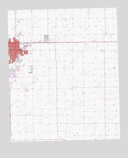
Levelland East, TX USGS Topographic Map
Click on map above to begin viewing in our Map Viewer.

This topographic map contains these locations and features:
Feature Name Type Latitude Longitude GNIS ID View Map
Cactus Drive Church of ChristChurchN33.5868°W102.3630°2020896View Map
Cactus Drive SchoolSchoolN33.5865°W102.3582°1353500View Map
Cactus Elementary SchoolSchoolN33.5868°W102.3635°2006344View Map
Capitol Elementary SchoolSchoolN33.6012°W102.3657°2006345View Map
Capitol SchoolSchoolN33.6020°W102.3621°1353797View Map
Carver SchoolSchoolN33.5979°W102.3732°1353911View Map
Christ United Methodist ChurchChurchN33.5709°W102.3677°2020898View Map
Church of EmmanuelChurchN33.5968°W102.3727°2020912View Map
City of LevellandCivilN33.5806°W102.3635°2410824View Map
College Avenue Baptist ChurchChurchN33.5951°W102.3674°2020892View Map
Country Club ParkParkN33.5631°W102.3721°2028551View Map
Covenant Hospital LevellandHospitalN33.5728°W102.3688°2015787View Map
First Baptist ChurchChurchN33.5884°W102.3716°2020893View Map
Hockley CountyCivilN33.6076°W102.3432°1383895View Map
Kauffman ParkParkN33.5965°W102.3330°2029101View Map
Levelland Country ClubLocaleN33.5701°W102.3705°1384597View Map
Levelland High SchoolSchoolN33.5831°W102.3474°2006349View Map
Levelland Junior High SchoolSchoolN33.5884°W102.3718°2006350View Map
Levelland Middle SchoolSchoolN33.5823°W102.3735°2006351View Map
Levelland Municipal AirportAirportN33.5556°W102.3741°1387076View Map
Lobb StadiumParkN33.5809°W102.3746°1384600View Map
Lobo StadiumParkN33.5884°W102.3718°2027777View Map
Morning Star Baptist ChurchChurchN33.5968°W102.3732°2020894View Map
My Fathers House ChurchChurchN33.5865°W102.3521°2020863View Map
OpdykePopulated PlaceN33.5931°W102.2755°1364566View Map
Opdyke WestPopulated PlaceN33.5923°W102.3024°1388575View Map
Park Drive ChurchChurchN33.5951°W102.3291°1364816View Map
Saint Michaels Catholic ChurchChurchN33.5951°W102.3646°2020895View Map
Saint Michaels SchoolSchoolN33.5954°W102.3635°1367281View Map
Sherman ParkParkN33.5840°W102.3632°2029409View Map
South Elementary SchoolSchoolN33.5784°W102.3721°2006355View Map
South Plains Junior CollegeSchoolN33.5770°W102.3630°1368741View Map
South SchoolSchoolN33.5773°W102.3718°1368766View Map
Town of Opdyke WestCivilN33.5927°W102.3006°2413083View Map

Note: Coordinates in the location and feature list above are referenced to NAD83 datum.


Copyright (C) 2008-2025 Ryan Niemi / Sunset Dynamics ... All Rights Reserved