TopoQuest Logo
Do you find TopoQuest useful?
Help keep TopoQuest running and adding new maps/features by donating!
Bitcoin:  19c7KJd3qBynnjoSw5npx9KScwjBe4ifkT
Litecoin:  LXs6TkuXGGXo1vDsWCkWVdjQX94eUKd6ui
Home View Maps Find Maps Find Places Resources & Links


Levelland West, Texas Topographic Map

USGS Map Title: Levelland West, TX
USGS Map MRC: 33102E4
DRG (GeoTIFF) Download: o33102e4.tif


Neighboring USGS Topographic Map Quads:


  Pettit, TX  
33102F5
 

  Hester Ranch, TX  
33102F4
 

  Whitharral, TX  
33102F3
 

  Whiteface, TX  
33102E5
 

  Levelland West, TX  
33102E4
 

  Levelland East, TX  
33102E3
 

  West of Sundown, TX  
33102D5
 

  Sundown, TX  
33102D4
 

  Lockettville, TX  
33102D3


Map MRC Location:

N34°
W103°
N34°
W102°
H8 H7 H6 H5 H4 H3 H2 H1
G8 G7 G6 G5 G4 G3 G2 G1
F8 F7 F6 F5 F4 F3 F2 F1
E8 E7 E6 E5 E4 E3 E2 E1
D8 D7 D6 D5 D4 D3 D2 D1
C8 C7 C6 C5 C4 C3 C2 C1
B8 B7 B6 B5 B4 B3 B2 B1
A8 A7 A6 A5 A4 A3 A2 A1
N33°
W103°
N33°
W102°

Levelland West, TX USGS 1:24K Topographic Map Preview:
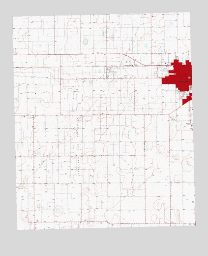
Levelland West, TX USGS Topographic Map
Click on map above to begin viewing in our Map Viewer.

This topographic map contains these locations and features:
Feature Name Type Latitude Longitude GNIS ID View Map
Assembly of God Church - ParkviewChurchN33.5887°W102.3896°2020891View Map
Church of ChristChurchN33.5806°W102.3818°2020897View Map
Cochran Emergency Medical ServiceBuildingN33.5824°W102.3771°2655745View Map
Fairview ChurchChurchN33.5657°W102.4874°1357192View Map
First Presbyterian ChurchChurchN33.5851°W102.3821°2020911View Map
Hockley County CemeteryCemeteryN33.5951°W102.4252°2773404View Map
Hockley County Constable's Office Precinct 5BuildingN33.5868°W102.3773°2750600View Map
Hockley County CourthouseBuildingN33.5873°W102.3771°2030586View Map
Hockley County Hispanic CemeteryCemeteryN33.6014°W102.4219°2773405View Map
Hockley County Sheriff's DepartmentBuildingN33.5783°W102.3788°2750601View Map
Homebound School - LevellandSchoolN33.5820°W102.3760°2006348View Map
KHOC-FM (Levelland)TowerN33.5818°W102.3971°1385909View Map
KLVT-AM (Levelland)TowerN33.5970°W102.3863°1385612View Map
LevellandPopulated PlaceN33.5873°W102.3780°1361113View Map
Levelland City HallBuildingN33.5747°W102.3770°2753429View Map
Levelland City ParkParkN33.5893°W102.3977°2028926View Map
Levelland Emergency Medical ServicesBuildingN33.5824°W102.3771°2656156View Map
Levelland Fire DepartmentBuildingN33.5881°W102.3757°2552094View Map
Levelland Municipal CemeteryCemeteryN33.5769°W102.3800°2773403View Map
Levelland Police DepartmentBuildingN33.5783°W102.3788°2750467View Map
Levelland Post OfficePost OfficeN33.5855°W102.3769°2731157View Map
Lobo LakeLakeN33.5804°W102.3766°1361585View Map
Lobo Lake ParkParkN33.5806°W102.3757°2028962View Map
Northside City ParkParkN33.5993°W102.3757°2029654View Map
West Early Childhood CenterSchoolN33.5873°W102.3874°2006375View Map
West SchoolSchoolN33.5893°W102.3877°1371217View Map

Note: Coordinates in the location and feature list above are referenced to NAD83 datum.


Copyright (C) 2008-2025 Ryan Niemi / Sunset Dynamics ... All Rights Reserved