TopoQuest Logo
Do you find TopoQuest useful?
Help keep TopoQuest running and adding new maps/features by donating!
Bitcoin:  19c7KJd3qBynnjoSw5npx9KScwjBe4ifkT
Litecoin:  LXs6TkuXGGXo1vDsWCkWVdjQX94eUKd6ui
Home View Maps Find Maps Find Places Resources & Links


Lewis Reservoir, Montana Topographic Map

USGS Map Title: Lewis Reservoir, MT
USGS Map MRC: 47106H6
DRG (GeoTIFF) Download: o47106h6.tif


Neighboring USGS Topographic Map Quads:


  Miller Coulee East, MT  
48106A7
 

  Blanchard Ranch, MT  
48106A6
 

  Wheeler, MT  
48106A5
 

  Bomber Coulee, MT  
47106H7
 

  Lewis Reservoir, MT  
47106H6
 

  Skunk Coulee, MT  
47106H5
 

  Middle Eighth Coulee, MT  
47106G7
 

  Seventh Point Buttes, MT  
47106G6
 

  Sage Creek Point, MT  
47106G5


Map MRC Location:

N48°
W107°
N48°
W106°
H8 H7 H6 H5 H4 H3 H2 H1
G8 G7 G6 G5 G4 G3 G2 G1
F8 F7 F6 F5 F4 F3 F2 F1
E8 E7 E6 E5 E4 E3 E2 E1
D8 D7 D6 D5 D4 D3 D2 D1
C8 C7 C6 C5 C4 C3 C2 C1
B8 B7 B6 B5 B4 B3 B2 B1
A8 A7 A6 A5 A4 A3 A2 A1
N47°
W107°
N47°
W106°

Lewis Reservoir, MT USGS 1:24K Topographic Map Preview:
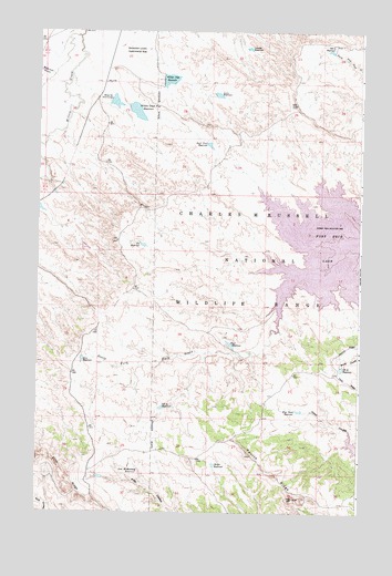
Lewis Reservoir, MT USGS Topographic Map
Click on map above to begin viewing in our Map Viewer.

This topographic map contains these locations and features:
Feature Name Type Latitude Longitude GNIS ID View Map
25N39E08ACDC01 WellWellN47.9358°W106.7126°825228View Map
26N39E29ADAB01 WellWellN47.9825°W106.7073°825347View Map
Berger ReservoirReservoirN47.8875°W106.6811°768717View Map
Bob Number 1 DamDamN47.9583°W106.6573°797376View Map
Duck Creek ReservoirReservoirN47.9705°W106.6840°770873View Map
Five Point ReservoirReservoirN47.9015°W106.6482°771412View Map
Glen ReservoirReservoirN47.9148°W106.7324°771799View Map
Langen ReservoirReservoirN47.9956°W106.6690°773217View Map
Lewis ReservoirReservoirN47.9835°W106.6808°773323View Map
Lost McMenomey ReservoirReservoirN47.8859°W106.7099°773701View Map
Paul ReservoirReservoirN47.9187°W106.6751°775116View Map
Paul Reservoir DamDamN47.9183°W106.6756°795848View Map
Third CouleeValleyN47.8925°W106.6265°777558View Map
Vic ReservoirReservoirN47.9445°W106.7095°778021View Map
VR 33 ReservoirReservoirN47.9126°W106.6320°777958View Map
VR 44 ReservoirReservoirN47.9022°W106.7016°777959View Map
VR 78 ReservoirReservoirN47.9951°W106.6373°777960View Map
Whatsitsname DamDamN47.9650°W106.6523°798204View Map
Wilderness CouleeValleyN47.9889°W106.7453°778498View Map
Willow Creek Flat DamDamN47.9783°W106.7139°795890View Map
Willow Creek Flat ReservoirReservoirN47.9792°W106.7123°778548View Map
Willow Flat Diversion DamDamN47.9811°W106.7228°778552View Map
Willow Flat Number 2 DamDamN47.9750°W106.7356°798211View Map
Willow Flat ReservoirReservoirN47.9873°W106.6996°778553View Map
Willow Flat Reservoir DamDamN47.9883°W106.7006°798199View Map

Note: Coordinates in the location and feature list above are referenced to NAD83 datum.


Copyright (C) 2008-2024 Ryan Niemi / Sunset Dynamics ... All Rights Reserved