TopoQuest Logo
Do you find TopoQuest useful?
Help keep TopoQuest running and adding new maps/features by donating!
Bitcoin:  19c7KJd3qBynnjoSw5npx9KScwjBe4ifkT
Litecoin:  LXs6TkuXGGXo1vDsWCkWVdjQX94eUKd6ui
Home View Maps Find Maps Find Places Resources & Links


Basin, Idaho Topographic Map

USGS Map Title: Basin, ID
USGS Map MRC: 42113B7
DRG (GeoTIFF) Download: o42113b7.tif


Neighboring USGS Topographic Map Quads:


  Marion, ID  
42113C8
 

  Marion SE, ID  
42113C7
 

  Mount Harrison, ID  
42113C6
 

  Oakley, ID  
42113B8
 

  Basin, ID  
42113B7
 

  Cache Peak, ID  
42113B6
 

  Blue Hill, ID  
42113A8
 

  Lyman Pass, ID  
42113A7
 

  Almo, ID  
42113A6


Map MRC Location:

N43°
W114°
N43°
W113°
H8 H7 H6 H5 H4 H3 H2 H1
G8 G7 G6 G5 G4 G3 G2 G1
F8 F7 F6 F5 F4 F3 F2 F1
E8 E7 E6 E5 E4 E3 E2 E1
D8 D7 D6 D5 D4 D3 D2 D1
C8 C7 C6 C5 C4 C3 C2 C1
B8 B7 B6 B5 B4 B3 B2 B1
A8 A7 A6 A5 A4 A3 A2 A1
N42°
W114°
N42°
W113°

Basin, ID USGS 1:24K Topographic Map Preview:
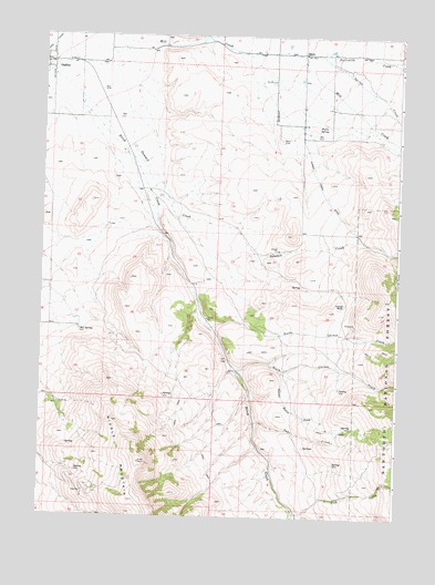
Basin, ID USGS Topographic Map
Click on map above to begin viewing in our Map Viewer.

This topographic map contains these locations and features:
Feature Name Type Latitude Longitude GNIS ID View Map
BasinPopulated PlaceN42.2455°W113.7845°399773View Map
Basin CemeteryCemeteryN42.2230°W113.7921°371378View Map
Birch CreekStreamN42.2388°W113.8711°377659View Map
Camel RockPillarN42.1796°W113.7708°371865View Map
Fairchild CreekStreamN42.2441°W113.7770°381528View Map
Fish CreekStreamN42.1260°W113.7853°381747View Map
Hot SpringSpringN42.1728°W113.8615°373162View Map
Lake CreekStreamN42.1494°W113.8003°373444View Map
North Carson CreekStreamN42.1741°W113.8167°387625View Map
Oakley Wildlife Habitat Area EastReserveN42.2296°W113.8708°401114View Map
South Carson CreekStreamN42.1624°W113.8070°390856View Map
Spring CreekStreamN42.2455°W113.7792°391193View Map
Summit CreekStreamN42.2494°W113.8711°391622View Map
Summit Creek DitchCanalN42.2135°W113.7797°400121View Map
Summit Station CreekStreamN42.1496°W113.8003°375341View Map
Warm SpringSpringN42.2264°W113.7790°375735View Map

Note: Coordinates in the location and feature list above are referenced to NAD83 datum.


Copyright (C) 2008-2025 Ryan Niemi / Sunset Dynamics ... All Rights Reserved