TopoQuest Logo
Do you find TopoQuest useful?
Help keep TopoQuest running and adding new maps/features by donating!
Bitcoin:  19c7KJd3qBynnjoSw5npx9KScwjBe4ifkT
Litecoin:  LXs6TkuXGGXo1vDsWCkWVdjQX94eUKd6ui
Home View Maps Find Maps Find Places Resources & Links


Cache Peak, Idaho Topographic Map

USGS Map Title: Cache Peak, ID
USGS Map MRC: 42113B6
DRG (GeoTIFF) Download: o42113b6.tif


Neighboring USGS Topographic Map Quads:


  Marion SE, ID  
42113C7
 

  Mount Harrison, ID  
42113C6
 

  Connor Ridge, ID  
42113C5
 

  Basin, ID  
42113B7
 

  Cache Peak, ID  
42113B6
 

  Elba, ID  
42113B5
 

  Lyman Pass, ID  
42113A7
 

  Almo, ID  
42113A6
 

  Jim Sage Canyon, ID  
42113A5


Map MRC Location:

N43°
W114°
N43°
W113°
H8 H7 H6 H5 H4 H3 H2 H1
G8 G7 G6 G5 G4 G3 G2 G1
F8 F7 F6 F5 F4 F3 F2 F1
E8 E7 E6 E5 E4 E3 E2 E1
D8 D7 D6 D5 D4 D3 D2 D1
C8 C7 C6 C5 C4 C3 C2 C1
B8 B7 B6 B5 B4 B3 B2 B1
A8 A7 A6 A5 A4 A3 A2 A1
N42°
W114°
N42°
W113°

Cache Peak, ID USGS 1:24K Topographic Map Preview:
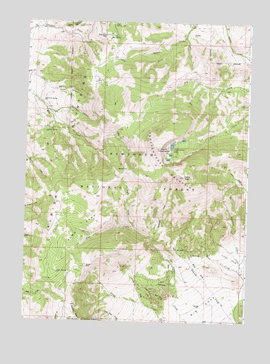
Cache Peak, ID USGS Topographic Map
Click on map above to begin viewing in our Map Viewer.

This topographic map contains these locations and features:
Feature Name Type Latitude Longitude GNIS ID View Map
Albion MountainsRangeN42.2299°W113.7181°397367View Map
Almo ParkParkN42.1599°W113.7189°376564View Map
Aspen CreekStreamN42.1635°W113.6886°376749View Map
Basin-Elba PassGapN42.2446°W113.7075°377016View Map
Black CreekStreamN42.1399°W113.6645°377738View Map
Bull SpringSpringN42.2433°W113.6987°378480View Map
Cache PeakSummitN42.1855°W113.6611°378685View Map
Castle RocksRangeN42.1388°W113.6789°379022View Map
Castle Rocks State ParkParkN42.1394°W113.6746°2084233View Map
Cold SpringSpringN42.2497°W113.7008°379521View Map
Heath CreekStreamN42.1410°W113.6467°383035View Map
Heath SpringSpringN42.1530°W113.6568°383039View Map
Independence LakesLakeN42.1984°W113.6675°383636View Map
Independence MountainSummitN42.1896°W113.6692°396687View Map
Johnson CreekStreamN42.1307°W113.6778°383973View Map
Logger SpringSpringN42.1453°W113.7318°385977View Map
Mount IndependenceSummitN42.1974°W113.6750°399929View Map
Myers CanyonValleyN42.2471°W113.7311°387435View Map
Pot HolesLakeN42.2250°W113.7102°388809View Map
Rangers TrailTrailN42.2038°W113.7070°389095View Map
Salt Lick SpringSpringN42.2171°W113.7405°389869View Map
Sanford SpringSpringN42.2040°W113.7393°389913View Map
Slide CanyonValleyN42.2277°W113.7478°390599View Map
Spring CanyonValleyN42.2116°W113.7353°391154View Map
Stines PassGapN42.1480°W113.7156°391465View Map

Note: Coordinates in the location and feature list above are referenced to NAD83 datum.


Copyright (C) 2008-2025 Ryan Niemi / Sunset Dynamics ... All Rights Reserved