TopoQuest Logo
Do you find TopoQuest useful?
Help keep TopoQuest running and adding new maps/features by donating!
Bitcoin:  19c7KJd3qBynnjoSw5npx9KScwjBe4ifkT
Litecoin:  LXs6TkuXGGXo1vDsWCkWVdjQX94eUKd6ui
Home View Maps Find Maps Find Places Resources & Links


Limaville, Ohio Topographic Map

USGS Map Title: Limaville, OH
USGS Map MRC: 40081H2
DRG (GeoTIFF) Download: o40081h2.tif


Neighboring USGS Topographic Map Quads:


  Suffield, OH  
41081A3
 

  Atwater, OH  
41081A2
 

  Deerfield, OH  
41081A1
 

  Hartville, OH  
40081H3
 

  Limaville, OH  
40081H2
 

  Alliance, OH  
40081H1
 

  Canton East, OH  
40081G3
 

  Robertsville, OH  
40081G2
 

  Homeworth, OH  
40081G1


Map MRC Location:

N41°
W82°
N41°
W81°
H8 H7 H6 H5 H4 H3 H2 H1
G8 G7 G6 G5 G4 G3 G2 G1
F8 F7 F6 F5 F4 F3 F2 F1
E8 E7 E6 E5 E4 E3 E2 E1
D8 D7 D6 D5 D4 D3 D2 D1
C8 C7 C6 C5 C4 C3 C2 C1
B8 B7 B6 B5 B4 B3 B2 B1
A8 A7 A6 A5 A4 A3 A2 A1
N40°
W82°
N40°
W81°

Limaville, OH USGS 1:24K Topographic Map Preview:
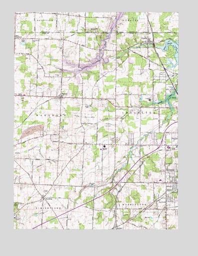
Limaville, OH USGS Topographic Map
Click on map above to begin viewing in our Map Viewer.

This topographic map contains these locations and features:
Feature Name Type Latitude Longitude GNIS ID View Map
Alliance Baptist TempleChurchN40.9309°W81.1282°1057395View Map
Alliance Plaza Shopping CenterLocaleN40.9026°W81.1329°1057624View Map
Beech School (historical)SchoolN40.8864°W81.1337°1057397View Map
BeechwoodPopulated PlaceN40.8914°W81.1340°1048508View Map
Beechwood CemeteryCemeteryN40.8860°W81.1333°1731083View Map
Beechwood PlaygroundParkN40.8976°W81.1337°1037804View Map
Butler Rodman ParkParkN40.9064°W81.1465°1057396View Map
Camp RodmanLocaleN40.8981°W81.1832°1057400View Map
Chosen AcresLocaleN40.9050°W81.2300°2706022View Map
Cutty Sunset Mobile Home ParkPopulated PlaceN40.9492°W81.2464°2553850View Map
Cuttys CampLocaleN40.9487°W81.2443°1057405View Map
Dale Walborn ReservoirReservoirN40.9713°W81.1887°1078039View Map
Dale Walborn Reservoir DamDamN40.9734°W81.1782°1078038View Map
Deer CreekStreamN40.9801°W81.1412°1066675View Map
Deer Creek Meeting House (historical)ChurchN40.9878°W81.1718°1057398View Map
Deer Creek ReservoirReservoirN40.9759°W81.1273°1070731View Map
France LakeReservoirN40.9611°W81.2012°1078041View Map
France Lake DamDamN40.9617°W81.2032°1078040View Map
French Baptist CemeteryCemeteryN40.9083°W81.2405°1731088View Map
HarrisburgPopulated PlaceN40.8934°W81.2273°1061122View Map
Lexington Elementary SchoolSchoolN40.9492°W81.1462°1081544View Map
LimavillePopulated PlaceN40.9820°W81.1484°1064996View Map
Limaville CemeteryCemeteryN40.9801°W81.1498°1731090View Map
Limaville Methodist ChurchChurchN40.9834°W81.1462°1057393View Map
Limaville Post OfficePost OfficeN40.9820°W81.1490°2057305View Map
Little Beech CreekStreamN40.9495°W81.1332°1066807View Map
MarlboroPopulated PlaceN40.9512°W81.2140°1057833View Map
Marlboro CemeteryCemeteryN40.9645°W81.2145°1043001View Map
Marlboro Census Designated PlaceCensusN40.9505°W81.2165°2628928View Map
Marlboro High SchoolSchoolN40.9526°W81.2432°1043003View Map
Marlboro Post Office (historical)Post OfficeN40.9514°W81.2137°2055428View Map
Marlboro Volunteer Fire CompanyBuildingN40.9512°W81.2148°2549280View Map
Marlington High SchoolSchoolN40.9228°W81.1809°1043004View Map
Marlington Middle SchoolSchoolN40.9212°W81.1837°1057399View Map
MaximoPopulated PlaceN40.8764°W81.1720°1061486View Map
Maximo Post OfficePost OfficeN40.8770°W81.1720°2057309View Map
Molesky GreenhousesBuildingN40.9006°W81.1636°2585601View Map
Molly Stark Hospital (historical)HospitalN40.8814°W81.2490°1043434View Map
Mud LakeLakeN40.8819°W81.1452°1043693View Map
Nazarene Church CampLocaleN40.8895°W81.2490°1057406View Map
New BaltimorePopulated PlaceN40.9845°W81.2495°1049005View Map
New Baltimore CemeteryCemeteryN40.9832°W81.2358°1043818View Map
Nimishillen Township Fire Department Station 3BuildingN40.8842°W81.2480°2550311View Map
Quaker Hill CemeteryCemeteryN40.9877°W81.1731°1044816View Map
Queen of Peace MonasteryChurchN40.9903°W81.1895°1044825View Map
Red Pine LakeLakeN40.9003°W81.1906°1044897View Map
Sacred Heart of Mary Catholic ChurchChurchN40.8917°W81.2284°1057404View Map
Sacred Heart of Mary CemeteryCemeteryN40.8913°W81.2279°1731095View Map
Saint Joseph Catholic CemeteryCemeteryN40.8779°W81.1724°1731096View Map
Saint Josephs Catholic ChurchChurchN40.8781°W81.1715°1057401View Map
Saint Pauls CemeteryCemeteryN40.9802°W81.2140°1045752View Map
Science Hill CemeteryCemeteryN40.9228°W81.1643°1731098View Map
Shaffers (historical)Populated PlaceN40.8873°W81.1340°1063132View Map
Stub's FieldAirportN40.9675°W81.2067°2442519View Map
Sunset ParkParkN40.9501°W81.2440°1046874View Map
Sunset StripAirportN40.9429°W81.2370°1082839View Map
Tannenhauf Golf CourseLocaleN40.9351°W81.1784°1080209View Map
Township of LexingtonCivilN40.9524°W81.1413°1086979View Map
Township of MarlboroCivilN40.9448°W81.2437°1086981View Map
Union Grove School (historical)SchoolN40.9456°W81.1534°1057394View Map
Village of LimavilleCivilN40.9841°W81.1483°2398439View Map
WDPN-AM (Alliance)TowerN40.9262°W81.1279°1085252View Map
Woods LakeLakeN40.9459°W81.1924°1048112View Map
Zion Evangelical and Reformed ChurchChurchN40.8770°W81.1715°1057402View Map

Note: Coordinates in the location and feature list above are referenced to NAD83 datum.


Copyright (C) 2008-2024 Ryan Niemi / Sunset Dynamics ... All Rights Reserved