TopoQuest Logo
Do you find TopoQuest useful?
Help keep TopoQuest running and adding new maps/features by donating!
Bitcoin:  19c7KJd3qBynnjoSw5npx9KScwjBe4ifkT
Litecoin:  LXs6TkuXGGXo1vDsWCkWVdjQX94eUKd6ui
Home View Maps Find Maps Find Places Resources & Links


Homeworth, Ohio Topographic Map

USGS Map Title: Homeworth, OH
USGS Map MRC: 40081G1
DRG (GeoTIFF) Download: o40081g1.tif


Neighboring USGS Topographic Map Quads:


  Limaville, OH  
40081H2
 

  Alliance, OH  
40081H1
 

  Damascus, OH  
40080H8
 

  Robertsville, OH  
40081G2
 

  Homeworth, OH  
40081G1
 

  Hanoverton, OH  
40080G8
 

  Malvern, OH  
40081F2
 

  Minerva, OH  
40081F1
 

  Kensington, OH  
40080F8


Map MRC Location:

N41°
W82°
N41°
W81°
H8 H7 H6 H5 H4 H3 H2 H1
G8 G7 G6 G5 G4 G3 G2 G1
F8 F7 F6 F5 F4 F3 F2 F1
E8 E7 E6 E5 E4 E3 E2 E1
D8 D7 D6 D5 D4 D3 D2 D1
C8 C7 C6 C5 C4 C3 C2 C1
B8 B7 B6 B5 B4 B3 B2 B1
A8 A7 A6 A5 A4 A3 A2 A1
N40°
W82°
N40°
W81°

Homeworth, OH USGS 1:24K Topographic Map Preview:
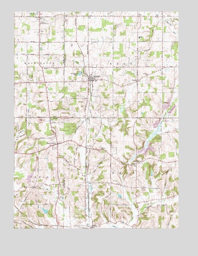
Homeworth, OH USGS Topographic Map
Click on map above to begin viewing in our Map Viewer.

This topographic map contains these locations and features:
Feature Name Type Latitude Longitude GNIS ID View Map
Baker School (historical)SchoolN40.7987°W81.1237°1057617View Map
BayardPopulated PlaceN40.7506°W81.0648°1048491View Map
Bayard Post Office (historical)Post OfficeN40.7514°W81.0651°1967481View Map
Beaver Lake (historical)LakeN40.8284°W81.0376°1052117View Map
Beaver RunStreamN40.8714°W81.0126°1037764View Map
Bethel CemeteryCemeteryN40.8727°W81.0171°1807409View Map
Bethel ChurchChurchN40.8723°W81.0173°1037944View Map
Brocklehurst LakeReservoirN40.7793°W81.1127°1078022View Map
Brocklehurst Lake DamDamN40.7801°W81.1148°1078021View Map
Buckeye Lawn FarmLocaleN40.8586°W81.0419°2704744View Map
Bulick FieldAirportN40.7675°W81.0581°1082242View Map
ChambersburgPopulated PlaceN40.7876°W81.0318°1060948View Map
Chambersburg CemeteryCemeteryN40.7870°W81.0344°1807411View Map
Crosswind Meadows AirportAirportN40.8113°W81.0575°1082865View Map
Edwards CemeteryCemeteryN40.7673°W81.0556°1040089View Map
Fairmount Children's Home CemeteryCemeteryN40.8708°W81.1053°1731085View Map
Fairmount Childrens HomeBuildingN40.8689°W81.1040°1040319View Map
Fairmount ChurchChurchN40.8720°W81.1057°1040320View Map
Fairmount Grange CemeteryCemeteryN40.8573°W81.1031°1731086View Map
Hawkins CemeteryCemeteryN40.8143°W81.1118°1041407View Map
HomeworthPopulated PlaceN40.8353°W81.0659°1064857View Map
Homeworth Census Designated PlaceCensusN40.8357°W81.0649°2628903View Map
Homeworth Post OfficePost OfficeN40.8348°W81.0665°1967547View Map
Homeworth Volunteer Fire DepartmentBuildingN40.8378°W81.0667°2550112View Map
Knox Elementary SchoolSchoolN40.8603°W81.0298°1081517View Map
Middle Branch Sandy CreekStreamN40.7501°W81.0718°1043263View Map
Middle Sandy United Presbyterian ChurchChurchN40.8381°W81.0690°1067648View Map
MoultriePopulated PlaceN40.7964°W81.0709°1048986View Map
Moultrie ChapelChurchN40.7956°W81.0590°1043518View Map
Moultrie Chapel CemeteryCemeteryN40.7967°W81.0595°1807416View Map
Mount Calvary ChurchChurchN40.7737°W81.1098°1043547View Map
New FranklinPopulated PlaceN40.7984°W81.0920°1057865View Map
New Franklin CemeteryCemeteryN40.7998°W81.0937°1731092View Map
New Franklin Methodist ChurchChurchN40.7987°W81.0907°1057614View Map
New Franklin Post Office (historical)Post OfficeN40.7987°W81.0915°2055446View Map
New Franklin School (historical)SchoolN40.7978°W81.0948°1057616View Map
Pinch School (historical)SchoolN40.8726°W81.0295°1052116View Map
Prospect Hill School (historical)SchoolN40.8581°W81.0729°1052115View Map
ReadingPopulated PlaceN40.8351°W81.0312°1062961View Map
Reading CemeteryCemeteryN40.8373°W81.0276°1807419View Map
Reading ChurchChurchN40.8389°W81.0237°1068215View Map
Saint Johns Evangelical Lutheran ChurchChurchN40.7989°W81.0915°1057615View Map
Sleepy Hollow AirportAirportN40.7845°W81.0988°1082893View Map
Township of KnoxCivilN40.8576°W81.0307°1085896View Map
Township of WestCivilN40.7706°W81.0309°1085907View Map
Vandergrift LakeReservoirN40.7600°W81.1011°1078020View Map
Vandergrift Lake DamDamN40.7589°W81.0996°1078019View Map
Walker CemeteryCemeteryN40.7679°W81.0903°1047501View Map
WDJQ-FM (Alliance)TowerN40.7901°W81.1070°1085307View Map
Woodland LakeReservoirN40.8393°W81.0749°1078197View Map
Woodland Lake DamDamN40.8401°W81.0732°1078196View Map
Yeagleys CornersPopulated PlaceN40.8339°W81.1015°1065736View Map

Note: Coordinates in the location and feature list above are referenced to NAD83 datum.


Copyright (C) 2008-2024 Ryan Niemi / Sunset Dynamics ... All Rights Reserved