TopoQuest Logo
Do you find TopoQuest useful?
Help keep TopoQuest running and adding new maps/features by donating!
Bitcoin:  19c7KJd3qBynnjoSw5npx9KScwjBe4ifkT
Litecoin:  LXs6TkuXGGXo1vDsWCkWVdjQX94eUKd6ui
Home View Maps Find Maps Find Places Resources & Links


Limekiln Rapids, Idaho Topographic Map

USGS Map Title: Limekiln Rapids, ID
USGS Map MRC: 46116A8
DRG (GeoTIFF) Download: o46116a8.tif


Neighboring USGS Topographic Map Quads:


  Weissenfels Ridge, WA  
46117B1
 

  Captain John Rapids, ID  
46116B8
 

  Waha, ID  
46116B7
 

  Black Butte, WA  
46117A1
 

  Limekiln Rapids, ID  
46116A8
 

  Frye Point, ID  
46116A7
 

  Teepee Butte, OR  
45117H1
 

  Jim Creek Butte, OR  
45116H8
 

  Wapshilla Creek, ID  
45116H7


Map MRC Location:

N47°
W117°
N47°
W116°
H8 H7 H6 H5 H4 H3 H2 H1
G8 G7 G6 G5 G4 G3 G2 G1
F8 F7 F6 F5 F4 F3 F2 F1
E8 E7 E6 E5 E4 E3 E2 E1
D8 D7 D6 D5 D4 D3 D2 D1
C8 C7 C6 C5 C4 C3 C2 C1
B8 B7 B6 B5 B4 B3 B2 B1
A8 A7 A6 A5 A4 A3 A2 A1
N46°
W117°
N46°
W116°

Limekiln Rapids, ID USGS 1:24K Topographic Map Preview:
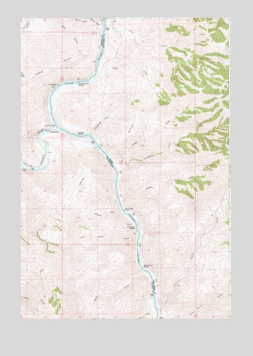
Limekiln Rapids, ID USGS Topographic Map
Click on map above to begin viewing in our Map Viewer.

This topographic map contains these locations and features:
Feature Name Type Latitude Longitude GNIS ID View Map
Anaconda CreekStreamN46.0446°W116.9385°1503021View Map
Bear BarBarN46.0002°W116.9182°371394View Map
Bear CreekStreamN46.0007°W116.9196°1503228View Map
Billy CreekStreamN46.1221°W116.9488°371547View Map
Birch CreekStreamN46.0335°W116.9304°1503381View Map
Bob GulchValleyN46.1107°W116.9610°1503464View Map
Box GulchValleyN46.1238°W116.9579°1503517View Map
Camp CreekStreamN46.1057°W116.9532°371867View Map
Captain Lewis RapidsRapidsN46.0984°W116.9661°1503807View Map
Captain Lewis RapidsRapidsN46.0984°W116.9661°371891View Map
Chimney CreekStreamN46.0627°W116.9429°371998View Map
Corral CreekStreamN46.0040°W116.9182°372136View Map
Craig Mountain Wildlife Management AreaReserveN46.1246°W116.9176°395160View Map
Dough CreekStreamN46.0663°W116.9463°372446View Map
Fisher GulchValleyN46.1124°W116.9529°1504904View Map
Gold HillSummitN46.0829°W116.9296°372866View Map
Grande Ronde RiverStreamN46.0802°W116.9796°1505215View Map
Lathrop GulchValleyN46.0996°W116.9976°1506100View Map
Lime HillSummitN46.0557°W116.9638°1512390View Map
Limekiln RapidsRapidsN46.0760°W116.9666°373579View Map
Limestone PointCliffN46.0818°W116.9524°373581View Map
Middle CreekStreamN46.0518°W116.9418°373920View Map
Negro Head RapidsRapidsN46.0440°W116.9375°374112View Map
Perkins GulchValleyN46.1218°W116.9504°1507381View Map
RogersburgPopulated PlaceN46.0782°W116.9796°1511268View Map
Rogersburg AirportAirportN46.0748°W116.9671°2443312View Map
Shovel CreekStreamN46.0190°W116.9249°1149448View Map
Shovel CreekStreamN46.0190°W116.9249°1508325View Map
Shovel Creek RapidsRapidsN46.0204°W116.9267°375018View Map
Wild Goose RapidsRapidsN46.0384°W116.9313°1509507View Map
Zindel (historical)Populated PlaceN46.1157°W116.9988°1514680View Map

Note: Coordinates in the location and feature list above are referenced to NAD83 datum.


Copyright (C) 2008-2024 Ryan Niemi / Sunset Dynamics ... All Rights Reserved