TopoQuest Logo
Do you find TopoQuest useful?
Help keep TopoQuest running and adding new maps/features by donating!
Bitcoin:  19c7KJd3qBynnjoSw5npx9KScwjBe4ifkT
Litecoin:  LXs6TkuXGGXo1vDsWCkWVdjQX94eUKd6ui
Home View Maps Find Maps Find Places Resources & Links


Captain John Rapids, Idaho Topographic Map

USGS Map Title: Captain John Rapids, ID
USGS Map MRC: 46116B8
DRG (GeoTIFF) Download: o46116b8.tif


Neighboring USGS Topographic Map Quads:


  Asotin, WA  
46117C1
 

  Lewiston Orchards South, ID  
46116C8
 

  Sweetwater, ID  
46116C7
 

  Weissenfels Ridge, WA  
46117B1
 

  Captain John Rapids, ID  
46116B8
 

  Waha, ID  
46116B7
 

  Black Butte, WA  
46117A1
 

  Limekiln Rapids, ID  
46116A8
 

  Frye Point, ID  
46116A7


Map MRC Location:

N47°
W117°
N47°
W116°
H8 H7 H6 H5 H4 H3 H2 H1
G8 G7 G6 G5 G4 G3 G2 G1
F8 F7 F6 F5 F4 F3 F2 F1
E8 E7 E6 E5 E4 E3 E2 E1
D8 D7 D6 D5 D4 D3 D2 D1
C8 C7 C6 C5 C4 C3 C2 C1
B8 B7 B6 B5 B4 B3 B2 B1
A8 A7 A6 A5 A4 A3 A2 A1
N46°
W117°
N46°
W116°

Captain John Rapids, ID USGS 1:24K Topographic Map Preview:
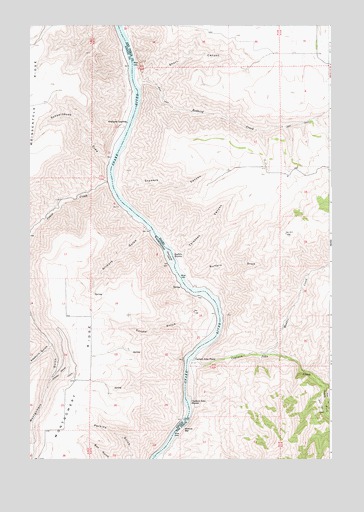
Captain John Rapids, ID USGS Topographic Map
Click on map above to begin viewing in our Map Viewer.

This topographic map contains these locations and features:
Feature Name Type Latitude Longitude GNIS ID View Map
Bobcat BarBarN46.1335°W116.9368°371628View Map
Buffalo DrawValleyN46.1757°W116.9293°397495View Map
Buffalo RapidsRapidsN46.1836°W116.9409°1503628View Map
Captain John CreekStreamN46.1527°W116.9335°371888View Map
Captain John FerryLocaleN46.1540°W116.9318°371889View Map
Captain John RapidsRapidsN46.1411°W116.9347°1503806View Map
Couse CreekStreamN46.2049°W116.9663°1504204View Map
Crowers CanyonValleyN46.2046°W116.9631°397596View Map
Edeburn GulchValleyN46.1579°W116.9910°1504673View Map
Gilmore GulchValleyN46.1902°W116.9501°1505138View Map
Grahams LandingPopulated PlaceN46.2204°W116.9599°1511008View Map
Madden CreekStreamN46.1552°W116.9029°373794View Map
Montgomery RidgeRidgeN46.1457°W116.9793°1506762View Map
Redbird CreekStreamN46.2324°W116.9549°374627View Map
Sandal GulchValleyN46.1599°W116.9285°1508098View Map
Schoolhouse DrawValleyN46.2104°W116.9679°1508156View Map
Sherry GradeTrailN46.1515°W116.9843°1508298View Map
Short CanyonValleyN46.2331°W116.9485°398125View Map
South Fork Captain John CreekStreamN46.1454°W116.8774°375145View Map
Steamboat IslandIslandN46.1829°W116.9415°1508705View Map
TaplinPopulated PlaceN46.1521°W116.9313°399515View Map
Thiessen CanyonValleyN46.1842°W116.9382°400132View Map

Note: Coordinates in the location and feature list above are referenced to NAD83 datum.


Copyright (C) 2008-2024 Ryan Niemi / Sunset Dynamics ... All Rights Reserved