TopoQuest Logo
Do you find TopoQuest useful?
Help keep TopoQuest running and adding new maps/features by donating!
Bitcoin:  19c7KJd3qBynnjoSw5npx9KScwjBe4ifkT
Litecoin:  LXs6TkuXGGXo1vDsWCkWVdjQX94eUKd6ui
Home View Maps Find Maps Find Places Resources & Links


Linch, Wyoming Topographic Map

USGS Map Title: Linch, WY
USGS Map MRC: 43106E2
DRG (GeoTIFF) Download: o43106e2.tif


Neighboring USGS Topographic Map Quads:


  Sussex, WY  
43106F3
 

  House Creek, WY  
43106F2
 

  Dry Fork Ranch, WY  
43106F1
 

  Dead Woman Crossing, WY  
43106E3
 

  Linch, WY  
43106E2
 

  Taylor Ranch, WY  
43106E1
 

  Midwest, WY  
43106D3
 

  Edgerton, WY  
43106D2
 

  Sawmill Canyon, WY  
43106D1


Map MRC Location:

N44°
W107°
N44°
W106°
H8 H7 H6 H5 H4 H3 H2 H1
G8 G7 G6 G5 G4 G3 G2 G1
F8 F7 F6 F5 F4 F3 F2 F1
E8 E7 E6 E5 E4 E3 E2 E1
D8 D7 D6 D5 D4 D3 D2 D1
C8 C7 C6 C5 C4 C3 C2 C1
B8 B7 B6 B5 B4 B3 B2 B1
A8 A7 A6 A5 A4 A3 A2 A1
N43°
W107°
N43°
W106°

Linch, WY USGS 1:24K Topographic Map Preview:
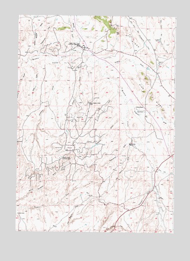
Linch, WY USGS Topographic Map
Click on map above to begin viewing in our Map Viewer.

This topographic map contains these locations and features:
Feature Name Type Latitude Longitude GNIS ID View Map
Anderson DrawValleyN43.5969°W106.2178°1584827View Map
Comer RanchLocaleN43.5703°W106.1806°1586915View Map
Endres DrawValleyN43.5969°W106.1867°1588312View Map
Fay Dennis DrawValleyN43.5536°W106.1809°1588406View Map
Frenchman DrawValleyN43.6044°W106.2336°1588750View Map
Hunter DrawValleyN43.5975°W106.2464°1589816View Map
Irvine Cow CampLocaleN43.5202°W106.1647°1589976View Map
Jack Rabbit Numbers One and Two ClaimsMineN43.5556°W106.1931°1747103View Map
Jim Dandy MineMineN43.6108°W106.1261°1746204View Map
Joe Grey SpringSpringN43.6119°W106.1817°1590128View Map
Jones DrawValleyN43.5994°W106.1939°1590220View Map
Knighton SpringSpringN43.5097°W106.2486°1590402View Map
LinchPopulated PlaceN43.6064°W106.1961°1590693View Map
Linch Post OfficePost OfficeN43.6067°W106.1977°2768542View Map
Linch SchoolSchoolN43.6064°W106.1961°1795539View Map
Meadow CreekLocaleN43.5419°W106.2147°1591428View Map
Meadow Creek Oil FieldOilfieldN43.5478°W106.2028°1591430View Map
Microwave PitMineN43.5064°W106.1508°1746206View Map
Moonshine DrawValleyN43.5519°W106.1811°1591721View Map
Nick Ray DrawValleyN43.5366°W106.1386°1592033View Map
North Meadow Creek CampLocaleN43.5744°W106.1914°1592235View Map
North Meadow Creek Oil FieldOilfieldN43.5650°W106.1959°1592236View Map
Ormsby DrawValleyN43.5261°W106.1697°1592480View Map
Pavey DrawValleyN43.5658°W106.1834°1592629View Map
Pugsley DrawValleyN43.5719°W106.1822°1593055View Map
Pugsley MineMineN43.5978°W106.1809°1593057View Map
Reeves DrawValleyN43.6047°W106.2059°1593369View Map
School Section DrawValleyN43.6019°W106.2339°1594015View Map
Sussex Oil FieldOilfieldN43.5991°W106.2095°1595222View Map
Sussex Repressuring PlantLocaleN43.5469°W106.2111°1595223View Map
Sussex UnitPopulated PlaceN43.6078°W106.2020°1605140View Map
Taylor MineMineN43.5811°W106.1384°1746205View Map
Tillman RanchLocaleN43.5725°W106.1820°1595568View Map
Wop DrawValleyN43.5986°W106.2392°1596623View Map

Note: Coordinates in the location and feature list above are referenced to NAD83 datum.


Copyright (C) 2008-2025 Ryan Niemi / Sunset Dynamics ... All Rights Reserved