TopoQuest Logo
Do you find TopoQuest useful?
Help keep TopoQuest running and adding new maps/features by donating!
Bitcoin:  19c7KJd3qBynnjoSw5npx9KScwjBe4ifkT
Litecoin:  LXs6TkuXGGXo1vDsWCkWVdjQX94eUKd6ui
Home View Maps Find Maps Find Places Resources & Links


Sussex, Wyoming Topographic Map

USGS Map Title: Sussex, WY
USGS Map MRC: 43106F3
DRG (GeoTIFF) Download: o43106f3.tif


Neighboring USGS Topographic Map Quads:


  Fourmile Reservoir, WY  
43106G4
 

  Soldier Creek, WY  
43106G3
 

  Fort Reno, WY  
43106G2
 

  Figure 8 Reservoir, WY  
43106F4
 

  Sussex, WY  
43106F3
 

  House Creek, WY  
43106F2
 

  Dugout Ranch, WY  
43106E4
 

  Dead Woman Crossing, WY  
43106E3
 

  Linch, WY  
43106E2


Map MRC Location:

N44°
W107°
N44°
W106°
H8 H7 H6 H5 H4 H3 H2 H1
G8 G7 G6 G5 G4 G3 G2 G1
F8 F7 F6 F5 F4 F3 F2 F1
E8 E7 E6 E5 E4 E3 E2 E1
D8 D7 D6 D5 D4 D3 D2 D1
C8 C7 C6 C5 C4 C3 C2 C1
B8 B7 B6 B5 B4 B3 B2 B1
A8 A7 A6 A5 A4 A3 A2 A1
N43°
W107°
N43°
W106°

Sussex, WY USGS 1:24K Topographic Map Preview:
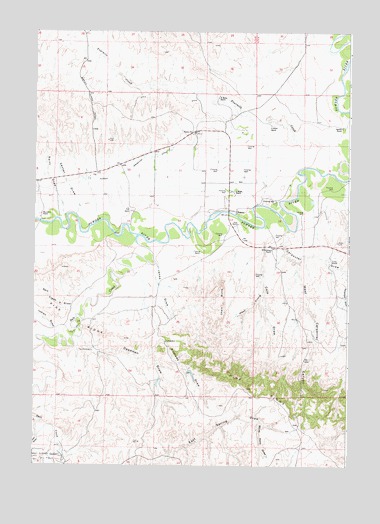
Sussex, WY USGS Topographic Map
Click on map above to begin viewing in our Map Viewer.

This topographic map contains these locations and features:
Feature Name Type Latitude Longitude GNIS ID View Map
Andrews DrawValleyN43.6564°W106.3320°1584835View Map
Carpenter DrawValleyN43.6925°W106.2756°1586384View Map
Center DrawValleyN43.7016°W106.3584°1586527View Map
Chalk ButteSummitN43.6716°W106.2997°1586549View Map
Cole DrawValleyN43.6900°W106.2834°1586890View Map
Deadman DrawValleyN43.6622°W106.3553°1587434View Map
E Meike RanchLocaleN43.7230°W106.2814°1587964View Map
E Patterson RanchLocaleN43.6872°W106.2809°1587965View Map
Fourmile CreekStreamN43.7275°W106.2536°1599819View Map
Garrett RanchLocaleN43.7225°W106.2531°1588830View Map
H Meike RanchLocaleN43.7308°W106.3023°1589215View Map
Indian DrawValleyN43.6641°W106.3684°1589895View Map
Jenks DrawValleyN43.6833°W106.3267°1590081View Map
Losey RanchLocaleN43.6839°W106.2578°1591013View Map
Matthews RanchLocaleN43.6975°W106.3723°1591264View Map
Meike Pit Number Three MineMineN43.7375°W106.2561°1746237View Map
P Meike RanchLocaleN43.7041°W106.2959°1592531View Map
Patrick DamDamN43.6416°W106.3022°1606502View Map
Patrick ReservoirReservoirN43.6416°W106.3022°1606503View Map
Raitt DrawValleyN43.6975°W106.3636°1593140View Map
Rider DrawValleyN43.6328°W106.3734°1593449View Map
Salt CreekStreamN43.6911°W106.3342°1593808View Map
Salt Creek V DrawValleyN43.6694°W106.3595°1593811View Map
Skiles Pit Number OneMineN43.7239°W106.3248°1746238View Map
SussexPopulated PlaceN43.6983°W106.2950°1597516View Map
Sussex SchoolSchoolN43.7211°W106.3120°1595224View Map
The ChimneyPillarN43.6580°W106.3520°1595410View Map
Turk RanchLocaleN43.6950°W106.2942°1595735View Map
Vest RanchLocaleN43.6983°W106.3370°1595925View Map
West Carpenter CanyonValleyN43.6833°W106.2695°1596160View Map
West Prong Cole DrawValleyN43.6764°W106.2839°1596236View Map
Windy Point DrawValleyN43.6378°W106.2850°1596541View Map

Note: Coordinates in the location and feature list above are referenced to NAD83 datum.


Copyright (C) 2008-2025 Ryan Niemi / Sunset Dynamics ... All Rights Reserved