TopoQuest Logo
Do you find TopoQuest useful?
Help keep TopoQuest running and adding new maps/features by donating!
Bitcoin:  19c7KJd3qBynnjoSw5npx9KScwjBe4ifkT
Litecoin:  LXs6TkuXGGXo1vDsWCkWVdjQX94eUKd6ui
Home View Maps Find Maps Find Places Resources & Links


Lincoln Center, Maine Topographic Map

USGS Map Title: Lincoln Center, ME
USGS Map MRC: 45068D4
DRG (GeoTIFF) Download: o45068d4.tif


Neighboring USGS Topographic Map Quads:


  Medunkeunk Lake, ME  
45068E5
 

  Mattaseunk Lake, ME  
45068E4
 

  Mattawamkeag, ME  
45068E3
 

  Nine Meadow Ridge, ME  
45068D5
 

  Lincoln Center, ME  
45068D4
 

  East Winn, ME  
45068D3
 

  Lincoln West, ME  
45068C5
 

  Lincoln East, ME  
45068C4
 

  Lee, ME  
45068C3


Map MRC Location:

N46°
W69°
N46°
W68°
H8 H7 H6 H5 H4 H3 H2 H1
G8 G7 G6 G5 G4 G3 G2 G1
F8 F7 F6 F5 F4 F3 F2 F1
E8 E7 E6 E5 E4 E3 E2 E1
D8 D7 D6 D5 D4 D3 D2 D1
C8 C7 C6 C5 C4 C3 C2 C1
B8 B7 B6 B5 B4 B3 B2 B1
A8 A7 A6 A5 A4 A3 A2 A1
N45°
W69°
N45°
W68°

Lincoln Center, ME USGS 1:24K Topographic Map Preview:
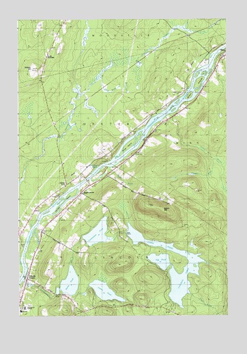
Lincoln Center, ME USGS Topographic Map
Click on map above to begin viewing in our Map Viewer.

This topographic map contains these locations and features:
Feature Name Type Latitude Longitude GNIS ID View Map
Bagley MountainSummitN45.4198°W68.4139°561433View Map
Blood BrookStreamN45.4676°W68.4622°562582View Map
Brown IslandsIslandN45.4712°W68.3922°563055View Map
Cambolasse PondLakeN45.4097°W68.4529°563369View Map
Cambolasse StreamStreamN45.3895°W68.4981°563370View Map
Cambolasse Stream ReservoirReservoirN45.3881°W68.4933°1774112View Map
Caribou PondLakeN45.4045°W68.4147°563537View Map
Center PondLakeN45.3853°W68.4487°563763View Map
ChesterPopulated PlaceN45.4087°W68.4997°579195View Map
Chester Siding (historical)LocaleN45.4559°W68.4786°563918View Map
Egg PondLakeN45.3982°W68.4153°565805View Map
Ella P Burr Elementary SchoolSchoolN45.3770°W68.4985°581668View Map
Flowers BrookStreamN45.4406°W68.3820°566324View Map
Glidden HillSummitN45.4790°W68.4917°566846View Map
Hersey IslandIslandN45.4234°W68.4714°567979View Map
Lincoln CenterPopulated PlaceN45.3870°W68.4697°569600View Map
Lincoln Center CemeteryCemeteryN45.4106°W68.4869°581666View Map
Long PondReservoirN45.3958°W68.4079°570289View Map
Long Pond DamDamN45.4103°W68.4352°1773837View Map
Marianne SchoolSchoolN45.4292°W68.4734°570768View Map
Mattanawcook AcademySchoolN45.3784°W68.4965°581667View Map
Middle Chester CemeteryCemeteryN45.4267°W68.4753°581665View Map
Mill Pond DamDamN45.3880°W68.4945°1774111View Map
North Chester CemeteryCemeteryN45.4681°W68.4043°572321View Map
North LincolnPopulated PlaceN45.4270°W68.4620°572359View Map
Salmon StreamStreamN45.4598°W68.4081°574781View Map
Sebonibus RapidsRapidsN45.4384°W68.4478°575178View Map
Smith BrookStreamN45.4376°W68.4447°575591View Map
Snag Pond DamDamN45.3841°W68.4772°1773835View Map
Snow CemeteryCemeteryN45.4440°W68.4285°578826View Map
Snow IslandIslandN45.4456°W68.4328°575681View Map
South Winn CemeteryCemeteryN45.4525°W68.4198°575927View Map
South WoodvillePopulated PlaceN45.4848°W68.4828°579729View Map
Stump PondReservoirN45.3889°W68.4697°576463View Map
Tobin BrookStreamN45.3839°W68.3970°577140View Map

Note: Coordinates in the location and feature list above are referenced to NAD83 datum.


Copyright (C) 2008-2024 Ryan Niemi / Sunset Dynamics ... All Rights Reserved