TopoQuest Logo
Do you find TopoQuest useful?
Help keep TopoQuest running and adding new maps/features by donating!
Bitcoin:  19c7KJd3qBynnjoSw5npx9KScwjBe4ifkT
Litecoin:  LXs6TkuXGGXo1vDsWCkWVdjQX94eUKd6ui
Home View Maps Find Maps Find Places Resources & Links


Bassett, Texas Topographic Map

USGS Map Title: Bassett, TX
USGS Map MRC: 33094C5
DRG (GeoTIFF) Download: o33094c5.tif


Neighboring USGS Topographic Map Quads:


  Hodgson, TX  
33094D6
 

  Malta, TX  
33094D5
 

  New Boston, TX  
33094D4
 

  Dalby Springs, TX  
33094C6
 

  Bassett, TX  
33094C5
 

  Corley, TX  
33094C4
 

  Naples, TX  
33094B6
 

  Marietta, TX  
33094B5
 

  Bryans Mill, TX  
33094B4


Map MRC Location:

N34°
W95°
N34°
W94°
H8 H7 H6 H5 H4 H3 H2 H1
G8 G7 G6 G5 G4 G3 G2 G1
F8 F7 F6 F5 F4 F3 F2 F1
E8 E7 E6 E5 E4 E3 E2 E1
D8 D7 D6 D5 D4 D3 D2 D1
C8 C7 C6 C5 C4 C3 C2 C1
B8 B7 B6 B5 B4 B3 B2 B1
A8 A7 A6 A5 A4 A3 A2 A1
N33°
W95°
N33°
W94°

Bassett, TX USGS 1:24K Topographic Map Preview:
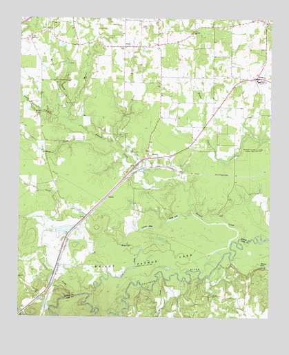
Bassett, TX USGS Topographic Map
Click on map above to begin viewing in our Map Viewer.

This topographic map contains these locations and features:
Feature Name Type Latitude Longitude GNIS ID View Map
BassettPopulated PlaceN33.3168°W94.5610°1372411View Map
Bassett CreekStreamN33.2829°W94.5133°1372412View Map
Blue LakeLakeN33.2668°W94.5759°1372640View Map
Blythe CreekStreamN33.3335°W94.6027°1372649View Map
Bowie County Constable's Office Precinct 4BuildingN33.3499°W94.5053°2751404View Map
Bowie High SchoolSchoolN33.3490°W94.5063°1372691View Map
Calver LakeLakeN33.2877°W94.5609°1372879View Map
Calvert CreekStreamN33.2587°W94.5980°1372880View Map
Cedar Grove CemeteryCemeteryN33.3704°W94.6099°1373021View Map
Crow CreekStreamN33.2662°W94.5552°1373294View Map
Dalby Springs-Simms DivisionCivilN33.3450°W94.5976°1938668View Map
DardenPopulated PlaceN33.3001°W94.5810°1380838View Map
Eds CreekStreamN33.3248°W94.5874°1373591View Map
Kruse BranchStreamN33.3201°W94.5749°1374406View Map
Mill CreekStreamN33.2510°W94.5744°1374953View Map
Morris CemeteryCemeteryN33.3632°W94.5741°1375007View Map
Mossy LakeLakeN33.2807°W94.5724°1375017View Map
Mudd LakeLakeN33.2915°W94.5482°1375051View Map
Powell CemeteryCemeteryN33.3421°W94.6055°1375555View Map
Sand Hill ChurchChurchN33.3690°W94.5394°1375990View Map
Schyler CreekStreamN33.3204°W94.5280°1967732View Map
SiloamPopulated PlaceN33.3635°W94.5733°1380921View Map
SimmsPopulated PlaceN33.3504°W94.5074°1380923View Map
Simms District Volunteer Fire DepartmentBuildingN33.3646°W94.5573°2655644View Map
Simms District Volunteer Fire Department Station 2BuildingN33.3480°W94.5071°2655652View Map
Simms Post OfficePost OfficeN33.3496°W94.5091°2731466View Map
Ward CreekStreamN33.3379°W94.6016°1376637View Map
Ward Creek ChurchChurchN33.3671°W94.6197°1376638View Map
Weaver CreekStreamN33.3335°W94.6027°1376668View Map

Note: Coordinates in the location and feature list above are referenced to NAD83 datum.


Copyright (C) 2008-2025 Ryan Niemi / Sunset Dynamics ... All Rights Reserved