TopoQuest Logo
Do you find TopoQuest useful?
Help keep TopoQuest running and adding new maps/features by donating!
Bitcoin:  19c7KJd3qBynnjoSw5npx9KScwjBe4ifkT
Litecoin:  LXs6TkuXGGXo1vDsWCkWVdjQX94eUKd6ui
Home View Maps Find Maps Find Places Resources & Links


Bassett Peak, Arizona Topographic Map

USGS Map Title: Bassett Peak, AZ
USGS Map MRC: 32110E3
DRG (GeoTIFF) Download: o32110e3.tif


Neighboring USGS Topographic Map Quads:


  Rhodes Peak, AZ  
32110F4
 

  Kennedy Peak, AZ  
32110F3
 

  Eureka Ranch, AZ  
32110F2
 

  Kielberg Canyon, AZ  
32110E4
 

  Bassett Peak, AZ  
32110E3
 

  Harrison Canyon, AZ  
32110E2
 

  Redington, AZ  
32110D4
 

  Cherry Spring Peak, AZ  
32110D3
 

  The Mesas, AZ  
32110D2


Map MRC Location:

N33°
W111°
N33°
W110°
H8 H7 H6 H5 H4 H3 H2 H1
G8 G7 G6 G5 G4 G3 G2 G1
F8 F7 F6 F5 F4 F3 F2 F1
E8 E7 E6 E5 E4 E3 E2 E1
D8 D7 D6 D5 D4 D3 D2 D1
C8 C7 C6 C5 C4 C3 C2 C1
B8 B7 B6 B5 B4 B3 B2 B1
A8 A7 A6 A5 A4 A3 A2 A1
N32°
W111°
N32°
W110°

Bassett Peak, AZ USGS 1:24K Topographic Map Preview:
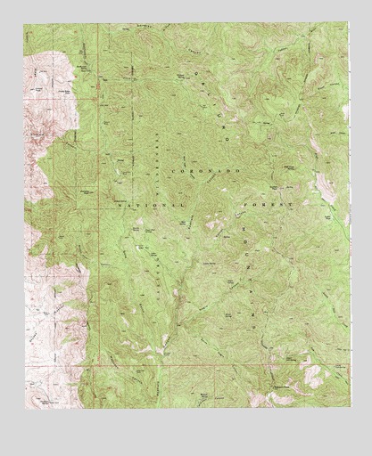
Bassett Peak, AZ USGS Topographic Map
Click on map above to begin viewing in our Map Viewer.

This topographic map contains these locations and features:
Feature Name Type Latitude Longitude GNIS ID View Map
Alamo SpringSpringN32.5468°W110.3068°555View Map
Bassett PeakSummitN32.5062°W110.2798°1061View Map
Black Eagle CanyonValleyN32.5728°W110.3073°1510View Map
Broken Horn CanyonValleyN32.5465°W110.3370°1977View Map
Browning Cement Dam TankReservoirN32.5120°W110.3329°22427View Map
Browning DamDamN32.5120°W110.3323°2009View Map
Cedar FlatFlatN32.5520°W110.3315°2622View Map
Cedar SpringSpringN32.5501°W110.3270°2645View Map
Cottonwood Mountain Trail Sixty sixTrailN32.6095°W110.3020°22462View Map
East Divide Two hundred eighty seven TrailTrailN32.5187°W110.2801°22481View Map
Echols SpringSpringN32.5673°W110.3350°4347View Map
Galiuro WildernessReserveN32.5849°W110.3317°2035127View Map
Gold GulchValleyN32.5178°W110.3229°5102View Map
Grassy PeakSummitN32.6037°W110.3706°5302View Map
Grassy Ridge SpringSpringN32.6029°W110.3568°5304View Map
Grassy Ridge TankReservoirN32.6028°W110.3571°2557791View Map
High Creek SpringSpringN32.5772°W110.2717°5791View Map
Holdout SpringSpringN32.6073°W110.3133°5877View Map
Hooker CabinLocaleN32.5176°W110.3215°5918View Map
Hooker TankReservoirN32.5615°W110.2575°5925View Map
Kielberg PeakSummitN32.5703°W110.3498°6690View Map
Kielberg TankReservoirN32.5828°W110.3426°22542View Map
Knothe SpringSpringN32.5584°W110.3334°6743View Map
Long Tom MineMineN32.5765°W110.3373°7352View Map
Lower Ash SpringSpringN32.5132°W110.2565°7445View Map
Maple SpringSpringN32.5301°W110.2984°7678View Map
Mitchell SpringSpringN32.5034°W110.3046°8133View Map
Mott SpringSpringN32.5607°W110.3130°8321View Map
Muleshoe CanyonValleyN32.5015°W110.3248°8429View Map
Negro CanyonValleyN32.5270°W110.3165°8562View Map
Negro SpringSpringN32.5409°W110.2976°8564View Map
North Fork Douglas CanyonValleyN32.6217°W110.3223°8725View Map
Powers MineMineN32.5928°W110.3445°9738View Map
Rattlesnake SpringSpringN32.6101°W110.3503°9979View Map
Sol Rhea SpringSpringN32.5020°W110.3660°11528View Map
South Negro CanyonValleyN32.5276°W110.3134°11622View Map
Sunset CanyonValleyN32.5520°W110.3076°11984View Map
Sunset PeakSummitN32.5712°W110.2776°11991View Map
Upper Ash SpringSpringN32.5164°W110.2753°13061View Map
Upper Flat SpringSpringN32.5577°W110.3290°13086View Map
West Divide Two Hundred Eighty-nineTrailN32.5092°W110.3234°22703View Map

Note: Coordinates in the location and feature list above are referenced to NAD83 datum.


Copyright (C) 2008-2025 Ryan Niemi / Sunset Dynamics ... All Rights Reserved