TopoQuest Logo
Do you find TopoQuest useful?
Help keep TopoQuest running and adding new maps/features by donating!
Bitcoin:  19c7KJd3qBynnjoSw5npx9KScwjBe4ifkT
Litecoin:  LXs6TkuXGGXo1vDsWCkWVdjQX94eUKd6ui
Home View Maps Find Maps Find Places Resources & Links


Bassey Creek, Oregon Topographic Map

USGS Map Title: Bassey Creek, OR
USGS Map MRC: 45118D5
DRG (GeoTIFF) Download: o45118d5.tif


Neighboring USGS Topographic Map Quads:


  Table Rock, OR  
45118E6
 

  Cabbage Hill, OR  
45118E5
 

  Meacham, OR  
45118E4
 

  Sevenmile Creek, OR  
45118D6
 

  Bassey Creek, OR  
45118D5
 

  Meacham Lake, OR  
45118D4
 

  Tamarack Gulch, OR  
45118C6
 

  Bally Mountain, OR  
45118C5
 

  McIntyre Creek, OR  
45118C4


Map MRC Location:

N46°
W119°
N46°
W118°
H8 H7 H6 H5 H4 H3 H2 H1
G8 G7 G6 G5 G4 G3 G2 G1
F8 F7 F6 F5 F4 F3 F2 F1
E8 E7 E6 E5 E4 E3 E2 E1
D8 D7 D6 D5 D4 D3 D2 D1
C8 C7 C6 C5 C4 C3 C2 C1
B8 B7 B6 B5 B4 B3 B2 B1
A8 A7 A6 A5 A4 A3 A2 A1
N45°
W119°
N45°
W118°

Bassey Creek, OR USGS 1:24K Topographic Map Preview:
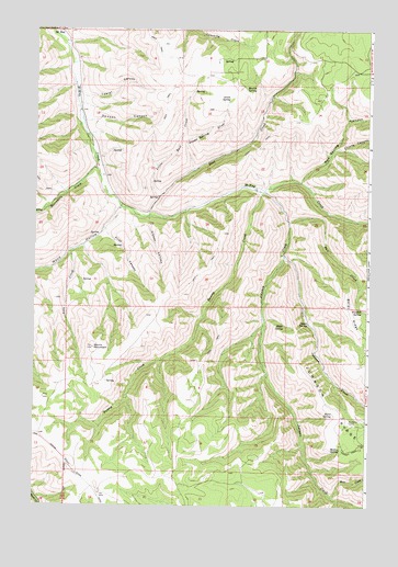
Bassey Creek, OR USGS Topographic Map
Click on map above to begin viewing in our Map Viewer.

This topographic map contains these locations and features:
Feature Name Type Latitude Longitude GNIS ID View Map
Baldy RidgeRidgeN45.4226°W118.5052°1117202View Map
Bassey CreekStreamN45.4585°W118.5425°1117305View Map
Bear CreekStreamN45.3776°W118.5133°1137694View Map
Beers SpringSpringN45.3985°W118.5141°1117481View Map
Buckhorn CampLocaleN45.3976°W118.5069°1118230View Map
Coyote CanyonValleyN45.4687°W118.5136°1140316View Map
Denson CanyonValleyN45.4760°W118.6072°1119864View Map
Elder SpringSpringN45.4225°W118.5315°1120429View Map
First CanyonValleyN45.4476°W118.5991°1120742View Map
Gibson CanyonValleyN45.4510°W118.5819°1121121View Map
Green SpringSpringN45.4820°W118.5530°1121401View Map
Green Spring DrawValleyN45.4629°W118.5652°1121402View Map
Johnson CreekStreamN45.4576°W118.5391°1144348View Map
Johnson RidgeRidgeN45.3985°W118.5102°1144364View Map
Lake CreekStreamN45.4418°W118.6102°1122892View Map
Lawler CanyonValleyN45.4857°W118.6105°1123000View Map
Little Johnson CreekStreamN45.4407°W118.5316°1145190View Map
Little Rail CreekStreamN45.4554°W118.5786°1123256View Map
Marlin SpringSpringN45.4846°W118.5470°1123777View Map
Mathis SpringSpringN45.3901°W118.5102°1123838View Map
McKayPopulated PlaceN45.4996°W118.6158°1136526View Map
McKay Post Office (historical)Post OfficeN45.4996°W118.6158°1165606View Map
Rail CreekStreamN45.4510°W118.5822°1125776View Map
Red Spring CanyonValleyN45.4601°W118.5258°1148337View Map
Salt CreekStreamN45.4499°W118.5300°1149000View Map
Sevenmile CreekStreamN45.4637°W118.6022°1126763View Map
Spino SpringSpringN45.4230°W118.5225°1127391View Map
Storm MountainSummitN45.4165°W118.6025°1127638View Map
Watkins SpringSpringN45.4262°W118.5025°1128734View Map
Wood HollowValleyN45.4535°W118.5930°1129299View Map

Note: Coordinates in the location and feature list above are referenced to NAD83 datum.


Copyright (C) 2008-2024 Ryan Niemi / Sunset Dynamics ... All Rights Reserved