TopoQuest Logo
Do you find TopoQuest useful?
Help keep TopoQuest running and adding new maps/features by donating!
Bitcoin:  19c7KJd3qBynnjoSw5npx9KScwjBe4ifkT
Litecoin:  LXs6TkuXGGXo1vDsWCkWVdjQX94eUKd6ui
Home View Maps Find Maps Find Places Resources & Links


Meacham Lake, Oregon Topographic Map

USGS Map Title: Meacham Lake, OR
USGS Map MRC: 45118D4
DRG (GeoTIFF) Download: o45118d4.tif


Neighboring USGS Topographic Map Quads:


  Cabbage Hill, OR  
45118E5
 

  Meacham, OR  
45118E4
 

  Duncan, OR  
45118E3
 

  Bassey Creek, OR  
45118D5
 

  Meacham Lake, OR  
45118D4
 

  Huron, OR  
45118D3
 

  Bally Mountain, OR  
45118C5
 

  McIntyre Creek, OR  
45118C4
 

  Kamela SE, OR  
45118C3


Map MRC Location:

N46°
W119°
N46°
W118°
H8 H7 H6 H5 H4 H3 H2 H1
G8 G7 G6 G5 G4 G3 G2 G1
F8 F7 F6 F5 F4 F3 F2 F1
E8 E7 E6 E5 E4 E3 E2 E1
D8 D7 D6 D5 D4 D3 D2 D1
C8 C7 C6 C5 C4 C3 C2 C1
B8 B7 B6 B5 B4 B3 B2 B1
A8 A7 A6 A5 A4 A3 A2 A1
N45°
W119°
N45°
W118°

Meacham Lake, OR USGS 1:24K Topographic Map Preview:
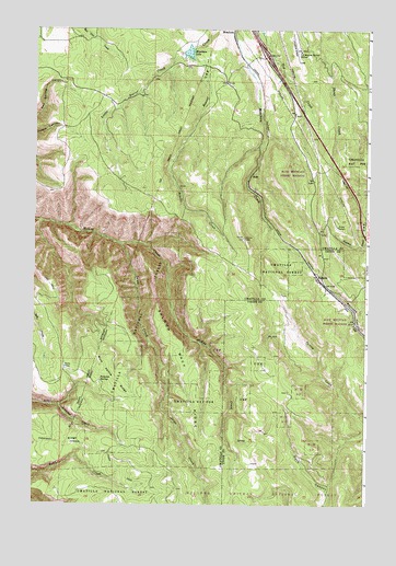
Meacham Lake, OR USGS Topographic Map
Click on map above to begin viewing in our Map Viewer.

This topographic map contains these locations and features:
Feature Name Type Latitude Longitude GNIS ID View Map
Blue Kettle RidgeRidgeN45.4115°W118.4747°1138309View Map
Blue Mountain Forest State Scenic CorridorParkN45.4582°W118.3969°1162292View Map
Folsoms SpringSpringN45.4072°W118.4752°1142290View Map
Forks TankReservoirN45.4111°W118.4881°1142310View Map
KamelaLocaleN45.4343°W118.3936°1144481View Map
Kamela Guard Station (historical)LocaleN45.4360°W118.3955°1167167View Map
Kamela Post Office (historical)Post OfficeN45.4343°W118.3936°1165467View Map
Little Beaver CreekStreamN45.4937°W118.4458°1145094View Map
Meacham LakeLakeN45.4939°W118.4429°1146040View Map
Nibley (historical)LocaleN45.4901°W118.4219°1162293View Map
Nordeen (historical)LocaleN45.4232°W118.3802°1167799View Map
RossLocaleN45.4615°W118.4197°1167720View Map
Salmon Back RidgeRidgeN45.4085°W118.4425°1148964View Map
Snipe CreekStreamN45.4435°W118.4677°1149798View Map
Snipe SpringSpringN45.3769°W118.4378°1638054View Map
Tip Top Lookout TowerTowerN45.4454°W118.4219°1116525View Map
United States Weather Bureau StationBuildingN45.4941°W118.4015°1163784View Map

Note: Coordinates in the location and feature list above are referenced to NAD83 datum.


Copyright (C) 2008-2024 Ryan Niemi / Sunset Dynamics ... All Rights Reserved