TopoQuest Logo
Do you find TopoQuest useful?
Help keep TopoQuest running and adding new maps/features by donating!
Bitcoin:  19c7KJd3qBynnjoSw5npx9KScwjBe4ifkT
Litecoin:  LXs6TkuXGGXo1vDsWCkWVdjQX94eUKd6ui
Home View Maps Find Maps Find Places Resources & Links


Linn NW, Texas Topographic Map

USGS Map Title: Linn NW, TX
USGS Map MRC: 26098F2
DRG (GeoTIFF) Download: o26098f2.tif


Neighboring USGS Topographic Map Quads:


  Santa Elena SE, TX  
26098G3
 

  Hartland, TX  
26098G2
 

  Callo Padrones, TX  
26098G1
 

  La Reforma, TX  
26098F3
 

  Linn NW, TX  
26098F2
 

  Linn NE, TX  
26098F1
 

  McAllen Ranch, TX  
26098E3
 

  Linn Siding, TX  
26098E2
 

  Linn, TX  
26098E1


Map MRC Location:

N27°
W99°
N27°
W98°
H8 H7 H6 H5 H4 H3 H2 H1
G8 G7 G6 G5 G4 G3 G2 G1
F8 F7 F6 F5 F4 F3 F2 F1
E8 E7 E6 E5 E4 E3 E2 E1
D8 D7 D6 D5 D4 D3 D2 D1
C8 C7 C6 C5 C4 C3 C2 C1
B8 B7 B6 B5 B4 B3 B2 B1
A8 A7 A6 A5 A4 A3 A2 A1
N26°
W99°
N26°
W98°

Linn NW, TX USGS 1:24K Topographic Map Preview:
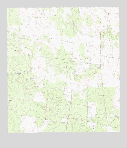
Linn NW, TX USGS Topographic Map
Click on map above to begin viewing in our Map Viewer.

This topographic map contains these locations and features:
Feature Name Type Latitude Longitude GNIS ID View Map
Agua Dulce WindmillLocaleN26.7187°W98.2167°1329259View Map
Beaurline Gas FieldOilfieldN26.6578°W98.1942°1330269View Map
Caliche WindmillLocaleN26.6356°W98.1864°1331886View Map
Comanche WindmillLocaleN26.6659°W98.1700°1333179View Map
Copita WellWellN26.7189°W98.1283°1333323View Map
Devisadores WindmillLocaleN26.7195°W98.2306°1334309View Map
El Neuvo WindmillLocaleN26.6353°W98.1511°1335225View Map
El Rancho Nuevo WindmillLocaleN26.6734°W98.1445°1335252View Map
El Rastrillo WindmillLocaleN26.6617°W98.1436°1335255View Map
El Rodeo WindmillLocaleN26.6395°W98.2075°1335263View Map
Hermanas WindmillLocaleN26.6628°W98.1881°1337640View Map
Hermanos WindmillLocaleN26.6901°W98.1389°1337646View Map
Leda WindmillLocaleN26.6364°W98.1745°1339767View Map
Los Indios Gas FieldOilfieldN26.6295°W98.1475°1340603View Map
Los Indios RanchLocaleN26.6406°W98.1275°1340605View Map
Los Indios WindmillLocaleN26.6298°W98.1333°1340609View Map
Muertos WindmillLocaleN26.7126°W98.1653°1342229View Map
Mujeres WindmillLocaleN26.7076°W98.1931°1342232View Map
Noche Buena WindmillLocaleN26.6856°W98.2064°1342635View Map
Number Two WindmillLocaleN26.7401°W98.2172°1342924View Map
Pamorana WindmillLocaleN26.6653°W98.2111°1343508View Map
Potrero WindmillLocaleN26.7212°W98.1578°1344433View Map
San Juan PastureFlatN26.7189°W98.1975°1346402View Map
Santa Fe RanchLocaleN26.7442°W98.1367°1346645View Map
Tres Lagunas WindmillLocaleN26.7337°W98.1797°1348753View Map

Note: Coordinates in the location and feature list above are referenced to NAD83 datum.


Copyright (C) 2008-2025 Ryan Niemi / Sunset Dynamics ... All Rights Reserved