TopoQuest Logo
Do you find TopoQuest useful?
Help keep TopoQuest running and adding new maps/features by donating!
Bitcoin:  19c7KJd3qBynnjoSw5npx9KScwjBe4ifkT
Litecoin:  LXs6TkuXGGXo1vDsWCkWVdjQX94eUKd6ui
Home View Maps Find Maps Find Places Resources & Links


Callo Padrones, Texas Topographic Map

USGS Map Title: Callo Padrones, TX
USGS Map MRC: 26098G1
DRG (GeoTIFF) Download: o26098g1.tif


Neighboring USGS Topographic Map Quads:


  Encino, TX  
26098H2
 

  San Tomas Camp, TX  
26098H1
 

  Pita Camp, TX  
26097H8
 

  Hartland, TX  
26098G2
 

  Callo Padrones, TX  
26098G1
 

  Julian, TX  
26097G8
 

  Linn NW, TX  
26098F2
 

  Linn NE, TX  
26098F1
 

  Andrea Ranch, TX  
26097F8


Map MRC Location:

N27°
W99°
N27°
W98°
H8 H7 H6 H5 H4 H3 H2 H1
G8 G7 G6 G5 G4 G3 G2 G1
F8 F7 F6 F5 F4 F3 F2 F1
E8 E7 E6 E5 E4 E3 E2 E1
D8 D7 D6 D5 D4 D3 D2 D1
C8 C7 C6 C5 C4 C3 C2 C1
B8 B7 B6 B5 B4 B3 B2 B1
A8 A7 A6 A5 A4 A3 A2 A1
N26°
W99°
N26°
W98°

Callo Padrones, TX USGS 1:24K Topographic Map Preview:
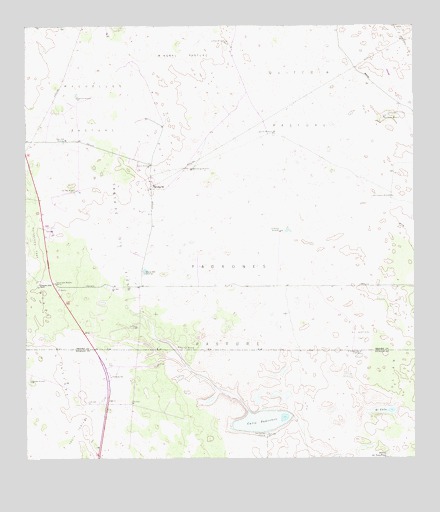
Callo Padrones, TX USGS Topographic Map
Click on map above to begin viewing in our Map Viewer.

This topographic map contains these locations and features:
Feature Name Type Latitude Longitude GNIS ID View Map
Alameda WindmillLocaleN26.7823°W98.0758°1329294View Map
Callo PadronesLakeN26.7610°W98.0497°1331906View Map
Catanes WindmillLocaleN26.8351°W98.0856°1332324View Map
Chorro WellWellN26.8420°W98.1128°1332794View Map
Cuatro Esquinas WindmillLocaleN26.8259°W98.0078°1333774View Map
Dos Pilas WindmillLocaleN26.8278°W98.1092°1334511View Map
El Aceitero TrapFlatN26.7856°W98.0181°1335150View Map
El Aceitero Well FiftyoneWellN26.7806°W98.0178°1335151View Map
El CalloLakeN26.7640°W98.0104°1335168View Map
El Naranjo WindmillsLocaleN26.8159°W98.0433°1335221View Map
Huisaches Altos RanchLocaleN26.8009°W98.1208°1338264View Map
Huisaches TrapFlatN26.8128°W98.1222°1338265View Map
Jassos Gate WindmillLocaleN26.8012°W98.1158°1338653View Map
Julian PastureFlatN26.7789°W98.0039°1338921View Map
La Posita WindmillLocaleN26.8706°W98.0608°1339383View Map
Laguna Del Toro PrietoLakeN26.7511°W98.0089°1339456View Map
Lagunitas WindmillLocaleN26.8442°W98.0456°1339475View Map
Los Cuates WindmillLocaleN26.8487°W98.0097°1340590View Map
Los Cuervos WindmillLocaleN26.8339°W98.0714°1340591View Map
Maguelles PastureFlatN26.8512°W98.1067°1340855View Map
Maguelles WindmillLocaleN26.8545°W98.1089°1340856View Map
Padrones PastureFlatN26.7870°W98.0608°1343415View Map
Padrones WellWellN26.7576°W98.0483°1343416View Map
Quiteria PastureFlatN26.8731°W98.0283°1344674View Map
Santa Fe Oil FieldOilfieldN26.8167°W98.0956°1346643View Map
Santa Fe PastureFlatN26.7567°W98.1231°1346644View Map
Sauceda WindmillLocaleN26.7726°W98.1236°1346717View Map
South Santa Fe Oil FieldOilfieldN26.7620°W98.1069°1347517View Map
Viboras WellWellN26.8039°W98.0869°1349255View Map

Note: Coordinates in the location and feature list above are referenced to NAD83 datum.


Copyright (C) 2008-2024 Ryan Niemi / Sunset Dynamics ... All Rights Reserved