TopoQuest Logo
Do you find TopoQuest useful?
Help keep TopoQuest running and adding new maps/features by donating!
Bitcoin:  19c7KJd3qBynnjoSw5npx9KScwjBe4ifkT
Litecoin:  LXs6TkuXGGXo1vDsWCkWVdjQX94eUKd6ui
Home View Maps Find Maps Find Places Resources & Links


Little Falls West, Minnesota Topographic Map

USGS Map Title: Little Falls West, MN
USGS Map MRC: 45094H4
DRG (GeoTIFF) Download: o45094h4.tif


Neighboring USGS Topographic Map Quads:


  Randall West, MN  
46094A5
 

  Randall East, MN  
46094A4
 

  Belle Prairie, MN  
46094A3
 

  Flensburg, MN  
45094H5
 

  Little Falls West, MN  
45094H4
 

  Little Falls East, MN  
45094H3
 

  Upsala, MN  
45094G5
 

  Bowlus, MN  
45094G4
 

  Royalton, MN  
45094G3


Map MRC Location:

N46°
W95°
N46°
W94°
H8 H7 H6 H5 H4 H3 H2 H1
G8 G7 G6 G5 G4 G3 G2 G1
F8 F7 F6 F5 F4 F3 F2 F1
E8 E7 E6 E5 E4 E3 E2 E1
D8 D7 D6 D5 D4 D3 D2 D1
C8 C7 C6 C5 C4 C3 C2 C1
B8 B7 B6 B5 B4 B3 B2 B1
A8 A7 A6 A5 A4 A3 A2 A1
N45°
W95°
N45°
W94°

Little Falls West, MN USGS 1:24K Topographic Map Preview:
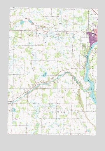
Little Falls West, MN USGS Topographic Map
Click on map above to begin viewing in our Map Viewer.

This topographic map contains these locations and features:
Feature Name Type Latitude Longitude GNIS ID View Map
Charles A Lindbergh HouseBuildingN45.9600°W94.3861°2068687View Map
Charles A Lindbergh State ParkParkN45.9589°W94.3953°641112View Map
Charles A Weyerhaeuser MuseumBuildingN45.9542°W94.3900°2068686View Map
City of SobieskiCivilN45.9230°W94.4818°2395905View Map
Ed Cash CemeteryCemeteryN45.8833°W94.4805°2068615View Map
Jaycee ParkParkN45.9744°W94.3817°2068807View Map
Kay Burial GroundCemeteryN45.9250°W94.4194°2068616View Map
Kiwanis Ball FieldsParkN45.9736°W94.3822°2068808View Map
Lincoln Elementary SchoolSchoolN45.9746°W94.3784°646699View Map
Lindbergh House Historical MarkerParkN45.9603°W94.3867°2068746View Map
Little Falls Country ClubLocaleN45.9611°W94.3764°2068689View Map
Little Falls Fire Department Station 2BuildingN45.9762°W94.3779°2666682View Map
Mud LakeLakeN45.9341°W94.4491°648269View Map
Our Lady of Lourdes CemeteryCemeteryN45.9766°W94.4206°649067View Map
Pike CreekStreamN45.9530°W94.3914°649408View Map
Pine Grove ParkParkN45.9791°W94.3869°649458View Map
Pine Grove ZooLocaleN45.9792°W94.3847°2068695View Map
Saint Stanislaus Church CemeteryCemeteryN45.9205°W94.4659°2068640View Map
Shayes IslandIslandN45.9427°W94.3875°651929View Map
SobieskiPopulated PlaceN45.9244°W94.4592°652216View Map
Star LakeLakeN45.8985°W94.4915°652554View Map
Swan RiverStreamN45.9194°W94.3856°652909View Map
Township of Pike CreekCivilN45.9789°W94.4494°665296View Map
Township of Swan RiverCivilN45.8848°W94.4360°665749View Map
Twin LakesLakeN45.9851°W94.4825°653441View Map
Twin Lakes CemeteryCemeteryN45.9861°W94.4972°2068624View Map

Note: Coordinates in the location and feature list above are referenced to NAD83 datum.


Copyright (C) 2008-2025 Ryan Niemi / Sunset Dynamics ... All Rights Reserved