TopoQuest Logo
Do you find TopoQuest useful?
Help keep TopoQuest running and adding new maps/features by donating!
Bitcoin:  19c7KJd3qBynnjoSw5npx9KScwjBe4ifkT
Litecoin:  LXs6TkuXGGXo1vDsWCkWVdjQX94eUKd6ui
Home View Maps Find Maps Find Places Resources & Links


Upsala, Minnesota Topographic Map

USGS Map Title: Upsala, MN
USGS Map MRC: 45094G5
DRG (GeoTIFF) Download: o45094g5.tif


Neighboring USGS Topographic Map Quads:


  Swanville, MN  
45094H6
 

  Flensburg, MN  
45094H5
 

  Little Falls West, MN  
45094H4
 

  Burtrum, MN  
45094G6
 

  Upsala, MN  
45094G5
 

  Bowlus, MN  
45094G4
 

  Freeport, MN  
45094F6
 

  Albany, MN  
45094F5
 

  Holdingford, MN  
45094F4


Map MRC Location:

N46°
W95°
N46°
W94°
H8 H7 H6 H5 H4 H3 H2 H1
G8 G7 G6 G5 G4 G3 G2 G1
F8 F7 F6 F5 F4 F3 F2 F1
E8 E7 E6 E5 E4 E3 E2 E1
D8 D7 D6 D5 D4 D3 D2 D1
C8 C7 C6 C5 C4 C3 C2 C1
B8 B7 B6 B5 B4 B3 B2 B1
A8 A7 A6 A5 A4 A3 A2 A1
N45°
W95°
N45°
W94°

Upsala, MN USGS 1:24K Topographic Map Preview:
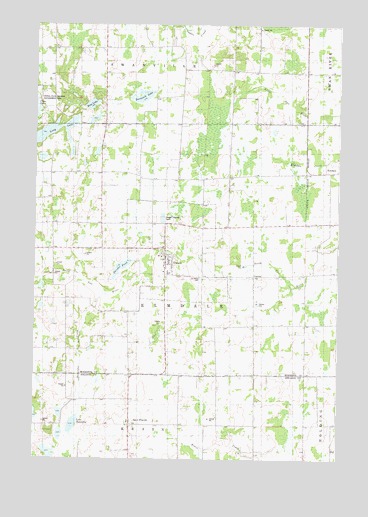
Upsala, MN USGS Topographic Map
Click on map above to begin viewing in our Map Viewer.

This topographic map contains these locations and features:
Feature Name Type Latitude Longitude GNIS ID View Map
Bass LakeLakeN45.8520°W94.6024°639677View Map
Beautiful CreekStreamN45.7977°W94.5961°639802View Map
City of UpsalaCivilN45.8100°W94.5673°2397095View Map
Community Covenant ChurchChurchN45.8075°W94.5714°2068728View Map
Covenant Church CemeteryCemeteryN45.8079°W94.5728°2068639View Map
Dunder PondLakeN45.8048°W94.5900°642980View Map
East Swanville CemeteryCemeteryN45.8688°W94.5822°2068614View Map
Gethsemane Lutheran ChurchChurchN45.8042°W94.5714°2068726View Map
Gethsemane Lutheran Church CemeteryCemeteryN45.8040°W94.5721°2068638View Map
Great River Regional LibraryBuildingN45.8131°W94.5708°2068722View Map
Lake BeautifulLakeN45.7598°W94.6090°639803View Map
Long LakeLakeN45.8440°W94.6190°647114View Map
Mount Olive Lutheran ChurchChurchN45.8108°W94.5711°2068725View Map
Saint FrancisPopulated PlaceN45.7600°W94.5850°650580View Map
Saint Francis CemeteryCemeteryN45.7601°W94.5835°2068124View Map
Saint Francis ChurchChurchN45.7606°W94.5858°2068123View Map
Saint Mary's ParishChurchN45.8056°W94.5714°2068727View Map
Saint Marys CemeteryCemeteryN45.8021°W94.5569°650865View Map
Tamarack LakeLakeN45.8548°W94.5810°653003View Map
Taylor CreekStreamN45.8750°W94.5561°653045View Map
Township of ElmdaleCivilN45.8084°W94.5505°664081View Map
UpsalaPopulated PlaceN45.8108°W94.5714°653575View Map
Upsala City HallBuildingN45.8086°W94.5708°2068724View Map
Upsala Fire DepartmentBuildingN45.8086°W94.5724°2068723View Map
Upsala High SchoolSchoolN45.8036°W94.5694°2068729View Map
Upsala Memorial CemeteryCemeteryN45.7891°W94.5716°653576View Map
Upsala Post OfficePost OfficeN45.8108°W94.5711°2068721View Map
Word of Life Free Lutheran ChurchChurchN45.8108°W94.5711°2068810View Map

Note: Coordinates in the location and feature list above are referenced to NAD83 datum.


Copyright (C) 2008-2025 Ryan Niemi / Sunset Dynamics ... All Rights Reserved