TopoQuest Logo
Do you find TopoQuest useful?
Help keep TopoQuest running and adding new maps/features by donating!
Bitcoin:  19c7KJd3qBynnjoSw5npx9KScwjBe4ifkT
Litecoin:  LXs6TkuXGGXo1vDsWCkWVdjQX94eUKd6ui
Home View Maps Find Maps Find Places Resources & Links


Little Park Lake, Arizona Topographic Map

USGS Map Title: Little Park Lake, AZ
USGS Map MRC: 36112C1
DRG (GeoTIFF) Download: o36112c1.tif


Neighboring USGS Topographic Map Quads:


  De Motte Park, AZ  
36112D2
 

  Dog Point, AZ  
36112D1
 

  Buffalo Ranch, AZ  
36111D8
 

  Kanabownits Spring, AZ  
36112C2
 

  Little Park Lake, AZ  
36112C1
 

  Point Imperial, AZ  
36111C8
 

  Shiva Temple, AZ  
36112B2
 

  Bright Angel Point, AZ  
36112B1
 

  Walhalla Plateau, AZ  
36111B8


Map MRC Location:

N37°
W113°
N37°
W112°
H8 H7 H6 H5 H4 H3 H2 H1
G8 G7 G6 G5 G4 G3 G2 G1
F8 F7 F6 F5 F4 F3 F2 F1
E8 E7 E6 E5 E4 E3 E2 E1
D8 D7 D6 D5 D4 D3 D2 D1
C8 C7 C6 C5 C4 C3 C2 C1
B8 B7 B6 B5 B4 B3 B2 B1
A8 A7 A6 A5 A4 A3 A2 A1
N36°
W113°
N36°
W112°

Little Park Lake, AZ USGS 1:24K Topographic Map Preview:
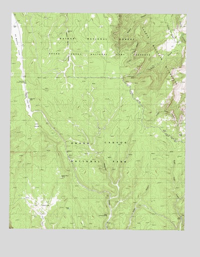
Little Park Lake, AZ USGS Topographic Map
Click on map above to begin viewing in our Map Viewer.

This topographic map contains these locations and features:
Feature Name Type Latitude Longitude GNIS ID View Map
Basin SpringSpringN36.2664°W112.1079°1044View Map
Burn TankReservoirN36.3073°W112.0146°44708View Map
Hades LakeLakeN36.2621°W112.0826°5500View Map
Johns TankReservoirN36.3408°W112.0494°2091877View Map
Lindbergh HillSummitN36.2970°W112.0829°7036View Map
Little Park LakeLakeN36.3247°W112.1122°7153View Map
Lower Little ParkFlatN36.3075°W112.1099°7486View Map
Mason WellWellN36.3669°W112.1243°7766View Map
Neal SpringSpringN36.2569°W112.0024°8551View Map
North Rim Entrance StationLocaleN36.3347°W112.1160°8758View Map
North Rim Lookout TowerTowerN36.3305°W112.1016°8759View Map
Robbers Roost SpringSpringN36.2805°W112.0888°10357View Map
Sourdough WellWellN36.3650°W112.0860°11566View Map
South Canyon SpringSpringN36.3382°W112.0375°11580View Map
Spare TankReservoirN36.3050°W112.0027°44707View Map
The BasinBasinN36.2697°W112.1085°12284View Map
Upper Little ParkFlatN36.3264°W112.1152°13102View Map
Upper Thompson SpringSpringN36.2594°W112.0560°13128View Map
Vaughn TankReservoirN36.3306°W112.0217°2091876View Map

Note: Coordinates in the location and feature list above are referenced to NAD83 datum.


Copyright (C) 2008-2024 Ryan Niemi / Sunset Dynamics ... All Rights Reserved