TopoQuest Logo
Do you find TopoQuest useful?
Help keep TopoQuest running and adding new maps/features by donating!
Bitcoin:  19c7KJd3qBynnjoSw5npx9KScwjBe4ifkT
Litecoin:  LXs6TkuXGGXo1vDsWCkWVdjQX94eUKd6ui
Home View Maps Find Maps Find Places Resources & Links


Locust Grove, Oklahoma Topographic Map

USGS Map Title: Locust Grove, OK
USGS Map MRC: 36095B2
DRG (GeoTIFF) Download: o36095b2.tif


Neighboring USGS Topographic Map Quads:


  Pryor, OK  
36095C3
 

  Salina, OK  
36095C2
 

  Salina SE, OK  
36095C1
 

  Chouteau, OK  
36095B3
 

  Locust Grove, OK  
36095B2
 

  Rose, OK  
36095B1
 

  Rocky Point, OK  
36095A3
 

  Cedar Crest, OK  
36095A2
 

  Peggs, OK  
36095A1


Map MRC Location:

N37°
W96°
N37°
W95°
H8 H7 H6 H5 H4 H3 H2 H1
G8 G7 G6 G5 G4 G3 G2 G1
F8 F7 F6 F5 F4 F3 F2 F1
E8 E7 E6 E5 E4 E3 E2 E1
D8 D7 D6 D5 D4 D3 D2 D1
C8 C7 C6 C5 C4 C3 C2 C1
B8 B7 B6 B5 B4 B3 B2 B1
A8 A7 A6 A5 A4 A3 A2 A1
N36°
W96°
N36°
W95°

Locust Grove, OK USGS 1:24K Topographic Map Preview:
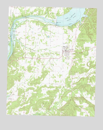
Locust Grove, OK USGS Topographic Map
Click on map above to begin viewing in our Map Viewer.

This topographic map contains these locations and features:
Feature Name Type Latitude Longitude GNIS ID View Map
BallouCivilN36.1397°W95.1984°2631070View Map
BallouPopulated PlaceN36.1459°W95.1902°1853455View Map
Ballou BranchStreamN36.1351°W95.1822°1089832View Map
Ballou CemeteryCemeteryN36.1334°W95.1830°2712520View Map
Ballou Census Designated PlaceCensusN36.1421°W95.1998°2407794View Map
Ballou ChurchChurchN36.1329°W95.1830°1089833View Map
Bryan-Lindsey CemeteryCemeteryN36.2492°W95.1868°1090590View Map
Calvalier CemeteryCemeteryN36.1587°W95.1673°1090813View Map
Camp GarlandLocaleN36.1598°W95.1466°1090859View Map
Camp ScottLocaleN36.1601°W95.1630°1090877View Map
Cedar Crest ChurchChurchN36.1251°W95.2294°1091108View Map
Chapel BranchStreamN36.2373°W95.1994°1091207View Map
Cherokee Oklahoma Tribal Statistical AreaCensusN36.2223°W95.1843°2418810View Map
Crutchfield BranchStreamN36.2090°W95.2444°1091868View Map
Earl Ward ParkParkN36.2412°W95.2372°1092344View Map
Haner CemeteryCemeteryN36.1515°W95.2184°1093508View Map
Hogan CemeteryCemeteryN36.1990°W95.2160°1093827View Map
Iron PostCivilN36.1557°W95.1351°2631115View Map
Iron PostPopulated PlaceN36.1581°W95.1413°1853471View Map
Iron Post Census Designated PlaceCensusN36.1557°W95.1351°2408432View Map
Iron Post ChurchChurchN36.1612°W95.1258°1094120View Map
Lake HudsonReservoirN36.2334°W95.1864°1101905View Map
Locust GrovePopulated PlaceN36.2001°W95.1677°1094881View Map
Locust Grove DivisionCivilN36.1781°W95.1482°1937759View Map
Locust Grove Early Learning CenterSchoolN36.2038°W95.1659°2712855View Map
Locust Grove Fire DepartmentBuildingN36.1993°W95.1685°2656945View Map
Locust Grove High SchoolSchoolN36.2048°W95.1715°1793753View Map
Locust Grove Middle SchoolSchoolN36.2038°W95.1572°1793754View Map
Locust Grove Police DepartmentBuildingN36.1994°W95.1678°2757582View Map
Locust Grove Post OfficePost OfficeN36.2014°W95.1600°1814832View Map
Locust Grove Upper Elementary SchoolSchoolN36.2023°W95.1559°1803522View Map
Low Water Dam Public Use AreaParkN36.2209°W95.2439°1095029View Map
Maner ChurchChurchN36.1620°W95.1338°1095106View Map
Markham Ferry ChurchChurchN36.1965°W95.1600°1095147View Map
Markham Ferry DamDamN36.2334°W95.1819°1758013View Map
Mayes BridgeBridgeN36.2379°W95.2264°1095189View Map
Mayes Emergency Services Trust Authority Station 3BuildingN36.1981°W95.1493°2695867View Map
McLain CemeteryCemeteryN36.1569°W95.1570°1095262View Map
MurphyPopulated PlaceN36.1470°W95.2447°1100655View Map
MurphyCivilN36.1337°W95.2409°2631137View Map
Murphy Census Designated PlaceCensusN36.1337°W95.2409°2408891View Map
New Hogan ChurchChurchN36.1904°W95.2172°1095801View Map
Open Door ChurchChurchN36.1907°W95.2077°1096291View Map
Pryor Water IntakeLocaleN36.2245°W95.2461°1102062View Map
Robert S Kerr DamDamN36.2315°W95.1821°1097253View Map
Sams CornerCivilN36.1983°W95.2167°2631166View Map
Sams Corner Census Designated PlaceCensusN36.1983°W95.2167°2409246View Map
Snake CreekStreamN36.1395°W95.1789°1098153View Map
Town of Locust GroveCivilN36.1977°W95.1685°2412908View Map
Township of BryanCivilN36.1904°W95.1544°1824569View Map

Note: Coordinates in the location and feature list above are referenced to NAD83 datum.


Copyright (C) 2008-2024 Ryan Niemi / Sunset Dynamics ... All Rights Reserved