TopoQuest Logo
Do you find TopoQuest useful?
Help keep TopoQuest running and adding new maps/features by donating!
Bitcoin:  19c7KJd3qBynnjoSw5npx9KScwjBe4ifkT
Litecoin:  LXs6TkuXGGXo1vDsWCkWVdjQX94eUKd6ui
Home View Maps Find Maps Find Places Resources & Links


Cedar Crest, Oklahoma Topographic Map

USGS Map Title: Cedar Crest, OK
USGS Map MRC: 36095A2
DRG (GeoTIFF) Download: o36095a2.tif


Neighboring USGS Topographic Map Quads:


  Chouteau, OK  
36095B3
 

  Locust Grove, OK  
36095B2
 

  Rose, OK  
36095B1
 

  Rocky Point, OK  
36095A3
 

  Cedar Crest, OK  
36095A2
 

  Peggs, OK  
36095A1
 

  Wagoner East, OK  
35095H3
 

  Hulbert, OK  
35095H2
 

  Thompson Corner, OK  
35095H1


Map MRC Location:

N37°
W96°
N37°
W95°
H8 H7 H6 H5 H4 H3 H2 H1
G8 G7 G6 G5 G4 G3 G2 G1
F8 F7 F6 F5 F4 F3 F2 F1
E8 E7 E6 E5 E4 E3 E2 E1
D8 D7 D6 D5 D4 D3 D2 D1
C8 C7 C6 C5 C4 C3 C2 C1
B8 B7 B6 B5 B4 B3 B2 B1
A8 A7 A6 A5 A4 A3 A2 A1
N36°
W96°
N36°
W95°

Cedar Crest, OK USGS 1:24K Topographic Map Preview:
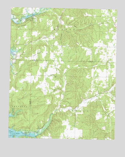
Cedar Crest, OK USGS Topographic Map
Click on map above to begin viewing in our Map Viewer.

This topographic map contains these locations and features:
Feature Name Type Latitude Longitude GNIS ID View Map
Big Hollow Public Use AreaParkN36.0715°W95.2477°1090117View Map
Calven HollowValleyN36.1127°W95.1921°1090823View Map
Cedar CrestCivilN36.1215°W95.1662°2631085View Map
Cedar CrestPopulated PlaceN36.1134°W95.2291°1091107View Map
Cedar Crest Census Designated PlaceCensusN36.1215°W95.1662°2407998View Map
Cedar Crest HeliportAirportN36.1051°W95.2352°1102538View Map
Cedar Crest LakeReservoirN36.1169°W95.2287°1091109View Map
Cedar Grove ChurchChurchN36.0804°W95.2366°1091115View Map
Clear CreekStreamN36.0043°W95.2150°1091426View Map
Coleman HollowValleyN36.1218°W95.2016°1091576View Map
Davis HollowValleyN36.1098°W95.1864°1091954View Map
Downing CemeteryCemeteryN36.0617°W95.2023°1092179View Map
Earbob Ferry Recreation AreaParkN36.0812°W95.2475°1092341View Map
Four Corners ChurchChurchN36.0893°W95.1897°1092984View Map
Gray CemeteryCemeteryN36.0704°W95.1944°1093340View Map
Hadley MountainSummitN36.0818°W95.2191°1093474View Map
Hare BranchStreamN36.0015°W95.2197°1093534View Map
Hogskin HollowValleyN36.1062°W95.1856°1093835View Map
Little Clear CreekStreamN36.0282°W95.1927°1094740View Map
Neely MountainSummitN36.1082°W95.2383°1095765View Map
Pipe Spring BranchStreamN36.1243°W95.2047°1096690View Map
Spring Creek Recreation AreaParkN36.1145°W95.2483°1089504View Map
Township of MurphyCivilN36.1140°W95.1905°1824571View Map
Vo-Tech HeliportAirportN36.0917°W95.2167°1102134View Map
Wooded HollowValleyN36.0018°W95.2291°1099982View Map

Note: Coordinates in the location and feature list above are referenced to NAD83 datum.


Copyright (C) 2008-2025 Ryan Niemi / Sunset Dynamics ... All Rights Reserved