TopoQuest Logo
Do you find TopoQuest useful?
Help keep TopoQuest running and adding new maps/features by donating!
Bitcoin:  19c7KJd3qBynnjoSw5npx9KScwjBe4ifkT
Litecoin:  LXs6TkuXGGXo1vDsWCkWVdjQX94eUKd6ui
Home View Maps Find Maps Find Places Resources & Links


Lone Star, Kansas Topographic Map

USGS Map Title: Lone Star, KS
USGS Map MRC: 38095G3
DRG (GeoTIFF) Download: o38095g3.tif


Neighboring USGS Topographic Map Quads:


  Clinton, KS  
38095H4
 

  Lawrence West, KS  
38095H3
 

  Lawrence East, KS  
38095H2
 

  Globe, KS  
38095G4
 

  Lone Star, KS  
38095G3
 

  Baldwin City, KS  
38095G2
 

  Ottawa NW, KS  
38095F4
 

  Ottawa North, KS  
38095F3
 

  Le Loup, KS  
38095F2


Map MRC Location:

N39°
W96°
N39°
W95°
H8 H7 H6 H5 H4 H3 H2 H1
G8 G7 G6 G5 G4 G3 G2 G1
F8 F7 F6 F5 F4 F3 F2 F1
E8 E7 E6 E5 E4 E3 E2 E1
D8 D7 D6 D5 D4 D3 D2 D1
C8 C7 C6 C5 C4 C3 C2 C1
B8 B7 B6 B5 B4 B3 B2 B1
A8 A7 A6 A5 A4 A3 A2 A1
N38°
W96°
N38°
W95°

Lone Star, KS USGS 1:24K Topographic Map Preview:
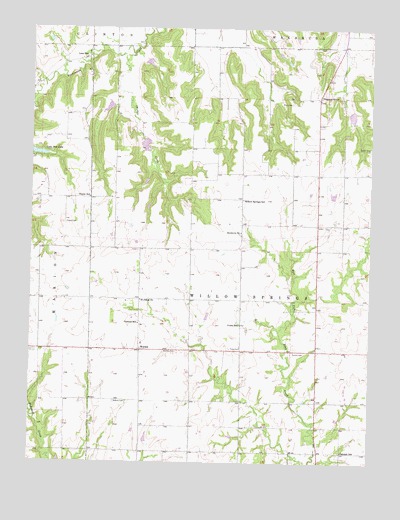
Lone Star, KS USGS Topographic Map
Click on map above to begin viewing in our Map Viewer.

This topographic map contains these locations and features:
Feature Name Type Latitude Longitude GNIS ID View Map
Bethel - Harbour CemeteryCemeteryN38.7675°W95.3441°479503View Map
Brethren ChurchChurchN38.8161°W95.2980°479508View Map
Central School (historical)SchoolN38.7900°W95.3353°479504View Map
Chicken CreekStreamN38.8678°W95.3386°479509View Map
Colyer CemeteryCemeteryN38.8189°W95.3628°479507View Map
Colyer CemeteryCemeteryN38.8189°W95.3627°2509642View Map
Colyer School (historical)SchoolN38.8261°W95.3536°479506View Map
Echo (historical)LocaleN38.8111°W95.3522°482176View Map
Exceline School (historical)SchoolN38.7536°W95.3064°479502View Map
Flory - Pleasant Hill CemeteryCemeteryN38.8536°W95.2797°479510View Map
Flory /Private AirportAirportN38.8210°W95.2883°481254View Map
Loma Vista NurseryBuildingN38.8243°W95.3438°2509807View Map
Lone StarPopulated PlaceN38.8667°W95.3553°479512View Map
Marion Springs Elementary SchoolSchoolN38.7843°W95.3341°2506557View Map
Maxwell AirportAirportN38.7706°W95.2744°2651056View Map
Michael's AirportAirportN38.8264°W95.2677°2675720View Map
Norris AirportAirportN38.8085°W95.3697°2651024View Map
Oakdale School (historical)SchoolN38.7536°W95.2600°479496View Map
Pleasant GrovePopulated PlaceN38.8556°W95.2697°479511View Map
Route 56 and Route 59 Weigh StationLocaleN38.7828°W95.2702°2695088View Map
Saint John's United Church of ChristChurchN38.7968°W95.3347°479505View Map
Saint Johns CemeteryCemeteryN38.7959°W95.3346°2673256View Map
Sutton CemeteryCemeteryN38.7819°W95.2791°479498View Map
Township of Willow SpringsCivilN38.8043°W95.2975°479497View Map
Ulrich CemeteryCemeteryN38.8410°W95.2507°2673405View Map
Union School (historical)SchoolN38.7897°W95.2980°479501View Map
Western Plains Church of the BrethrenChurchN38.8673°W95.3550°2509490View Map
Williams CemeteryCemeteryN38.8192°W95.3358°2775088View Map
Willow Springs (historical)LocaleN38.8186°W95.2966°482177View Map
Willow Springs School (historical)SchoolN38.8258°W95.2975°479513View Map
Willow Springs Township Fire DepartmentBuildingN38.7827°W95.2981°2112000View Map
WordenPopulated PlaceN38.7822°W95.3344°479499View Map
Worden CemeteryCemeteryN38.7819°W95.3265°479500View Map

Note: Coordinates in the location and feature list above are referenced to NAD83 datum.


Copyright (C) 2008-2025 Ryan Niemi / Sunset Dynamics ... All Rights Reserved